EAA 2015 and Glasgow

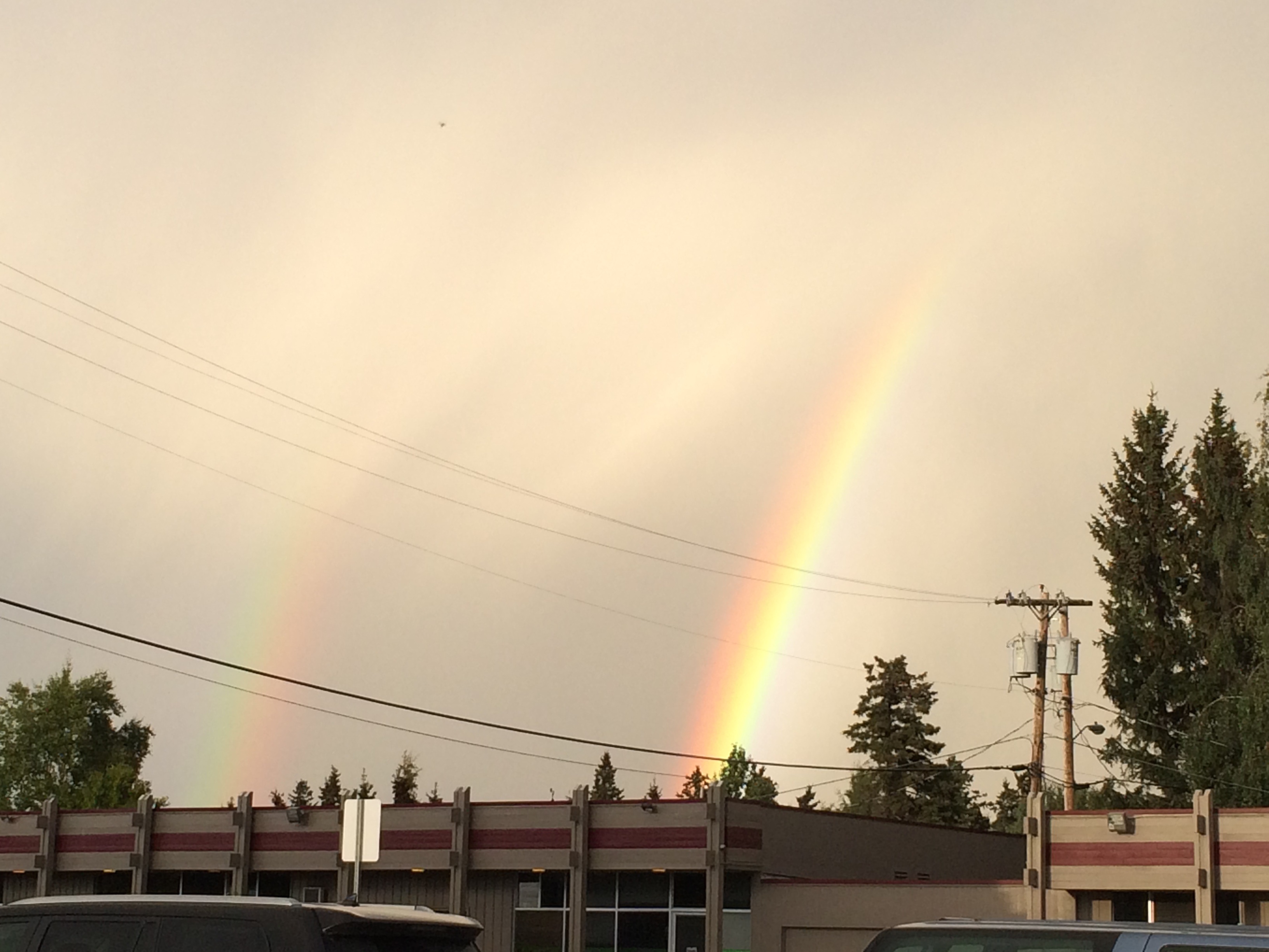
We went to Glasgow where the 2014 European Archaeology Association was held, by way of Anchorage and Reykjavik.  Because flights from Barrow are disrupted fairly frequently, we went down a bit early, and had a chance to visit with our daughter.  There was a pretty amazing double rainbow and a nice lenticular cloud.

The rainbow
The rainbow
Closer shot of the rainbow
Lenticular cloud over the Church Mts.

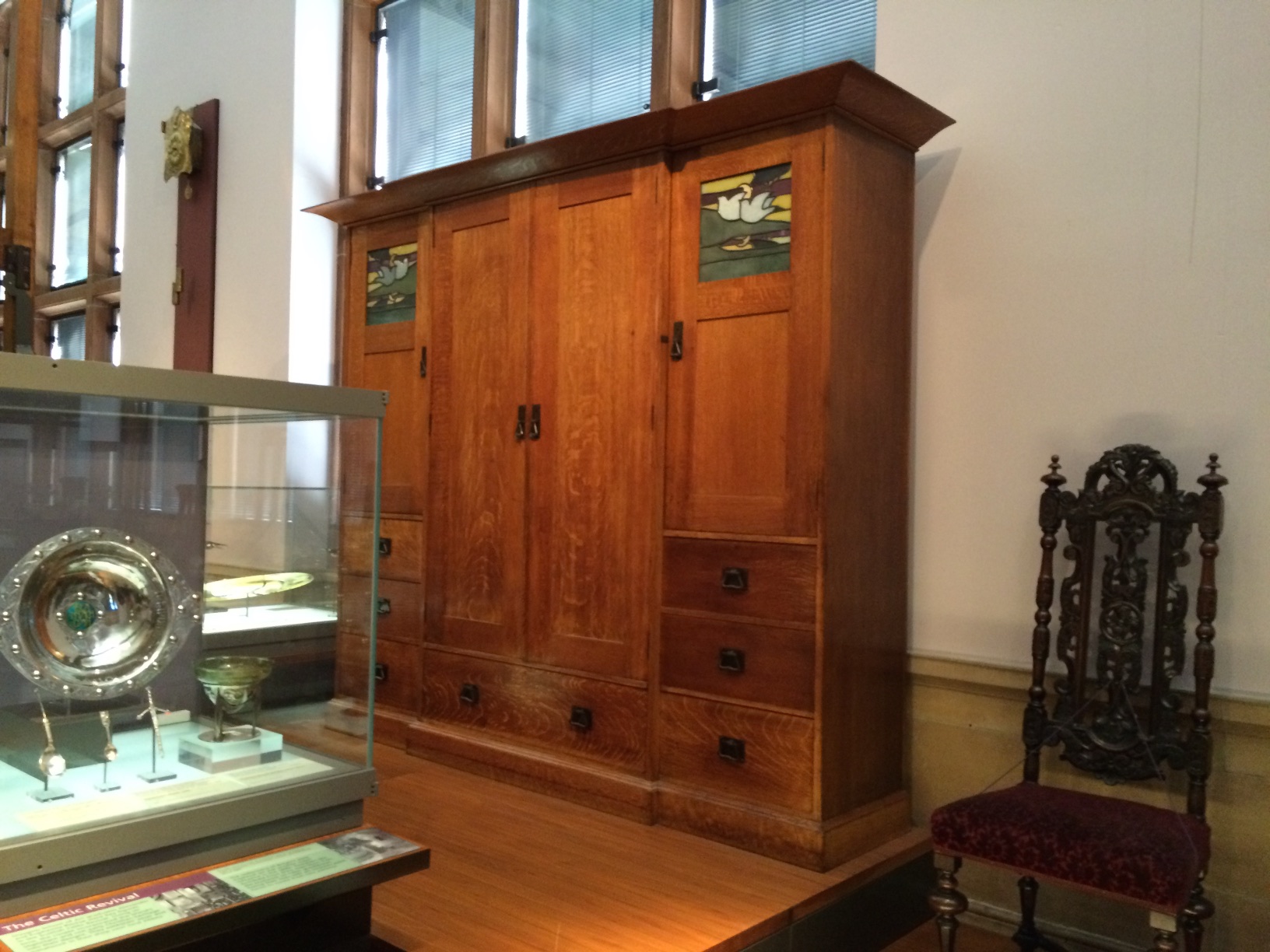
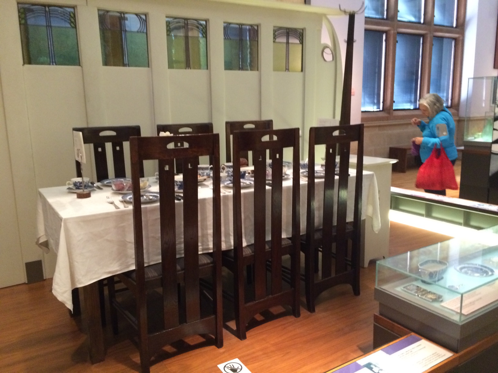
We flew Icelandair to Reykjavik and then from there to Glasgow.  Glasgow was great.  The people who live there seem really proud of their city.  The cab driver on the way in from the airport was recommending museums, and in particular Christ of Saint John on the Cross by Dali at the Kelvingrove Art Gallery & Musuem.  Glasgow was once the second most prosperous  city in the UK, and the residents seem to have been very civic-minded.  The Kelvingrove was built to house the collections that were donated by prominent Glaswegians, using funds from an international exposition and public subscriptions.  It houses a fair bit of Charles Rennie Mackintosh material.  We got in a good visit our last day there.  Unfortunately, some of the other Mackintosh venues were under renovation.

The Kelvingrove Art Gallery and Museum
Charles Rennie Mackintosh cabinet
Charles Rennie Mackintosh table & chairs.
Charles Rennie Mackintosh table & chairs from one of the famous tea room interiors.

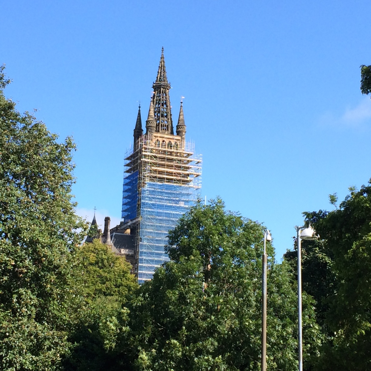
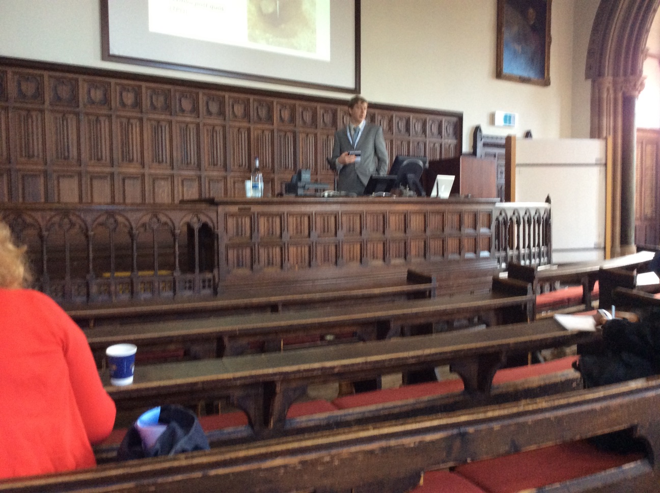
The meetings were held in various venues at the University, including some very old lecture halls and more modern buildings.

University of Glasgow Main Building tower
Nuvuk Archaeology Project alum Dr. Tony Krus chairing a session in a centuries-old lecture hall

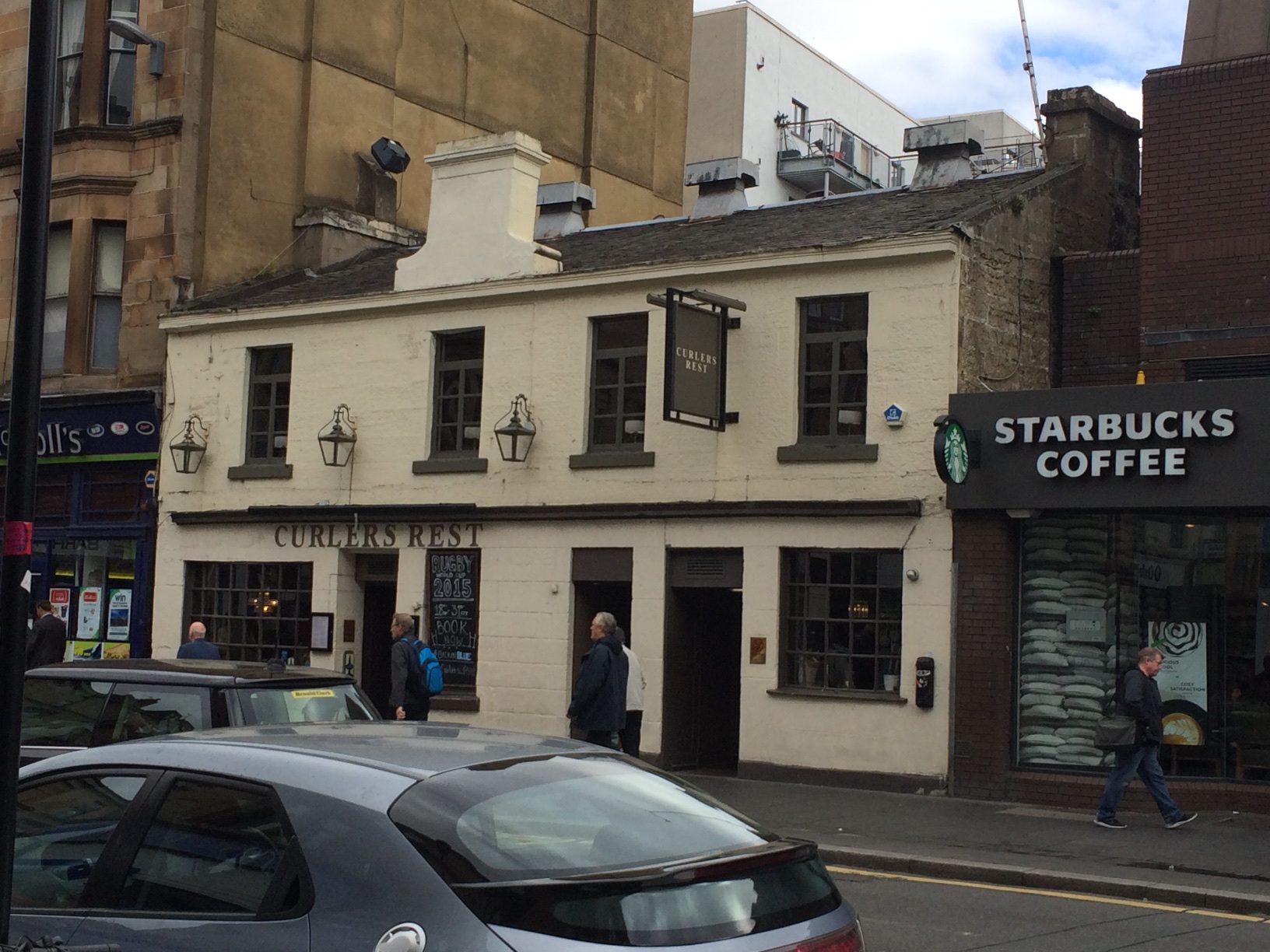
We spent most of our time around the University.  There were a number of good restaurants & pubs, particularly along Ashton Lane.  We tried a bunch of them.  We never made it to this one,which was apparently an isolated inn before Glasgow got so big, near a pond where local curlers used to throw rocks.  This is apparently where they went afterwards back then, as curlers are wont to do :-).

Curlers' Rest
Curler’s Rest

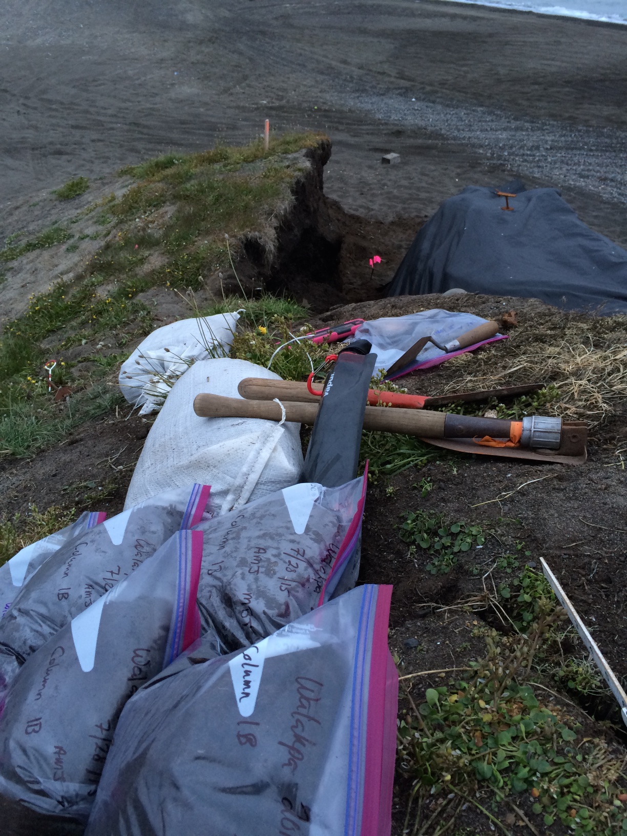
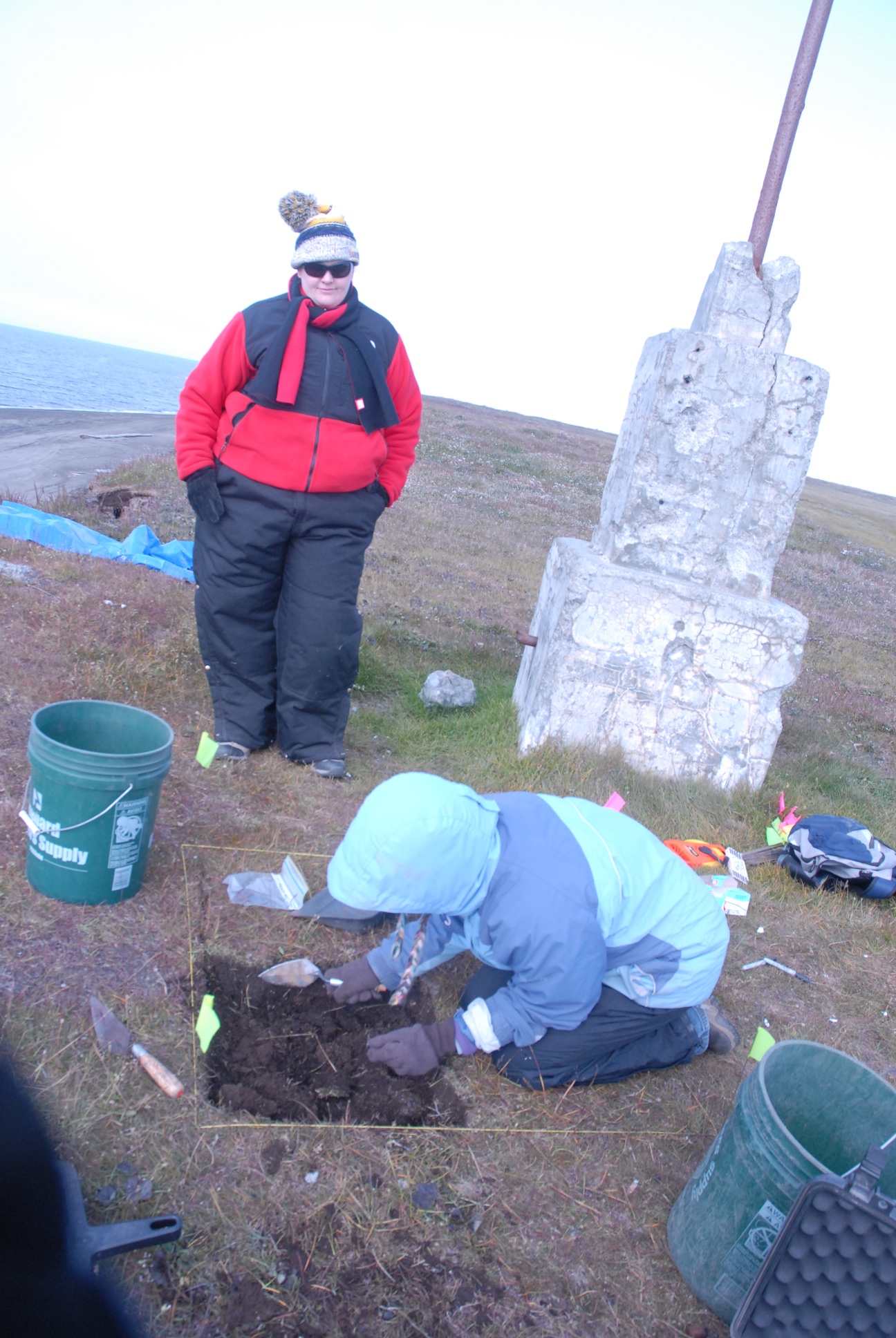
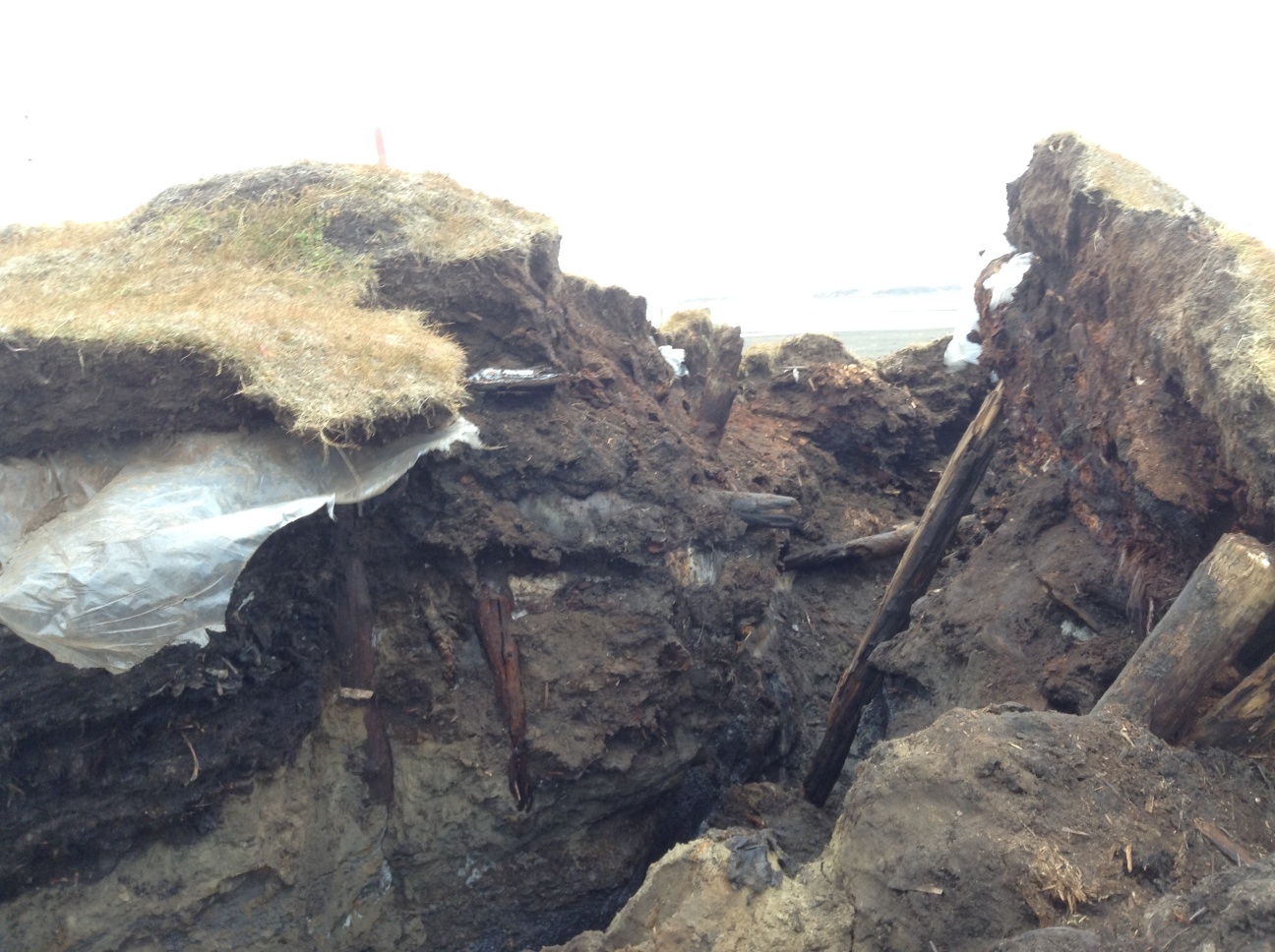
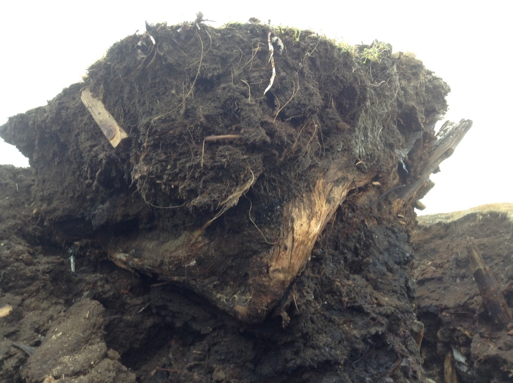
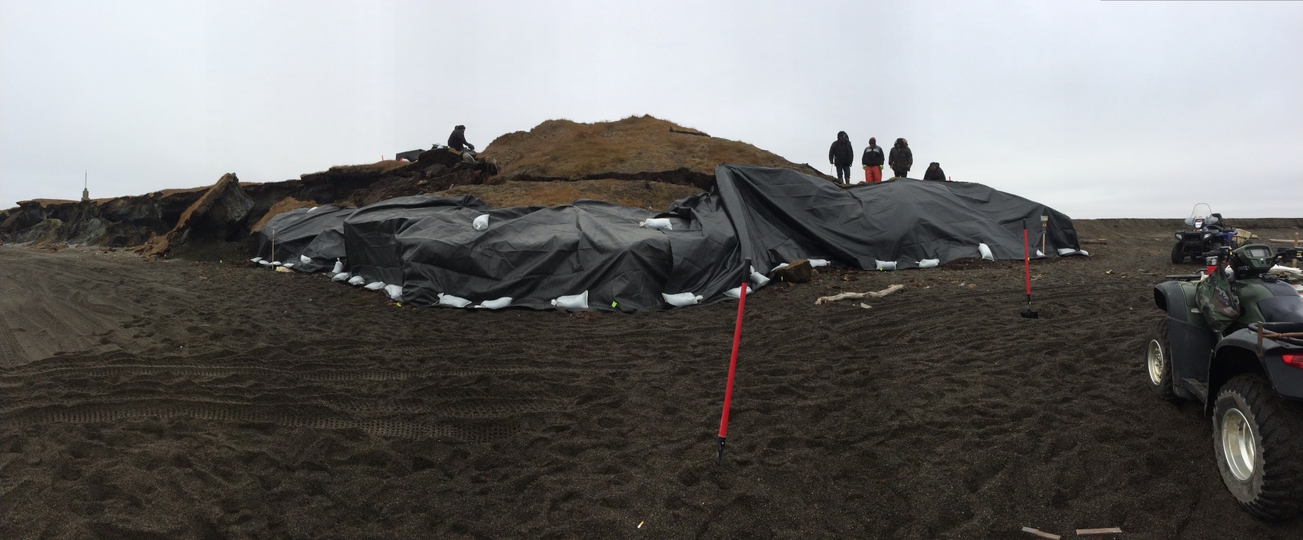
Our session (Archaeology and Climate Change) was heavily advertised.  Tom Dawson, the organizer, had managed to get leaflets put up all around campus before the session, so it was very well attended.  As you can see, there were participants from all over.  I talked about the threats to frozen coastal sites from climate change, with an emphasis on the Barrow area.  I was able to incorporate images from the storm that had happened the week before.  There were some other pretty bad situations, but none that were worse.  On the other hand, some people are making strides in dealing with these issues with public help, which is good given the turn-around time for even successful funding applications.

Poster for our session on
Poster for our session on Archaeology and Climate Change.

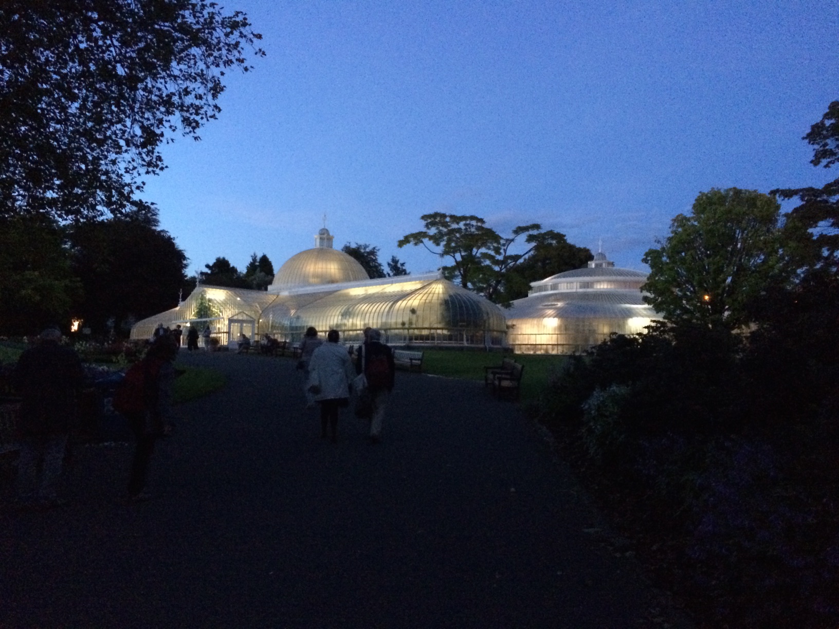
The conference featured a very nice party, spread across two venues, both within a block of our hotel!  One was Òran Mór, a converted church which now houses performance space and a bar.  The upstairs had been rented for the party.  It had obviously been redone from its days as a church.  The other was the glass house at the Glasgow Botanic Gardens, just across the way.

Òran Mór from the outside, with a blue halo on the tower.
Interior space at Òran Mór
Interior space at Òran Mór, with a crowd of EAA delegates
Approaching the Glass House at the Glasgow Botanic Garden

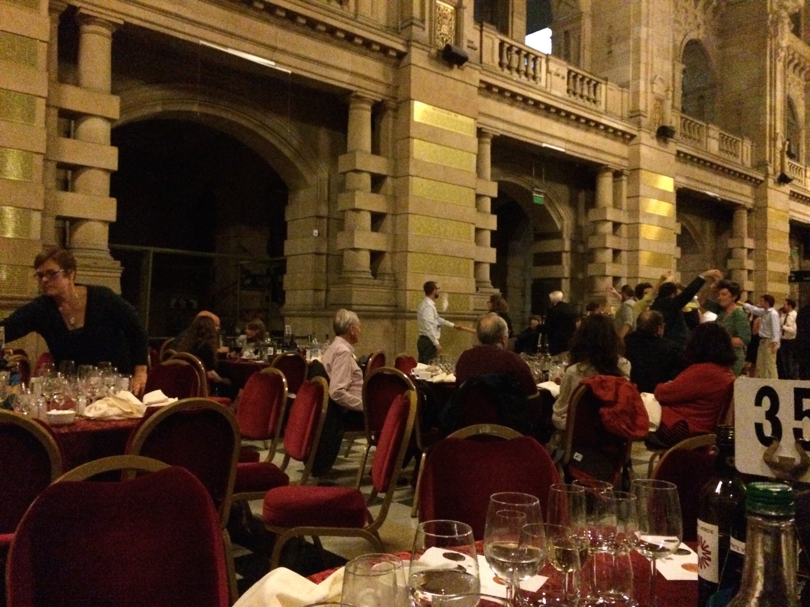
The conference banquet was held in the main hall at the Kelvingrove.  It was sponsored by Glenmorangie (the distillery near Glasgow) so there were samples of a couple of their special products.  After the speeches and dinner, there was a fine band and dancing.

Dancing at Kelvingrove. BT Wygal and Katie Krazinski by pillar at center.

Walakpa, July 30, 2015

We got up with the goal of getting packed up.  It wasn’t clear if the UICS logistics staff would be able to come and get us today, but we decided to finish all the field work, and pack up as much as possible.  We got right on the screening, and recording of the edges of the midden and the units on the Pipe Monument mound.  Owen went to work on a detailed profile of CS 2.

CS 2 after excavation and preparation for detailed profiling.

Once that was well in hand, it still wasn’t clear if we would be able to get home.  I needed to go in to Barrow to make sure everything was progressing with the other project, so we decided I could take trailer load of field gear, samples and some of my gear back to town.  That way, we would need less help getting back, and if the pickup wasn’t going to happen until tomorrow, I could bring back my sleeping bag and sleep in the mess tent.

Once I got to town, I unloaded and did some more work on the other project.  It turned out that some logistics folks were available, so I went back down with them, and we managed to get everything back to town, and into the UICS yellow building.   Everybody got to sleep in a real bed.

Walakpa, July 29, 2015

Last night was not particularly restful.  The collapse had complicated matters quite a bit.  However, after breakfast, we went back to work.

The old location was not viable, so I picked a new spot about a meter south, which became Column Sample 2 (CS 2).  There was a bit of an overhang, and a very deep crack behind the bluff face.  We needed to get all that material out of there.  It took a bit of thought to figure out how to do it (not a usual archaeological operation, fortunately).  Finally, we put a blue tarp down on the bottom of the main cleft so we could drag fill without anyone having to be under any overhangs or unstable areas, everybody got out of the way, and I cut the overhang back while standing as far back from it as possible.  We then took the material out with a bucket brigade.  Once that was done, I levered all the cracked material off, and we took it out the same way.

Bucket brigade in action.

Once that was done, I decided that we would excavate in levels labeled with letters, so we could proceed quickly, rather than wait for Owen to try to match levels in the detailed CS1 profile, which could have been a slow process.  It seemed like the fairly warm, dry weather was letting the face dry out while detailed profiling was happening, and the longer it was exposed the more chance of another collapse.  Owen would do another detailed profile after we got the column sample.

I also decided to make the sample a bit smaller in volume.  CS 1 we had been trying for 75 cm x 75 cm (mostly because that size fit between some prior disturbances), but 50 cm x 50 cm seemed more manageable in the time we had left.  One gallon from each sub level was retained as a bulk sample, and the remainder of sediment from the sub level was screened through 1/8″ and 1/4″ mesh.

We were just getting started when someone arrived to do a coastal DGPS survey that is part of the coastal mapping aspect of the Barrow Area Information Database project.  He passed on a message that said my boss needed me to come back into town.  (There is no effective connectivity at Walakpa, which is why this is being posted after the fact).  I reviewed recording stratigraphy  (or artifacts if any showed up) with Laura Crawford, made sure everyone knew how to use the InReach is needed, and headed back to Barrow by ATV around 1PM.

Something had come up with one of the compliance projects we are working on, and I needed to talk to people and draft some documents.  I made it back to Walakpa around 10PM.

On the way, I met some folks out for an evening ride, and they stopped over to visit.  One of them had spent a lot of time at Walakpa when she was younger, and had some great stories.  I hope we can get them recorded for future generations.

The rest of the folks had managed to complete the column sample, so we talked about closing up shop tomorrow.  We just need to finish screening, record the Test Units on the Pipe Monument midden, and backfill the TUs.

Walakpa, July 28, 2015

Owen and Laura got up early and screened what we had dug last night.  Owen worked to finish the profile.  There is an apparent marine level at Level 13.

CS 1 profile
CS 1 profile

We had problems with both transit and radio batteries.  Despite that, I showed Laura how to run the transit, so I don’t have to be awake all the time.  We shot in the remaining levels of CS 1, as well as the new test units on the mound.

Laura and Owen continued taking CS 1 down.  Unfortunately, after the dinner break, they returned to find that the bottom of the profile had collapsed.

The view after dinner.

It was a pretty depressing situation.  It left an overhang, so there was no way to just continue safely.  It mean that we would have to start over again in the morning.

Walakpa–July 27, 2015

We went to work in earnest today.  Owen went to work on recording the stratigraphy of the profile we had chosen for the column sample (CS 1).  I had him marking the bottom of each level so we could continue excavation even after he went to sleep.  Anne Garland and Laura kept working on the tests on the mound with the monument.  The SW quad of the 1×1 came down on a cryoturbated sterile layer.  There was metal throughout the cultural levels.  We expanded northward to examine some wood in that wall.

Owen Mason examining the profile of CS 1.

Meanwhile, I set up the transit and began shooting in the CS 1 profile, as well as the bluff edge.  The NW quad of TU 1 had similar results, so we put some 50x50s closer to the bluff edge to see if we could find datable material and the edge of the  feature.

Mary Beth Timm and I took naps, so we could stay up late and work on the CS 1 profile.  After dinner, we shot in the upper levels of the CS 1 profile, as well as a polar bear jaw that was exposed in Level 12, so that it would not get stepped on.  Mary Beth & I started excavating CS 1.  We are excavating in natural stratigraphic levels, with any level that is more than 5 cm in depth broken into 5 cm sub-levels.   One gallon from each 5 cm is being kept as a bulk sample, and we are screening the remainder.

Midnight double selfie.  Anne & Mary Beth at work on CS 1.
Midnight double selfie. Anne & Mary Beth at work on CS 1.

We kept going until it go so dark that we really couldn’t see the soil colors, which was around 2 AM.  We had accomplished a fair bit, so we headed off to bed.

Results of our labor.
Off to bed.
Off to bed.

The weather is often best at night.  It was really beautiful.  A pair of loons was swimming on the lagoon.

Loons on the lagoon.

Walakpa–July 26, 2015

The crew (Owen Mason, Anne Garland, Mary Beth Timm, Laura Crawford and myself) gathered out at NARL, at a small yellow warehouse.  We were using UIC Science archaeological gear.  IHLC & Ilisagvik College let us use some tents, sleeping pads & kitchen gear.  We managed to get everything packed into side-by-sides and trailers and headed off to Walakpa with Sean Gunnells, Oona Edwardsen and Ray Kious of the UICS logistics staff who weren’t otherwise occupied.

Loading up to head to Walakpa

We got to Walakpa around 2PM.  We got camp set up, with a slight hitch because  some of the tents had not been repacked properly when last used.  However, the logistics staff dealt with it, and headed back to town.

We uncovered portions of the bluff so that we could examine the profiles and decide where we want to take the column sample.  While walking the beach examining the bluff profiles, we noticed that there was a cultural layer exposed in the mound with one of the two monuments on it.  Anne Garland laid out a 1×1 meter test, well back from the edge of the bluff, to see if it continued across the mound.

Laura Crawford excavating the SW quadrant of a 1x1 while Mary Beth Timm looks on.
Laura Crawford excavating the SW quadrant of a 1×1 while Mary Beth Timm looks on.  View NE along the coast toward Barrow.

It was clear that we couldn’t safely do a profile in the central area where the meat cache had been, since there was still an overhang.  In addition, some of the geotextile fabric protecting the site was pinned by collapse of bluffs, preventing its removal.  Eventually, after cleaning profiles on either side of the overhang, we picked a spot and Owen went to work on a detailed drawing.

We had visitors in the early morning, a young couple whose ATV had a flat, and were hoping that we had a tire pump.  Unfortunately, we didn’t, so they headed on up the coast with both of them on one side of the ATV.

Back from the field

We’re back from Walakpa, most of the gear is cleaned up and put away, and initial sample processing is done.  We couldn’t post from the field, so I’m going to put the posts up a day at a time.

A day in the lab

I spent much of Friday in the lab, selecting items from Walakpa to send off for radiocarbon dating.  We had a reasonable set of samples from 2013 and funds to run the dates, but given that that entire area is gone, I wanted to get some idea of how old some of what was exposed this fall is.  That meant I had to make some choices about what got sent and what didn’t.

We had managed to collect several caribou bones, but most of them were ex situ (not in their original location).  There are also several samples of plant material from known locations which are much more likely to be informative.  Everything had been frozen as soon as it came in from the field due to the aggressive mold we had had to deal with last year.  For carbon dating, the lab needs to have a certain minimum weight to work with (varies by each type of material), which means that the samples had to be thawed enough to allow them to be split, cleaned, and dried enough to make sure that the weights were accurate.

Beta Analytic has got a slick new sample submission interface that I had never used before.  It has a few quirks, which meant that I had to quadruple check the submissions to fix things.  I got better at it, so .  In the end, it prints out a barcoded form that you put in the package with the samples.

IMG_1538

By the time I finished, it was too late to mail the samples on Friday.  The US Post Office in Barrow doesn’t have any counter service on Saturdays, so they’ll get mailed on Monday.

As a result, I didn’t get to see much of the sun that day.  It is almost time for it to go down for the winter, and we’ve had so much cloudy weather this year, it was a pity to miss a rare sunny day.  By the time I had finished, the sun was down, and this was the view from the BARC.

IMG_1541
UnPhotoshopped iPhone picture of the sunset


A quick recap

This summer was unexpectedly quite on the archaeology front.  The non-profit through which my grants were run had some problems, which meant that work had to stop and I had to move my grants.  This turned into a rather long drawn-out process, with many fits and starts.  In the end, I was appointed as a Research Associate in the Department of Anthropology at Bryn Mawr College and the three grants on which I am PI (Principal Investigator) were moved.  We are still finalizing moving the purchase orders to allow for work to proceed on the WALRUS grant, but hope to get it done this coming week.

We had hoped to be doing some work at Walakpa, which had survived the winter unscathed, but despite the North Slope Borough asking for UIC Science’s Certificate of Insurance, which usually happens when a contract is about to be awarded (good thing, the insurance company charges to issue those things), nothing was issued.  Then came the first week in September.

I was in Point Hope monitoring the drilling of a geotechnical test hole for a possible fiber project.  It took an extra day to get there from Kotzebue, because the weather was so stormy that planes couldn’t land in Point Hope.  We didn’t find anything during the drilling, but the extra day gave me a chance to visit with Molly Odell and some other colleagues who had been working in Kotzebue and look at some of what they had recovered during their field season.  That was fun, but unfortunately the same storm really did some damage at Walakpa.

The site was undermined by high surf.  Mark Ahsoak Jr. kept me posted (Taikuu Mark) via Facebook message, and it was pretty depressing.   In the end, the house we were working on last year seem to have been entirely obliterated.  A big slump block broke off and is resting on the beach.

Slump block on the right, intact strata on the left. Notice the Visqueen on both sides.

I went down with a crew from UIC Science Logistics to evaluate it.  We found that there had been a lot more Visqueen under the surface than we had thought.   The stratigraphy is very complex, with a very large feature containing solidified marine mammal oil, some artifacts and what appears to be maqtaq at the landward edge of the slump block.

Marine mammal oil feature.

Unfortunately, the marine mammal oil feature is starting to break loose from the  main slump block and tip back into the crack between the block and the intact site.  We put driftwood props under it, and then stopped all work under the overhang, since it could easily kill someone.

IMG_0028
Side view of overhanging block of marine mammal oil. Note crack on the left.

We didn’t find any loose artifacts, although there were a number of visible artifacts that were frozen in.   Some folks had been collecting them and turning them in, which is great.  I’d really like to thank everyone who has been helping in this way.  Unfortunately, some other people have just been collecting them.  Several of the artifacts that we saw the first day were gone by the time we returned.

After we headed home, the next day was spent in getting a crew and material to do some stabilization.  Several of the Barrow-based UIC subsidiaries pitched in with materials, crew and transport, and we went back to put some temporary protection on the site.  We were able to cover almost all the eroding surfaces with  geotextile fabric , secured with some cutdown metal support fasteners and sandbags.

IMG_1503
Panorama of the site after the initial covering.

We made another trip down with the theodolite to map the new boundaries of the site.  This let us document the loss of over 33 feet (11+ m) in that storm alone.  We also put a lot more sandbags on the site, and so far it has resisted the weather.