
About a month ago, Tracey Sinclaire and Beth Verge from Anchorage TV station KTUU came to Utqiagvik to do a number of weather/climate-related stories. One was on the effects of coastal erosion. I took them out toward Nuvuk/Point Barrow as far as seemed prudent for the vehicle I had, and got interviewed. The weather was quite challenging while they were here, but they hung in and got stories on the NOAA site, and the blue football field which is endangered by coastal erosion.
Tag: media
Some media attention, and why it can be a double-deged sword
For some reason, this year there has been quite a bit of media interest in Barrow and archaeology. To begin with, there were several film crews in Barrow while we were working at Walakpa, two of which actually came out to the site and filmed as well as filming in the lab. Only one of them has anything out yet. PBS filmed for several both in the field and in the lab, and a little bit of it made it into this piece, and a shot in the slideshow that they put up on the web in conjunction with the series on sea ice change. It was a very buggy day in the field, and it was quite the challenge not to be swatting mosquitoes all the time.
Oh, and the buoy experiment that Ignatius Rigor is working on in the film clip is supported by UIC Science staff (not that they have to do much, the idea is to see how the buoys do with no servicing). Their data can be compared to data from ARM’s established serviced meteorological instruments. That way, when scientists get buoy data, they have an idea how reliable it is, and if there are any special considerations in interpretation (becoming uncalibrated over time, etc.)
We’ve also gotten interest from the press. Abra Stolte-Patkotak, one of our volunteers writes for the Arctic Sounder, and did a piece on the Walakpa excavations, which is on-line here. For some reason, they don’t have the picture that was published up on-line, but I will ask Abra if I can put it up here & add it if so.
I am currently working with a free-lancer who has interviewed me and asked me to fact check the article before he goes further. A very good idea, as many years ago I was interviewed by a reporter who mis-heard my answer to the question of how far back in time human occupation of the Barrow area was archaeologically demonstrated to extend. I said “maybe 4 to 5 thousand years” which was what people thought reasonable for Denbigh at the time. He refused fact-checking help, and published an article in which I was directly quoted as saying “45,000 years”. Although Glenn & I could never get the Arctic Sounder to mail our subscription to us in Pennsylvania, apparently Tiger Burch could. I got a very puzzled email from him after the article came out, in which I believe he was politely trying to ask me if I’d lost my mind. Fortunately, he had enough experience with the press that he believed the explanation.

August 15th at Walakpa–78 years ago and today
Seventy-eight years ago, it was a foggy day at Walakpa. The Okpeaha family was camping there. A floatplane descended out of the fog, and two men asked how to get to Barrow, since they had lost their bearings in the fog. Getting directions, the got back in the plane and took off. The engine failed, and the nose-heavy aircraft crashed into the lagoon and flipped. Unable to reach the plane to help the men, Clare Okpeaha ran all the way to Brower’s Trading Post in Barrow, over 12 miles of very rough going, to get help. When boats got back to Walakpa & they got to the plane, it became clear the men had been killed instantly. They were Will Rogers, a noted humorist and political commentator, who was traveling around Alaska to get stories for the newspapers, and Wiley Post, probably the most famous American aviator of the time after Charles Lindbergh.
The crash was national news at the time, and a few years later a monument was erected near the site, followed some time later by another one. These are the monuments that show up in some of the pictures of the site. For some reason, these are on the National Register of Historic Places, but the archaeological site isn’t.

- The first monument , looking out over the lagoon where the crash occurred.

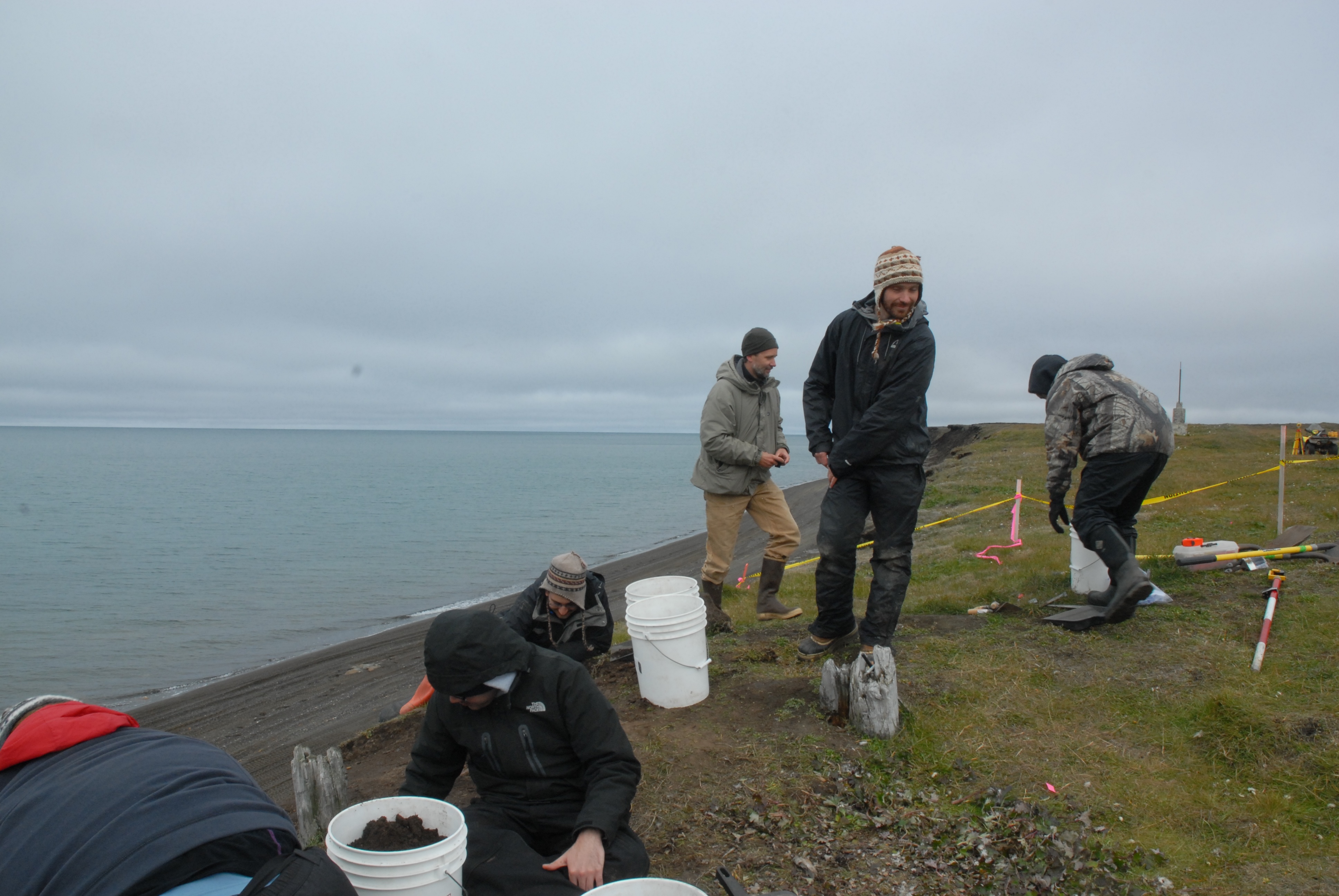
Today was a much better day at Walakpa. We headed down with 7 volunteers, including David Pettibone, Michael Berger, dental extern Temurkin Cucukov, and the entire Von Duyke family, plus Marybeth Timm from the Inupiat Heritage Center. The stream was running high and fast at Nunavak, but we got across, although not before I got my boot wet. With that many people, it seemed worth getting the water screening going, so we did, using a small pump to take water out of the lagoon. Alan & Scott Kerner happened by on an ATV ride and pitched in for a while as well.

- Wet screeners in action by the lagoon.
The rest of us continued with taking down the rather disturbed level under the sod. It would be a lot easier if we could just shovel it out, but the bluff doesn’t seem that stable & we’re afraid we’ll knock the whole thing down if we shovel, especially since there are still a lot of roots holding things together at this level.
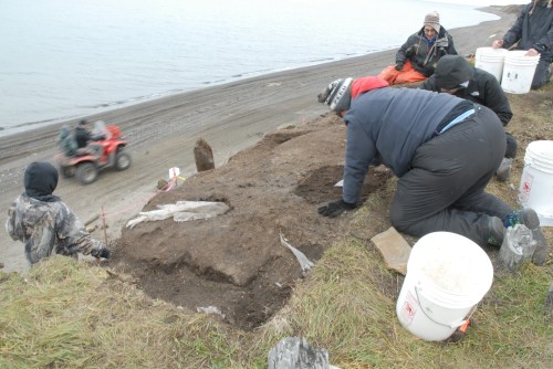
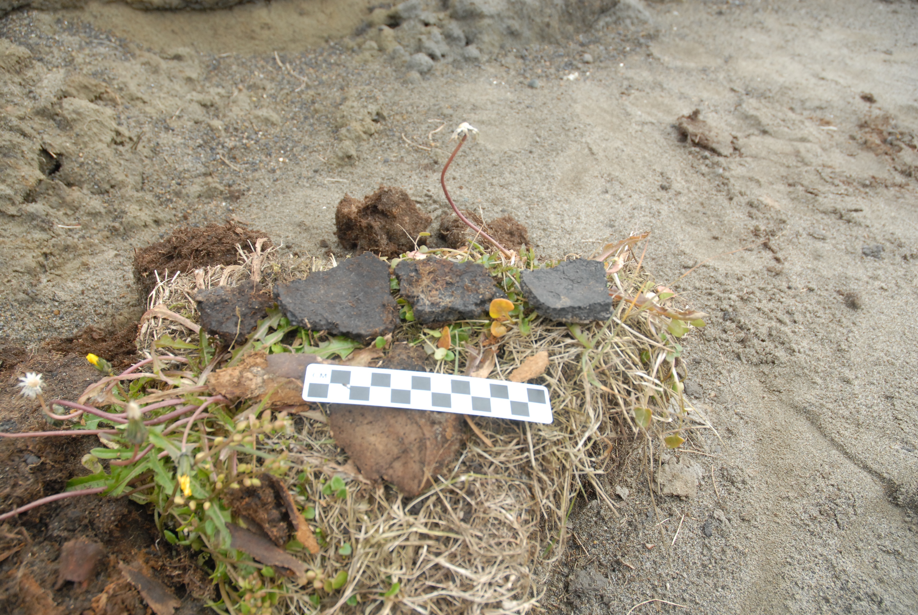
- Excavating the disturbed layer. Note the Visqueen.
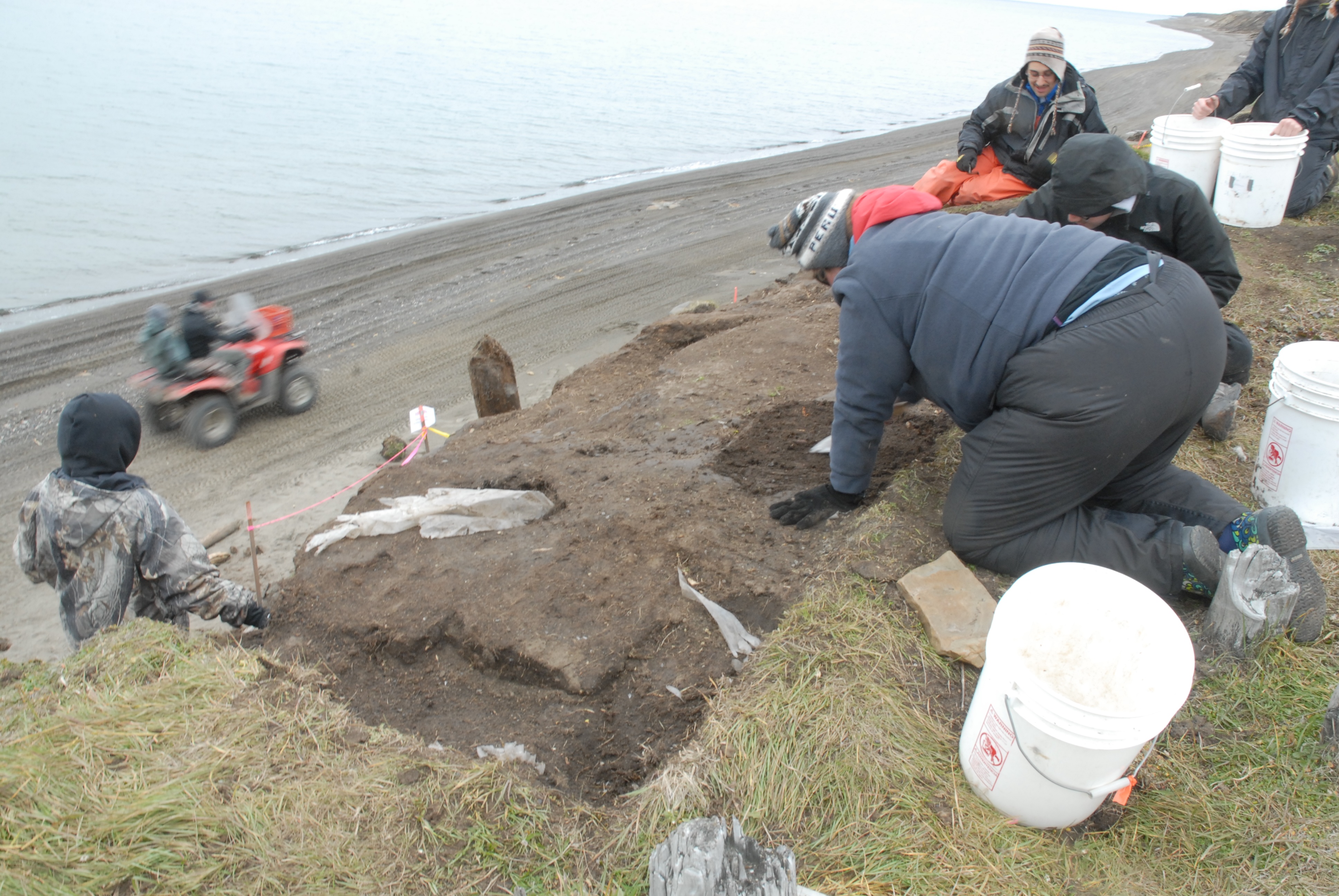
A while after we got there, a boat pulled in, and Jeff Rasic from the National Park Service (in town for a meeting at the Inupiat Heritage Center) Patuk Glenn (IHC) and Kunneak Nageak (IHLC) appeared. They got a good tour, and spent a bit of time wandering around. Jeff found a big sod with a lot of artifacts in it, including several very nice potsherds, one with residue, which we collected.

- Excavation at Walakpa. L. to R. Marybeth Timm, Temerkin Cucukov, Michael Berger, Jeff Rasic, David Pettibone & Trina Brower.

- Potsherds.
The ride home was even more exciting. Nunavak wasn’t too bad, but they were unloading a barge on the beach, so we took the old Nunavak “road” back to town. It has pretty much disappeared back into the tundra on the middle section the last few years, and it was a very muddy ride!
A trip to the Point
On Friday afternoon we headed to Point Barrow. I’d gotten KTUU set up with Aarigaa Tours, who picked them up in town at Top of the World Hotel, and then picked me up at my house at NARL on the way out to the point. I’d run home from work to change into my warm gear. A good thing, too, as will become clear later.
We’d been having a pretty strong blow from the NNW, and waves had actually been coming up onto the road. The road to the point had actually been closed right by Piġniq (Birnirk), because the waves had been breaking over the road and had done some significant damage. We were in a van equipped for off-road travel, so we were OK, but we had to detour through the cabin area. Once past there, the road was still in pretty good shape, but we could see water seeping in under the gravel berm. Once we got out a bit farther we could see a number of vessels & barges that had come into Elson Lagoon to anchor up and wait out the rough weather.

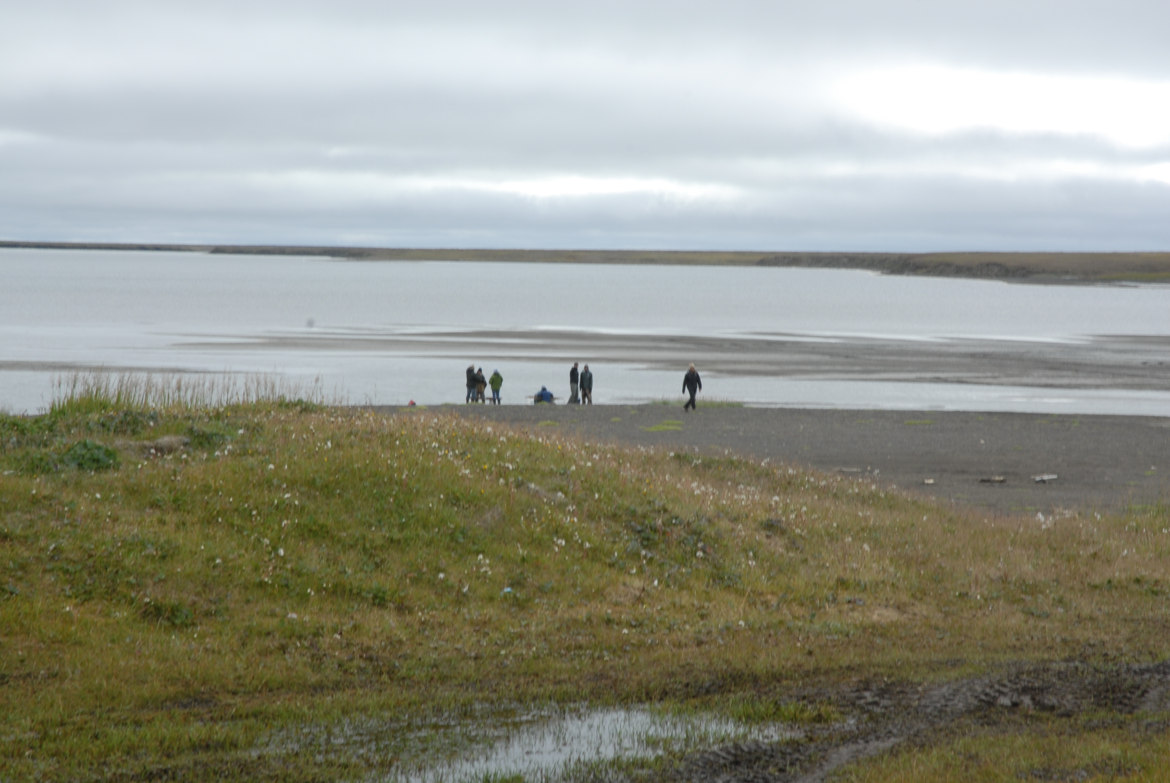
Once we got to Nuvuk and got a look at the site, it was a bit depressing. However, it made a perfect example of coastal erosion in action, and made it really easy to illustrate how information about the past, which could have application to understanding what directions to take to have a sustainable future, is being lost. At least 10 feet (3 m) of the site had been lost to the ocean since couple weeks ago. The gravel slump that had been protecting the face was gone, and thawing permafrost was sticking out and undercut.

And in that permafrost was the same strandline debris that has proven to be a marker for the Ipiutak occupation. There was a large patch of what looked like fur or peat (which often seems to be found on the floors of Ipiutak structures) and an area where the wood seemed to be far more aligned and level than is normal for a strandline, but would be quite typical for an Ipiutak floor. I tried to get decent pictures, but in the end decided I needed to try to get a sample. I tried walking down on the permafrost, but it was angled, and I couldn’t get close enough without falling off. There were big waves, and the bluff was undercut. If a really big one came at the wrong time, it could wash me off my feet.
Finally, I asked Ricky Bodfish, who was driving the tour van & giving the tour except for the archaeology part, if they had a rope. He did, so he dangled it down the bluff by me, we waited until right after big waves when it looked like a lull and I went down to check it out and try to get close-ups and a sample.

The patch of material turned out to be peat, which I was able to sample, and will send out for dating. My camera got some spray on it, but there was not way or time to clean the lens, so I just kept shooting. Unfortunately a pretty big wave came and dumped gravel on the surfaces just before I got a shot off of the wood, (I managed to turn so I caught it on the side where KTUU’s microphone pack wasn’t) and I could hear the next one was even louder. I ran, and made it into an area above the waves before the big one broke.

Fortunately, nothing soaked through the Carhartts so I just took them off for the rest of the trip.
We had been monitoring the tower we’d put out in June, and just a few days earlier had thought it would be fine. However, the storm had taken out a lot of the bluff, and I wound up calling & texting the guys who work on the ARM project for UICS. They wound up going out later that evening and hauling the whole thing about 50 feet (15m) farther back from the edge. Just in time, since by the time they got out there, they figured it was 2-3 feet (< 1m) from the edge.

After that, the KTUU fellow wanted to see the farthest North point and go to the bone pile to see if there were any bears. We set off, and almost immediately had to detour. The trail we normally use to get to the site, which is always dry, had water all over it from the storm surge.

We made it to the farthest North point, which was a bit less far North than previously. The storm surge had made it to the tip of one of the whale jawbones, and about 10 feet was missing here too. However, we did get some nice light, and the KTUU guys got busy.


- KTUU crew at Farthest North Point.
Unfortunately, the trip to the bone pile did not come off. The storm surge had caused it to nearly become an island. Ricky was not sure how solid the ground was, and we did not want to get stuck there, so we gave it a miss. On the way back to the road, it was really clear how much of the Chukchi side of the Point Barrow spit had been eaten. The ocean was almost up to the berm along the road, and there used to be a fairly wide strip of gravel there.

A visit from the media
The important but not overly exciting routine of proposal preparation & writing on my part, and cataloging on Coby’s part was broken on Friday. KTUU TV, the Anchorage NBS affiliate, sent a crew to Barrow for a few days. They were covering the football team, and wanted to get some practice footage, but that left them with lots of free time, so they had to get as many other stories as possible, and they decided to go for science stories.
I know they did an interview with George Divoky, who had just made it in off Cooper Island (the weather has been really awful–not boating weather at all). They also shot some footage about Nuvuk and coastal erosion.
First they stopped into my lab for an hour or so. They shot a fair bit of footage of Coby Hatcher (who is going to HS on-line and therefore was working in the lab when they were there) doing various things one does in an archaeology lab, including re-bagging cataloged artifacts and entering storage locations for artifacts in the catalog database so they can be found again.

With a big collection, this is pretty important, since otherwise it can be very hard to retrieve things. It actually came up because I was trying to find the bird bone from the Ipiutaq levels that had been used to make needle blanks. A number of folks think it looks like it is an albatross bone, which is interesting if true, since there aren’t many albatross around here. One of them is involved in a project which is doing ancient DNA work, and offered to run some of this bone to see if it really is albatross. There was no storage location in the catalog, so we had to look a bit. We found it and I’ll mail it out, and Coby put updates in the catalog.
Then they shot some footage of me showing some of the artifacts, and some of me doing an interview about the project and what one can learn through archaeology. That lead into what gets lots when sites are lost to coastal erosion and/or warming and permafrost thawing.


After that, they headed off to do something else. In the late afternoon, we headed out to Point Barrow for them to get some shots of the site and, as it turned out, coastal erosion in action. That’s a story in itself, so that will be the next post.
List of Archaeology Journals | Doug’s Archaeology
A very handy list of Open Access and other Journals:
List of Archaeology Journals | Doug’s Archaeology.
Thanks, Doug!
Random Acts of Science – Blog – Geotagged Photos or “Hey! Dig here!”
Random Acts of Science – Blog – Geotagged Photos or “Hey! Dig here!”.
This is a pretty important point, and something most people probably don’t think about. It might not matter for well-know sites like Pompeii or something, but for a lot of places, it could be a problem. Why take a chance?
Streaming URL update
OK, this is the fixed URL for streamed Saturday Schoolyard talks: http://www.alaska.edu/oit/cts/streaming/BARC/
It should work whenever they are being streamed.
We’ll be on around 1:30 AKDT today. No Heather, since she fell on the ice we’ve got covering everything here (they even canceled the evening plane due to an icy runway) and hurt her ankle, so she’s laid up.
Adventures with journalists; or, I never said anything about 45,000 yr. old Eskimos
Obviously, I think that archaeology is interesting. In my experience, so do most non-archaeologists I meet. People ask lots of questions, and it’s amazing how many of them say they always wanted to be archaeologists (hey, we take volunteers!).
So, I imagine that there’s a reasonable audience for journalism (print, broadcast or Web) that covers it. The Arctic, as the canary in the climatic coal mine and home to endangered charismatic megafauna (AKA polar bears), also seems to be a hot journalistic topic. Given that Barrow is served by at least two jet flights a day and has decent connectivity, we get our fair share of journalists, and a fair number of them want to talk to me.
The public pays for most archaeology (and other science) so I think they deserve to hear what they’re paying for us to learn, especially since most people are interested in other people and their doings, as opposed to, say, permafrost or midge hatches, for which the interested audience may be smaller. So I take the time to talk to journalists. I also try to find out a bit about the journalist in question. If I get the sense that they are not very experienced with science or research, I’ll offer to at least check dates and spellings in their story before it goes to print, pointing out that that’s less embarrassing than having to issue corrections of errors later. Some take me up; some don’t.
I also take the time to attend panels on working with the media at scientific meetings. They are usually composed of a variety of people who are public information officers for scientific organizations or institutions and science journalists, often quite well-known ones who write for national science magazines or newspapers. They are all very earnest and full of good advice. They are usually amazed at the questions asked by the audience, and horrified by those of us who want to see stories prior to publication. They seem bewildered that the archaeologists making up the audience don’t all see journalists as friends and a great help.
Of course, if all journalists were like the ones on the panels, we probably would see them that way. I’ve worked with some great folks. Angelika Franz, a German writer who has done several pieces about Nuvuk, actually has a doctorate in archaeology, so she’s been great to work with, knowing what sorts of information are critical to get right, and understanding technical terms so we can concentrate on the interesting parts of the story. She has done pieces for Spiegel Online Wissenschaft, a magazine called Epoc and now she’s got a book coming out with a number of pieces she’s done.
I had great fun being interviewed (in Danish) by some Danish journalists who were retracing Knud Rasmussen’s travels across Arctic America. The story wound up mostly being about the fact that I have a complete set of the 5th Thule Report, in Barrow. We also had a nice trip to Nuvuk in the local tour van, which resulted in some good polar bear pictures for them.
Most of the others have been reasonably competent, and haven’t garbled the stories too much, although they haven’t written stories that answer the sorts of questions people ask me.
And then there are the others. There was a group of filmmakers working on video for a major producer of science programming. They had decided to focus on an ice scientist and his (cute female) grad student. It was spring, so there was not much to see at Nuvuk, but they wanted to go there anyway. They wanted to film them pulling up on snow machines. The tracks aren’t the best thing for the site, but we had already excavated the area near the bluffs, so I said that would be OK there. Of course, they didn’t like the shot, or the light, and wanted to have them coming from a different angle, and retake it, and I kept having to tell them to stay in the cleared area. Then they decided that the scientists/protagonists should start scraping away gravel from logs (actually a NARL-era sled shed base) projecting from the bluff, with their mittens. Since this is precisely what we want the public to avoid, it didn’t’ seem like a good idea to show them SCIENTISTS doing it on a reputable science TV series. I pointed that out, to no avail. So I told them I couldn’t be party to that, on film or off, and since they seemed bent on damaging the site, which belonged to my employer, I was going to have to ask them to leave.
Better yet was a Barrow reporter for the local newspaper, the Arctic Sounder. The Sounder is not a bad paper given the area it covers and the budget it has. However, I doubt that the editor considers this fellow one of his better hires. He was an odd duck. He once asked me to help him set up the Mac that the paper had given him so that he could file electronically. I got everything set up, and then went to plug the modem into the phone line (this was some years ago). He would not let me. I suggested that we could test it, and then he could plug it in to file and unplug it. No dice. He also thought there was a hole at the North Pole. He interviewed me about some work I had been doing, and in the course of the interview asked me how long people had been in the Barrow area. I said it was hard to be sure, since sea levels had risen and between that and erosion the earliest evidence was probably gone, but that there was some Arctic Small Tool Tradition (ASTt) material there, which was probably “4 to 5 thousand years old”.
Imagine my surprise at being quoted (in quotation marks, no less) as having said that there were “45,000-year-old Eskimos” in the Barrow area! I got calls from folks as far away as Pennsylvania (Tiger Burch for one) who basically wanted to know if I was off my rocker. When I suggested to the reporter that perhaps a correction was in order, he refused on the grounds that “someday they’ll find 45,000-year-old sites here, and then you’ll have been the first to say it in print.” I have heard, although I can’t confirm, that he was removed from town in a straitjacket.
And they wonder why archaeologists view journalists with a somewhat jaundiced eye…
