
This summer was unexpectedly quite on the archaeology front. The non-profit through which my grants were run had some problems, which meant that work had to stop and I had to move my grants. This turned into a rather long drawn-out process, with many fits and starts. In the end, I was appointed as a Research Associate in the Department of Anthropology at Bryn Mawr College and the three grants on which I am PI (Principal Investigator) were moved. We are still finalizing moving the purchase orders to allow for work to proceed on the WALRUS grant, but hope to get it done this coming week.
We had hoped to be doing some work at Walakpa, which had survived the winter unscathed, but despite the North Slope Borough asking for UIC Science’s Certificate of Insurance, which usually happens when a contract is about to be awarded (good thing, the insurance company charges to issue those things), nothing was issued. Then came the first week in September.
I was in Point Hope monitoring the drilling of a geotechnical test hole for a possible fiber project. It took an extra day to get there from Kotzebue, because the weather was so stormy that planes couldn’t land in Point Hope. We didn’t find anything during the drilling, but the extra day gave me a chance to visit with Molly Odell and some other colleagues who had been working in Kotzebue and look at some of what they had recovered during their field season. That was fun, but unfortunately the same storm really did some damage at Walakpa.
The site was undermined by high surf. Mark Ahsoak Jr. kept me posted (Taikuu Mark) via Facebook message, and it was pretty depressing. In the end, the house we were working on last year seem to have been entirely obliterated. A big slump block broke off and is resting on the beach.
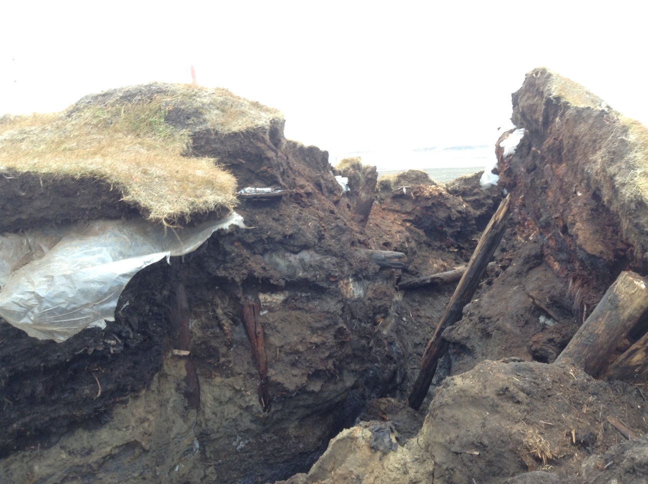
I went down with a crew from UIC Science Logistics to evaluate it. We found that there had been a lot more Visqueen under the surface than we had thought. The stratigraphy is very complex, with a very large feature containing solidified marine mammal oil, some artifacts and what appears to be maqtaq at the landward edge of the slump block.

Unfortunately, the marine mammal oil feature is starting to break loose from the main slump block and tip back into the crack between the block and the intact site. We put driftwood props under it, and then stopped all work under the overhang, since it could easily kill someone.
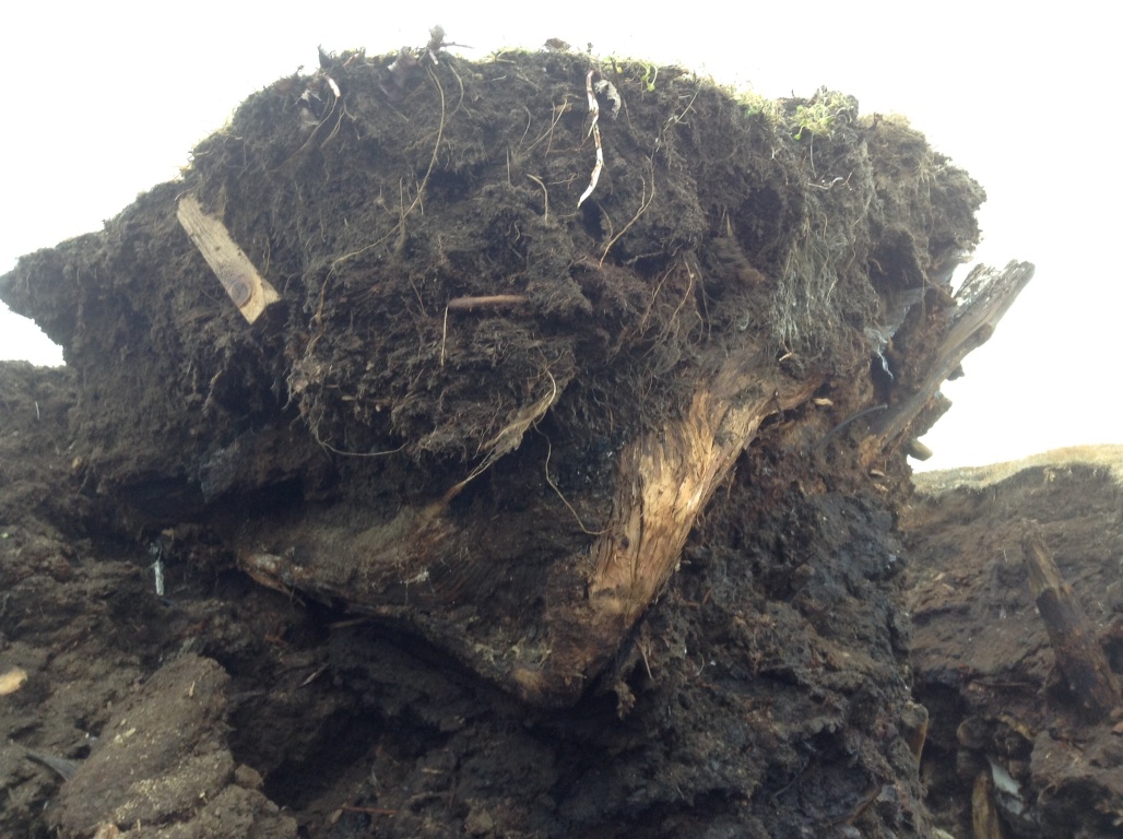
We didn’t find any loose artifacts, although there were a number of visible artifacts that were frozen in. Some folks had been collecting them and turning them in, which is great. I’d really like to thank everyone who has been helping in this way. Unfortunately, some other people have just been collecting them. Several of the artifacts that we saw the first day were gone by the time we returned.
After we headed home, the next day was spent in getting a crew and material to do some stabilization. Several of the Barrow-based UIC subsidiaries pitched in with materials, crew and transport, and we went back to put some temporary protection on the site. We were able to cover almost all the eroding surfaces with geotextile fabric , secured with some cutdown metal support fasteners and sandbags.
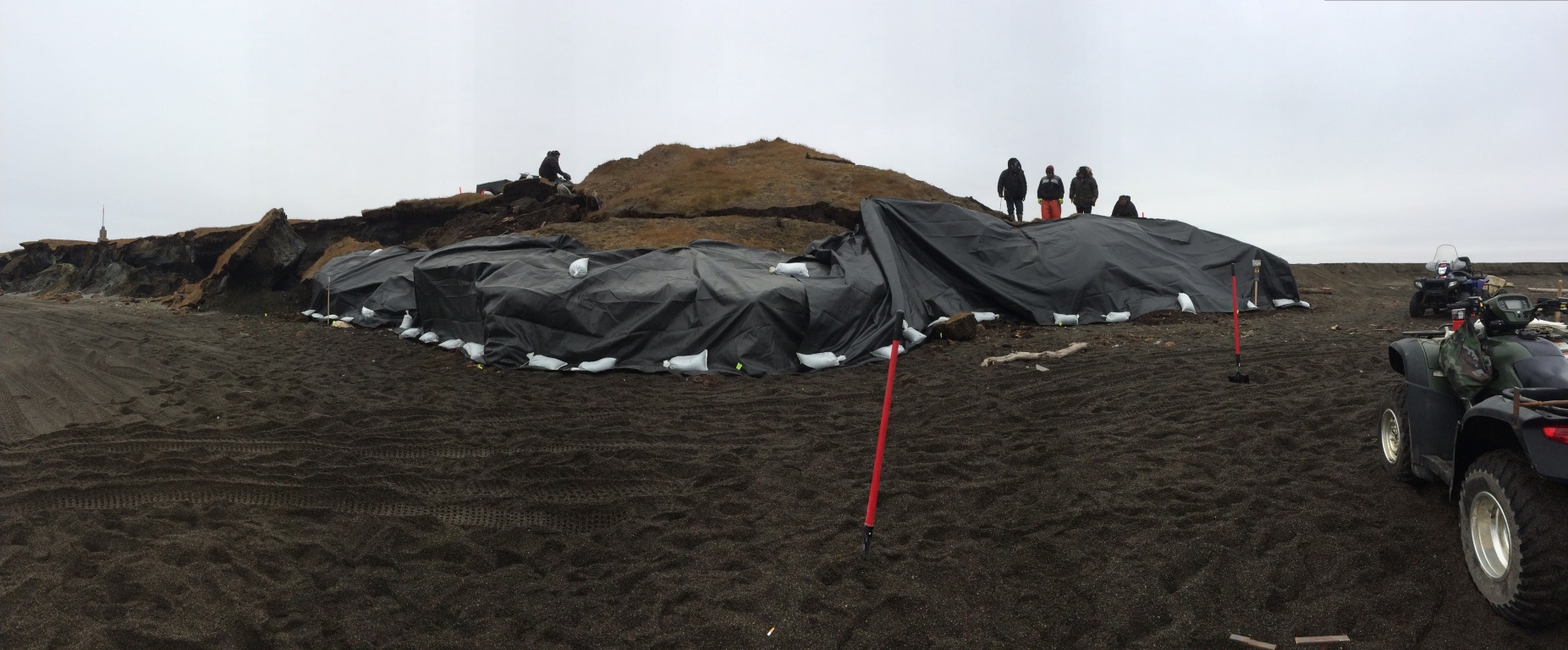
We made another trip down with the theodolite to map the new boundaries of the site. This let us document the loss of over 33 feet (11+ m) in that storm alone. We also put a lot more sandbags on the site, and so far it has resisted the weather.

One thought on “A quick recap”