I had a fun morning talking to about 40 elementary school teachers from the North Slope Borough School District. They were having an in-service. The original plan was to take them out to Walakpa by boat, but the weather this weekend features snow, a bit of rain and winds up to 30 mph. So–not boating weather.
Since we knew this a couple of days ago, we were able to get the lab ready for visitors. We (Ashtyn & I) put out several drawers with some of the more interesting artifacts from Walakpa and Nuvuk. I put together a slide show to give them an idea about the project, which we showed before they visit d the lab. I also talked a bit about the history of science in Barrow, and the building of the BARC.
A number of the teachers are interested in bringing their classes out to the lab. A few of them are also interesting in volunteering, either in the lab or as photographers. And I think I probably sold a bunch of the Barrow Science hoodies, given how many people asked how they could buy one :-).
After we got back from Walakpa, we had fieldwork in both Deering and Wainwright, which kept me pretty busy. After that, I had to head to Honolulu for the World Conservation Congress. I had organized a workshop on Global Environmental Change Threats to Heritage and Long Term Observing Networks of the Past. The timing of the conference was a bit unfortunate, since it overlapped with the World Archaeological Conference in Japan, so the workshop was fairly small. However, the idea was to get some of the people who are active the conservation field to look to the paleoecological data from archaeological sites to help build realistic conservation plans. It was pretty well attended and on top of that, it was live-streamed. The video is now up on YouTube for your viewing pleasure.
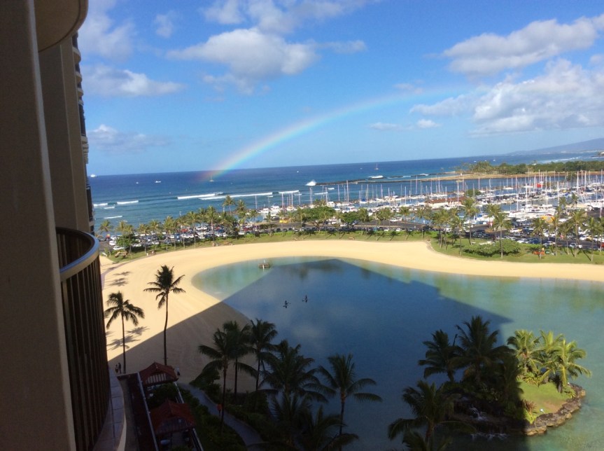
Honolulu was quite a switch from Alaska, with temperatures in the 80s the whole time. It was beautiful, of course.
Rainbow on the walk back to the hotel after the workshop.Another rainbow from the balcony of the hotel room.
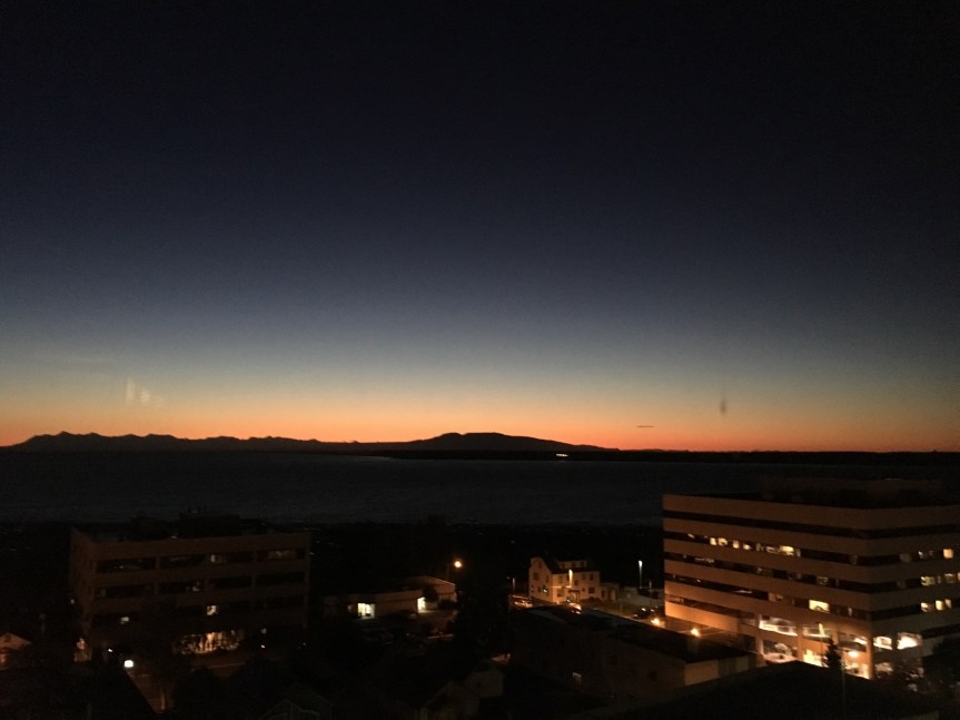
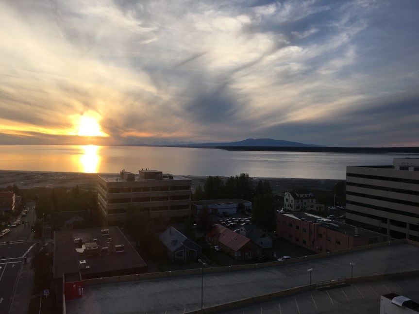
On the other hand, it was nice to get home to Alaska. The sunsets are better.
I’ve had a request from Fleur Schinning, a graduate student of Leiden University in the Netherlands. She is doing research on archaeology blogs, and how they can help the public be involved in archaeology, and has a questionnaire she would like to ask readers to fill out. I’ve tried to attach it here: Questionnaire for blog readers. It should also be available at this link:http://goo.gl/forms/z3BAUTyYUL
You can fill out the form anonymously, or if you give her your email she will be holding a drawing for 6 issues of Archaeology magazine.
Yesterday was supposed to be a big day for interviews. One of the Alaska TV stations has someone coming to Barrow who wanted an interview, and Joe Schuldenrein was scheduled to prerecord an interview with me for his internet radio show on archaeology, Indiana Jones: Myth, Reality and 21st Century Archaeology. Unfortunately for them, the TV folks went on a tour of the entire state, except Barrow, courtesy of Alaska Airlines and didn’t get in until after 7 PM. We may reschedule.
The radio interview did happen, and will be broadcast today, 1 PM EDT, 4PM AKDT. I believe you should be able to access the archived version here after the broadcast. If you want to listen live, I think you can log in here and do so, but I don’t know the details, since I have only tried the saved version of the show.
Now for some time in the lab, and maybe another interview…
Wednesday at 3 PM Pacific Time on VoiceAmerica Variety Channel
Indiana Jones: Myth, Reality and 21st Century Archaeology
Imagine that you are an archaeologist carrying your equipment to site only to meet a polar bear along the way! Once you’ve arrived at site, weather conditions may mean the ground is too frozen to dig or you have a chance of getting hypothermia if you try waterscreening. While Indiana Jones is well known for his travels to far off places and harrowing recovery of artifacts, what are the dangers of archaeology in less desirable destinations? Our guest, Dr. Anne Jensen, has over 30 years experience working in Barrow, Alaska, the ninth northernmost city in the world! Although remote, the climate of Alaska’s north coast allows for the recovery of some remarkable items including ivory harpoons, plank floors, and even seal oil. Join our guest, Dr. Anne Jensen, and us as we discuss her archaeological work in this far-flung part of the world and how her findings challenge the idea that such environments are inhospitable for human occupation. Learn More »
Missed the Live Shows? Past Episodes are available On Demand and Podcast Ready.
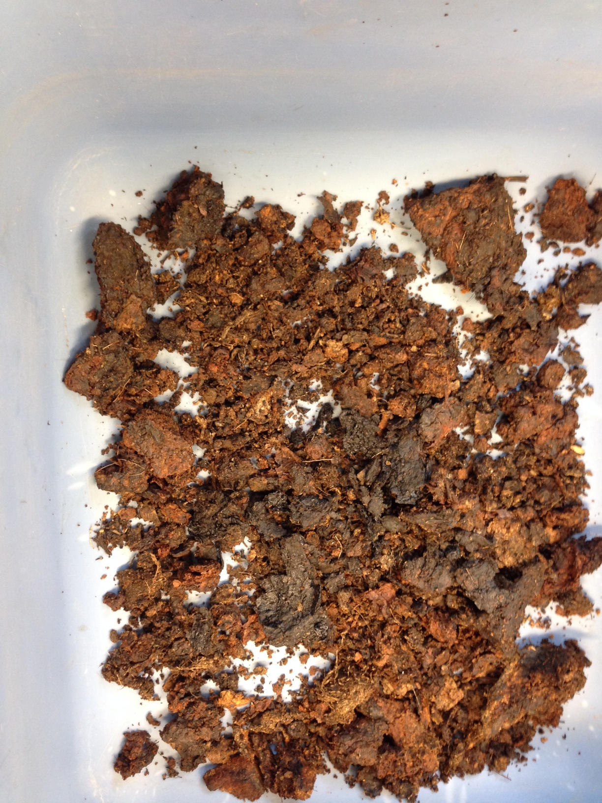
… can be a bit overpowering. I chose one of the bags of frozen samples from Utiqiaġvik to thaw out for the lab tour after the Saturday Schoolyard talk.
The talk went well, with a very large turn out. Afterwards, a fair number of them came by the lab for a tour. And then I opened the bag. It was from Mound 8, and was described as containing fish bones and perhaps artifacts embedded in seal oil.
Provenience tag from the bag.
It was rather smelly to say the least. The oil made up most of the matrix, with a consistency like cold greasy peanut butter. Not only that, the most obvious contents were wood chips and hair, which weren’t too exciting. Most folks didn’t feel like hanging around too long. Since it was my birthday & there was a party at my house, I didn’t finish the bag.
Today I got back to work on it for an hour or so. It still smelled, I guess, but I think the smell of old seal oil is sort of nice. It’s the smell of archaeological sites, and they are places I like to be. The couple of extra days had let the oil warm up and it was a little easier to work with.
Contents of the bag.
I found a number of interesting things, including a fish vertebra, some fish scales, a number of hairs, some bone fragments, and of course, wood chips. When I was labeling the bags, I realized it had been excavated by none other than Kevin Smith, now at the Haffenreffer, exactly 32 years and 3 months ago.
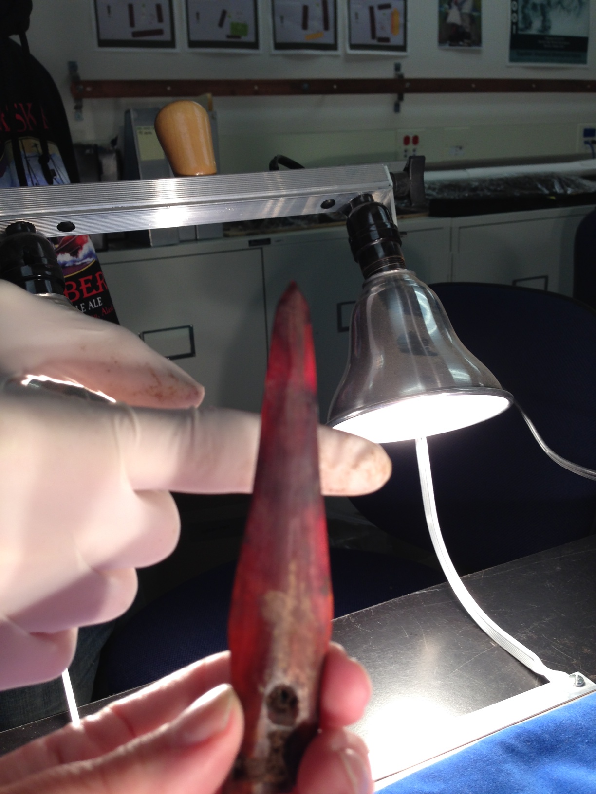
This Saturday, I’m giving a Saturday Schoolyard talk about the Walakpa salvage project. That means I need a lot of pictures. So I spent the last couple of days in the lab taking pictures of the artifacts from we recovered.
Just a few of the results:
Rim sherdFragments of arrowheads.Very thin ivory harpoon head. Note the shadow of the finger showing through the artifact.
I am currently in Washington, DC, participating in a workshop on Arctic Research and Logistic Support planning. The idea is to get a group of scientists working in the Arctic together to see what we think Arctic research will be like in 10-20 years, and what sort of logistic support will be needed. Then, action steps to get there from here will be formulated. One hopes it is not just an exercise in futility.
As is usual at such gatherings, there are not very many social scientists. There are a lot of physical scientists (marine, terrestrial & atmospheric) and a fair number of biology types. Many of the groups are quite interested in new “toys” (UAVs) and the like, as well as more icebreakers. Better connectivity is also something that is high on most people’s lists, mine included. What I find interesting as an anthropologist is how the cultures of various disciplines vary so widely. One of the breakout sessions was organized more or less by location of research (with social sciences its own group). I actually went to the Coastal group, since I’d just had lunch with Sophia Perdikaris & Genny LeMoine, both of whom are archaeologists, who were going to be in the social science group, and I thought it might be more valuable to get a social science voice into one of the other groups.
The variation in the visions of the groups when they reported back was quite striking. Although there were some things all agreed on, one group saw research in 10-20 years as being done remotely. They even thought that maybe social science could be conducted through social media. Unfortunately they didn’t describe how they imagined one could excavate a site that way; I’m sure it would be a lot warmer than what I was doing last month!
While all that was going on, the Alaska Dispatch picked up Abra’s Arctic Sounder story. Then Archaeology magazine added it to their website news, even asking if they could use a specific picture from this blog. Then they used another one… Oh, well. And I got another interview request.
For some reason, this year there has been quite a bit of media interest in Barrow and archaeology. To begin with, there were several film crews in Barrow while we were working at Walakpa, two of which actually came out to the site and filmed as well as filming in the lab. Only one of them has anything out yet. PBS filmed for several both in the field and in the lab, and a little bit of it made it into this piece, and a shot in the slideshow that they put up on the web in conjunction with the series on sea ice change. It was a very buggy day in the field, and it was quite the challenge not to be swatting mosquitoes all the time.
Oh, and the buoy experiment that Ignatius Rigor is working on in the film clip is supported by UIC Science staff (not that they have to do much, the idea is to see how the buoys do with no servicing). Their data can be compared to data from ARM’s established serviced meteorological instruments. That way, when scientists get buoy data, they have an idea how reliable it is, and if there are any special considerations in interpretation (becoming uncalibrated over time, etc.)
We’ve also gotten interest from the press. Abra Stolte-Patkotak, one of our volunteers writes for the Arctic Sounder, and did a piece on the Walakpa excavations, which is on-line here. For some reason, they don’t have the picture that was published up on-line, but I will ask Abra if I can put it up here & add it if so.
I am currently working with a free-lancer who has interviewed me and asked me to fact check the article before he goes further. A very good idea, as many years ago I was interviewed by a reporter who mis-heard my answer to the question of how far back in time human occupation of the Barrow area was archaeologically demonstrated to extend. I said “maybe 4 to 5 thousand years” which was what people thought reasonable for Denbigh at the time. He refused fact-checking help, and published an article in which I was directly quoted as saying “45,000 years”. Although Glenn & I could never get the Arctic Sounder to mail our subscription to us in Pennsylvania, apparently Tiger Burch could. I got a very puzzled email from him after the article came out, in which I believe he was politely trying to ask me if I’d lost my mind. Fortunately, he had enough experience with the press that he believed the explanation.
On Friday afternoon we headed to Point Barrow. I’d gotten KTUU set up with Aarigaa Tours, who picked them up in town at Top of the World Hotel, and then picked me up at my house at NARL on the way out to the point. I’d run home from work to change into my warm gear. A good thing, too, as will become clear later.
We’d been having a pretty strong blow from the NNW, and waves had actually been coming up onto the road. The road to the point had actually been closed right by Piġniq (Birnirk), because the waves had been breaking over the road and had done some significant damage. We were in a van equipped for off-road travel, so we were OK, but we had to detour through the cabin area. Once past there, the road was still in pretty good shape, but we could see water seeping in under the gravel berm. Once we got out a bit farther we could see a number of vessels & barges that had come into Elson Lagoon to anchor up and wait out the rough weather.
Barges in Elson Lagoon, seen from the trail by the marked graves.
Once we got to Nuvuk and got a look at the site, it was a bit depressing. However, it made a perfect example of coastal erosion in action, and made it really easy to illustrate how information about the past, which could have application to understanding what directions to take to have a sustainable future, is being lost. At least 10 feet (3 m) of the site had been lost to the ocean since couple weeks ago. The gravel slump that had been protecting the face was gone, and thawing permafrost was sticking out and undercut.
Exposed thawing Ipiutak level at Nuvuk.
And in that permafrost was the same strandline debris that has proven to be a marker for the Ipiutak occupation. There was a large patch of what looked like fur or peat (which often seems to be found on the floors of Ipiutak structures) and an area where the wood seemed to be far more aligned and level than is normal for a strandline, but would be quite typical for an Ipiutak floor. I tried to get decent pictures, but in the end decided I needed to try to get a sample. I tried walking down on the permafrost, but it was angled, and I couldn’t get close enough without falling off. There were big waves, and the bluff was undercut. If a really big one came at the wrong time, it could wash me off my feet.
Finally, I asked Ricky Bodfish, who was driving the tour van & giving the tour except for the archaeology part, if they had a rope. He did, so he dangled it down the bluff by me, we waited until right after big waves when it looked like a lull and I went down to check it out and try to get close-ups and a sample.
Sampled peat in Ipiutak layer. My finger for scale.
The patch of material turned out to be peat, which I was able to sample, and will send out for dating. My camera got some spray on it, but there was not way or time to clean the lens, so I just kept shooting. Unfortunately a pretty big wave came and dumped gravel on the surfaces just before I got a shot off of the wood, (I managed to turn so I caught it on the side where KTUU’s microphone pack wasn’t) and I could hear the next one was even louder. I ran, and made it into an area above the waves before the big one broke.
Edge of eroding Ipiutak layer showing some of the aligned wood. The white is the foam on the wave that is going under this layer into the bluff.
Fortunately, nothing soaked through the Carhartts so I just took them off for the rest of the trip.
We had been monitoring the tower we’d put out in June, and just a few days earlier had thought it would be fine. However, the storm had taken out a lot of the bluff, and I wound up calling & texting the guys who work on the ARM project for UICS. They wound up going out later that evening and hauling the whole thing about 50 feet (15m) farther back from the edge. Just in time, since by the time they got out there, they figured it was 2-3 feet (< 1m) from the edge.
Getting close to the edge.
After that, the KTUU fellow wanted to see the farthest North point and go to the bone pile to see if there were any bears. We set off, and almost immediately had to detour. The trail we normally use to get to the site, which is always dry, had water all over it from the storm surge.
Trail covered by storm surge.
We made it to the farthest North point, which was a bit less far North than previously. The storm surge had made it to the tip of one of the whale jawbones, and about 10 feet was missing here too. However, we did get some nice light, and the KTUU guys got busy.
Crew and van near Farthest North PointDan Carpenter gets ready to shoot at the Farthest North Point.
KTUU crew at Farthest North Point.
Unfortunately, the trip to the bone pile did not come off. The storm surge had caused it to nearly become an island. Ricky was not sure how solid the ground was, and we did not want to get stuck there, so we gave it a miss. On the way back to the road, it was really clear how much of the Chukchi side of the Point Barrow spit had been eaten. The ocean was almost up to the berm along the road, and there used to be a fairly wide strip of gravel there.