We made it back into town just over two weeks ago. The field season went well, despite a few challenges from sea ice, snow drifts on the beach and general cold weather. There was a huge amount of catching up to do (nearly 4000 emails), three projects which needed various forms filed, an MOA which had to be done for this project, some radiocarbon calibrations to write up for another project, lots of equipment which needed to be cleaned, dried, put away or returned, and many artifacts and samples which needed processing. Although I had lots of help, I’ve been working 16 hour days since before we went into the field, and something had to give.
Unfortunately, we didn’t have good connectivity in the field, so the only updates I could send were from my deLorme InReach. At 160 characters per message, it really isn’t up to blog posts. That means I’m sort of going to have to do some catch-up posts. I head to Deering for a monitoring project on Saturday, and it’s not clear how good the connectivity will be there either, so there may be another gap.
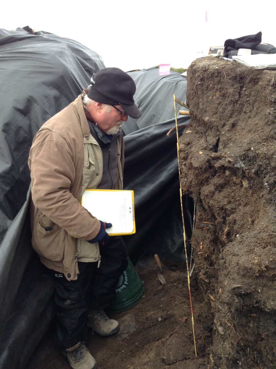
We went to work in earnest today. Owen went to work on recording the stratigraphy of the profile we had chosen for the column sample (CS 1). I had him marking the bottom of each level so we could continue excavation even after he went to sleep. Anne Garland and Laura kept working on the tests on the mound with the monument. The SW quad of the 1×1 came down on a cryoturbated sterile layer. There was metal throughout the cultural levels. We expanded northward to examine some wood in that wall.
Owen Mason examining the profile of CS 1.
Meanwhile, I set up the transit and began shooting in the CS 1 profile, as well as the bluff edge. The NW quad of TU 1 had similar results, so we put some 50x50s closer to the bluff edge to see if we could find datable material and the edge of the feature.
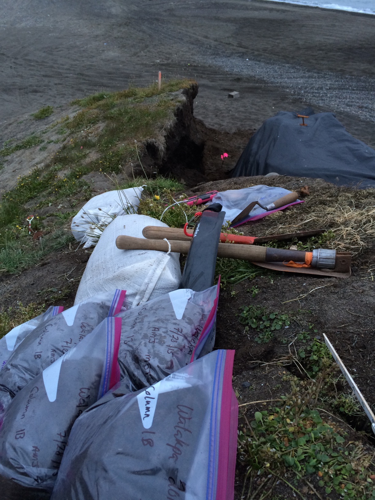
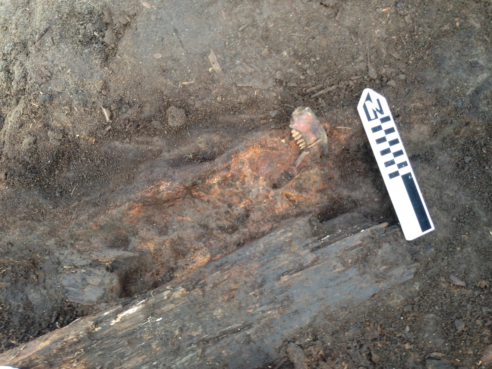
Mary Beth Timm and I took naps, so we could stay up late and work on the CS 1 profile. After dinner, we shot in the upper levels of the CS 1 profile, as well as a polar bear jaw that was exposed in Level 12, so that it would not get stepped on. Mary Beth & I started excavating CS 1. We are excavating in natural stratigraphic levels, with any level that is more than 5 cm in depth broken into 5 cm sub-levels. One gallon from each 5 cm is being kept as a bulk sample, and we are screening the remainder.
Midnight double selfie. Anne & Mary Beth at work on CS 1.
We kept going until it go so dark that we really couldn’t see the soil colors, which was around 2 AM. We had accomplished a fair bit, so we headed off to bed.
Results of our labor.Off to bed.
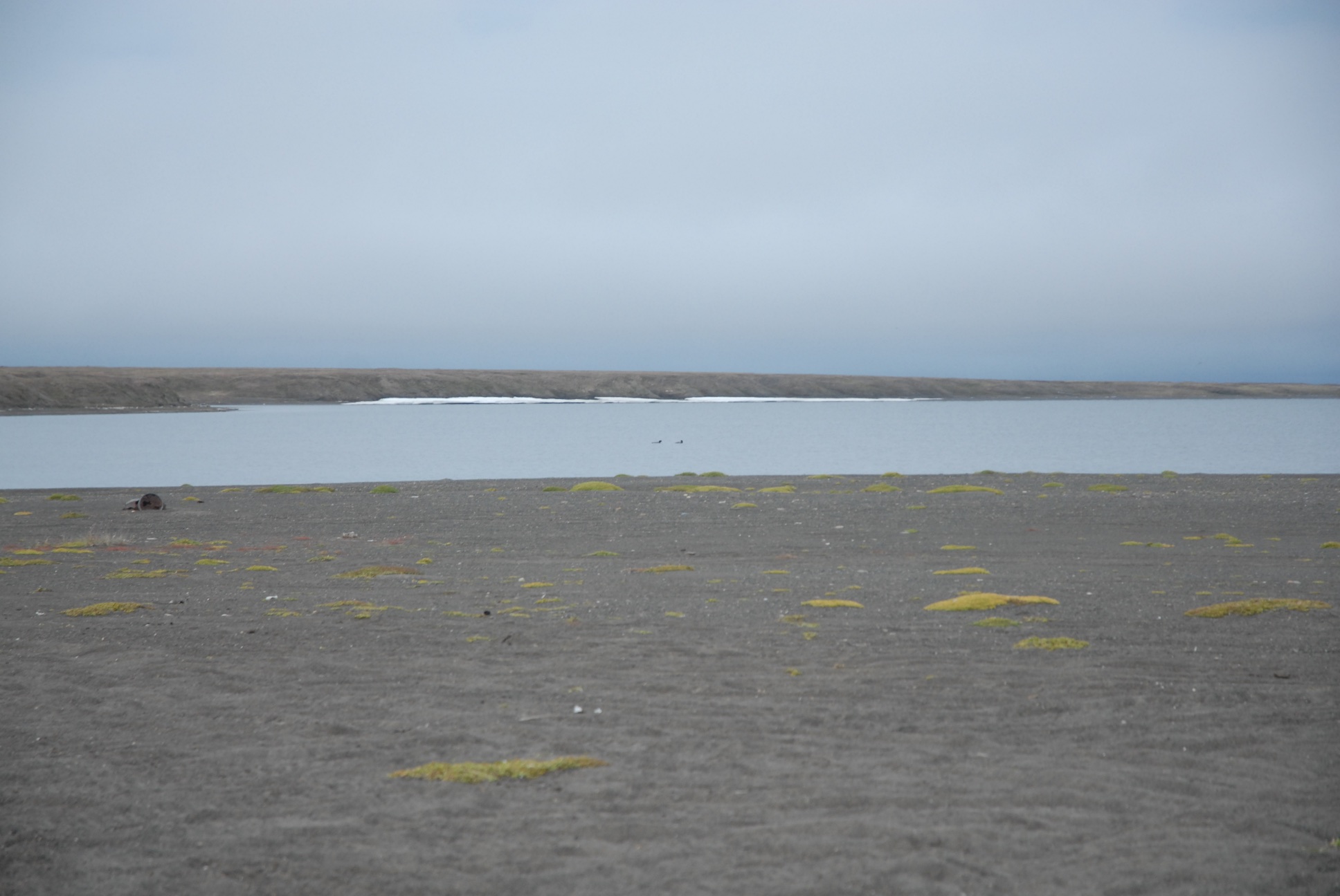
The weather is often best at night. It was really beautiful. A pair of loons was swimming on the lagoon.
Things got rather busy around here, since I hadn’t actually been planning to be in the field, and had several other things going at work that required some time and attention. Combined with rather chilly weather and a commute that did my no-longer-fused spine no favors, I wound up putting sleep ahead of updating the blog. Now that the fieldwork is done & I’m getting everything else caught up, time for an update on what happened before the season ended.
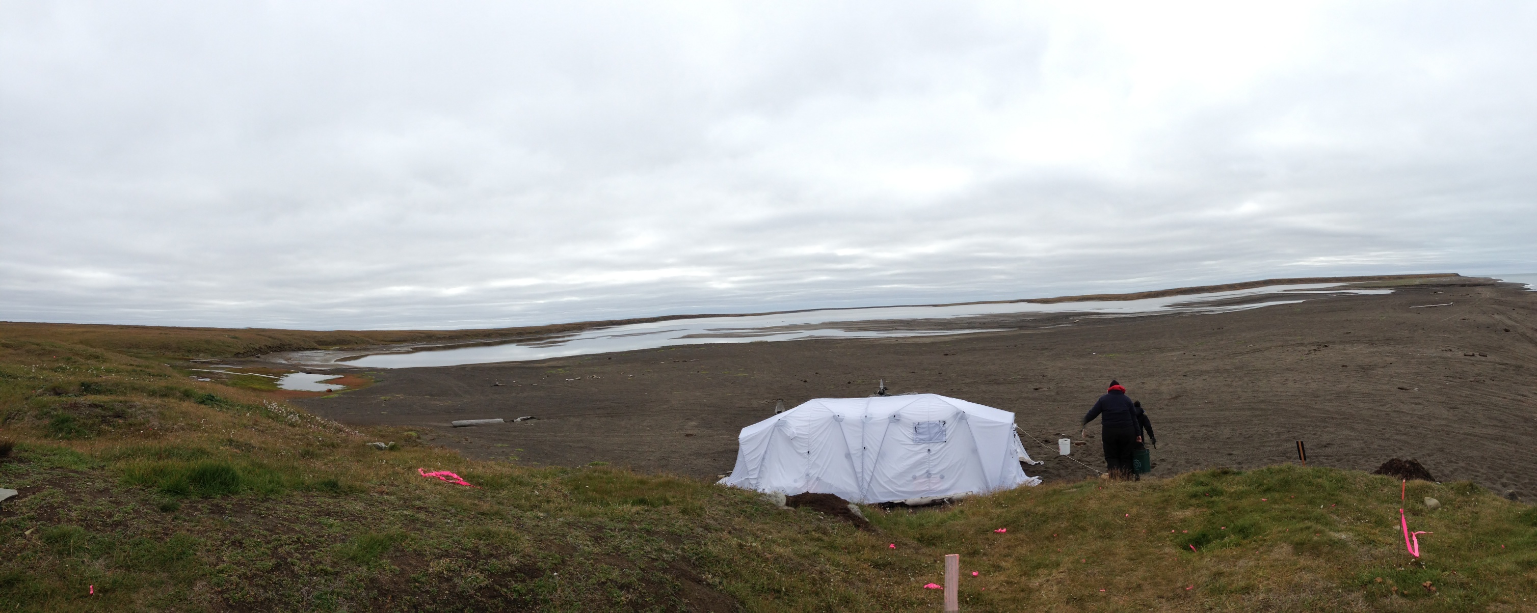
We managed to get quite a bit accomplished before the weather stopped us. Fortunately, the entrances to the lagoons closed up, and we generally had less trouble getting to the site in September, thank goodness! In the end, we had just hit frozen ground at the back corner of the excavation when everything started freezing up. This is good, since that means everything behind/below that should still be in great shape if erosion doesn’t get to it before we can. We actually had some really lovely days. And enough wind so no bugs!
Lagoon and tent on a nice day, as seen from the excavation.
The floor that we had encountered in the south end of the trench cleaned up nicely. There had been a pot in the corner, but all that was left was a pile of smashed sherds. The digging of the pit that someone had put in above it had probably smashed what was left. Near where the arrow shafts were found was an area of floor so soaked with marine mammal oil that you could actually wipe it off of one patch of floor. It seems most likely that this was a tent floor, since there was no evidence of structure otherwise, and it was not far enough below the surface for a semi-subterranean house.
Probable tent floor after cleaning. Pot was located in the lower left corner, left of the stick. The oil patch surrounds the North arrow.
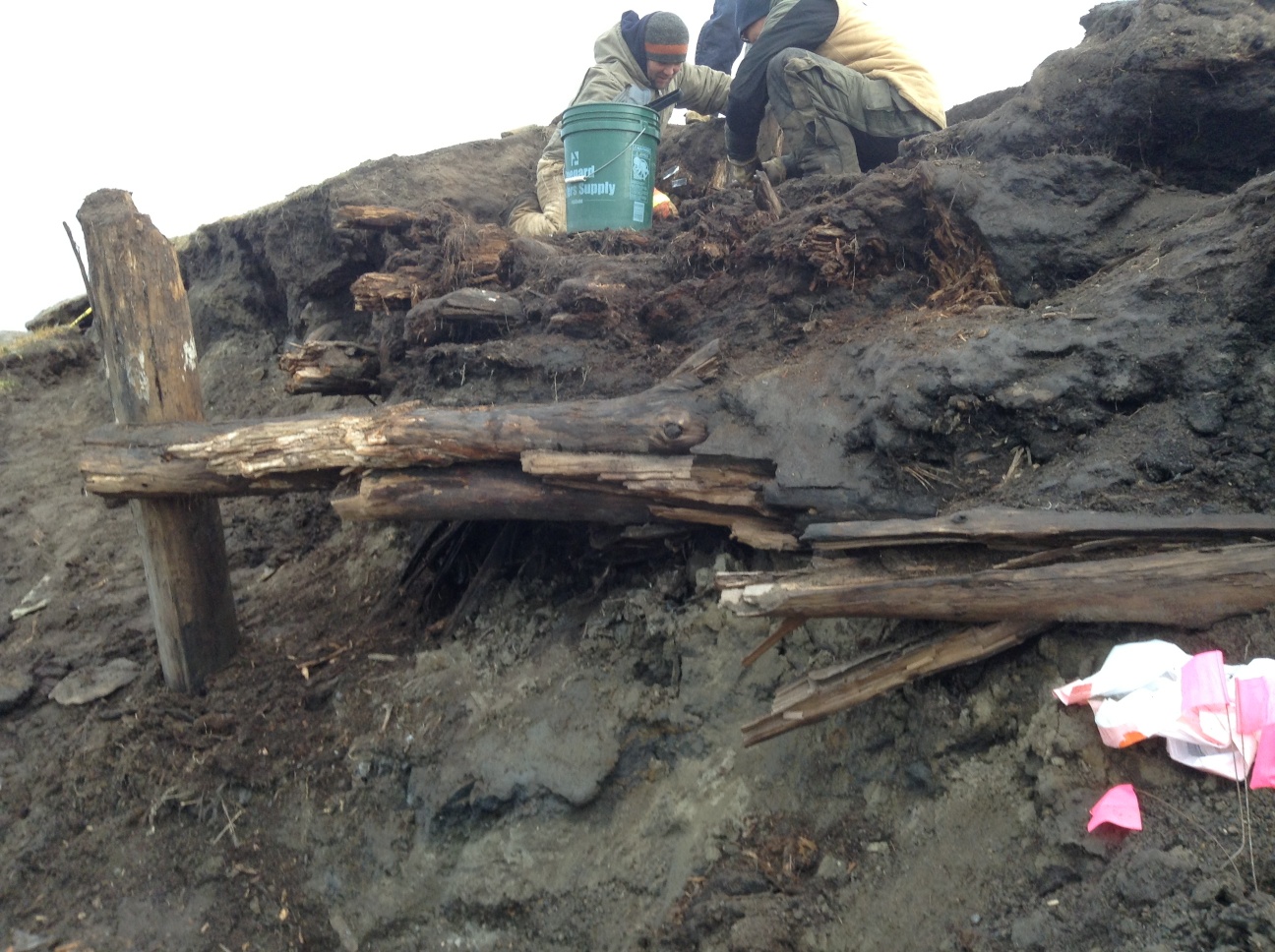
The house (at least I think it was a house) proved very complex. The small area we were able to open was not big enough to let me see what was going on well enough to be definite. However, there seem to have been several floors. We were not able to get down to them before freeze up, but we determined that there were several layers of midden (trash deposit) on them, so it would appear that the house must have been abandoned and reused, rather than just rebuilt.
View from the side showing several layers of floor logs above the sill logs & below the green bucket.
At some point in the sequence, it looks like the structure may have had a meat cache pit (sort of the forerunner of today’s ice cellars) in it. There was a distinct line of hardened red marine mammal oil
North edge of the meat pit. Caribou jaw lying along the sloping side just to the left of the North arrow. The red oil layer continued under the plank. The north logs were above the edge of the pit, but there was a layer of midden in between, so they were not associated.Another view of the red oil level underneath some logs (possibly 2 separate floors). Notice the seal scapula used as a chock under the plank on the right.Another view of the red oil layer showing it sloping up to the right. Note that the apparent sill logs for the main structure are below what is visible in the picture.
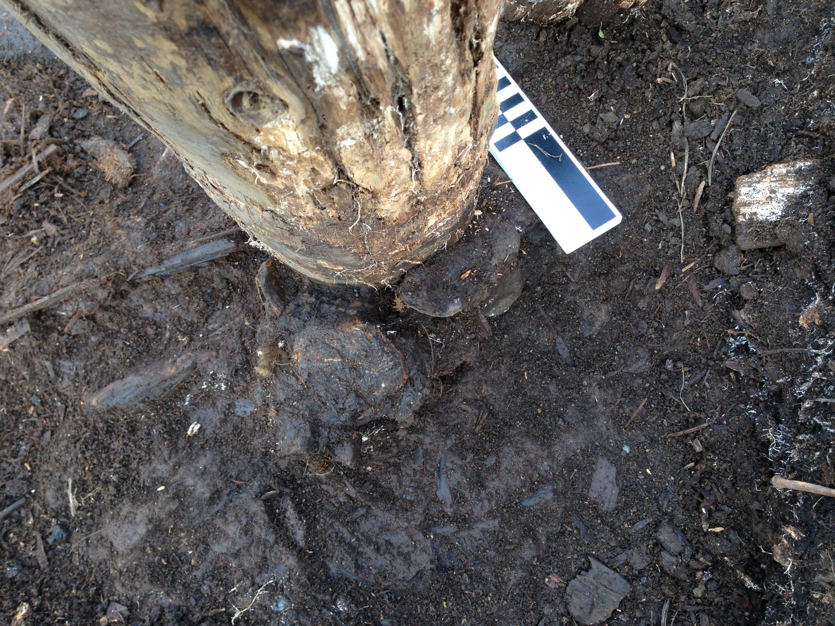
We got all the way to the bottom of the large post in the northern half of the trench. It turned out to be a later addition, dug into an existing midden, and chocked with a seal sacrum, a walrus vertebra and a broken pick head. There were two smaller (and apparently earlier) posts very close to it, one of which had a deposit of shell next to it. That will be interesting if we can ID any of them.
Post, showing sacrum and vertebra used as chocks.Post with pick used as chock at base to left of North arrow.A view of the excavation before the post and north logs came out. NO, the wall was not curved; this is a raw iPhone panorama shot, & that happens. Our walls are straighter than that!
We had been working as fast as we could on the structures at Walakpa. Given how far north we are, “Winter is coming!” pretty much applies as soon as it starts thawing in spring. We had a fair bit of windy weather, so it wasn’t pleasant working conditions, but the ambient temperature was generally above freezing, so the ground remained soft, and we were able to continue excavation.
The batteries on the transit were not happy, and we pretty much needed to have one charging at all times, or risk shut-down until we could charge a battery. The batteries are a bit old, and need to be re-celled or replaced, but since I hadn’t expected to be excavating this summer, that was scheduled to happen over the coming winter, which left us a bit handicapped.
But then, last Monday, there was a dusting of snow on the ground in the morning, and it didn’t melt. Further south in Alaska, snow on the tops of the mountains is often called “Termination Dust” since its appearance signals the beginning of the end of the summer season. And so it was here.
I had started accumulating materials to protect the site over the weekend. UIC Construction had some surplus damaged materials in their yard which would otherwise have just gone to the dump, and they were kind enough to donate them to the cause. Monday, we started hauling them down to Walakpa.
A dusting of snow on the site & the beach in the morningShards of ice from the tarp after the site was uncovered.
We kept digging, since the ground wasn’t frozen. The next morning, there was a lot more snow on the beach, and the ground was really stiff although we did manage to dig a bit more and screen all but two buckets.
We met a polar bear on the way down to the site. It was tired, resting on the beach, but was so wary that it got up and moved before we could detour around it so it could rest.
More snow on the beach. And a tired polar bear, who was none too happy when we showed up on ATVs.
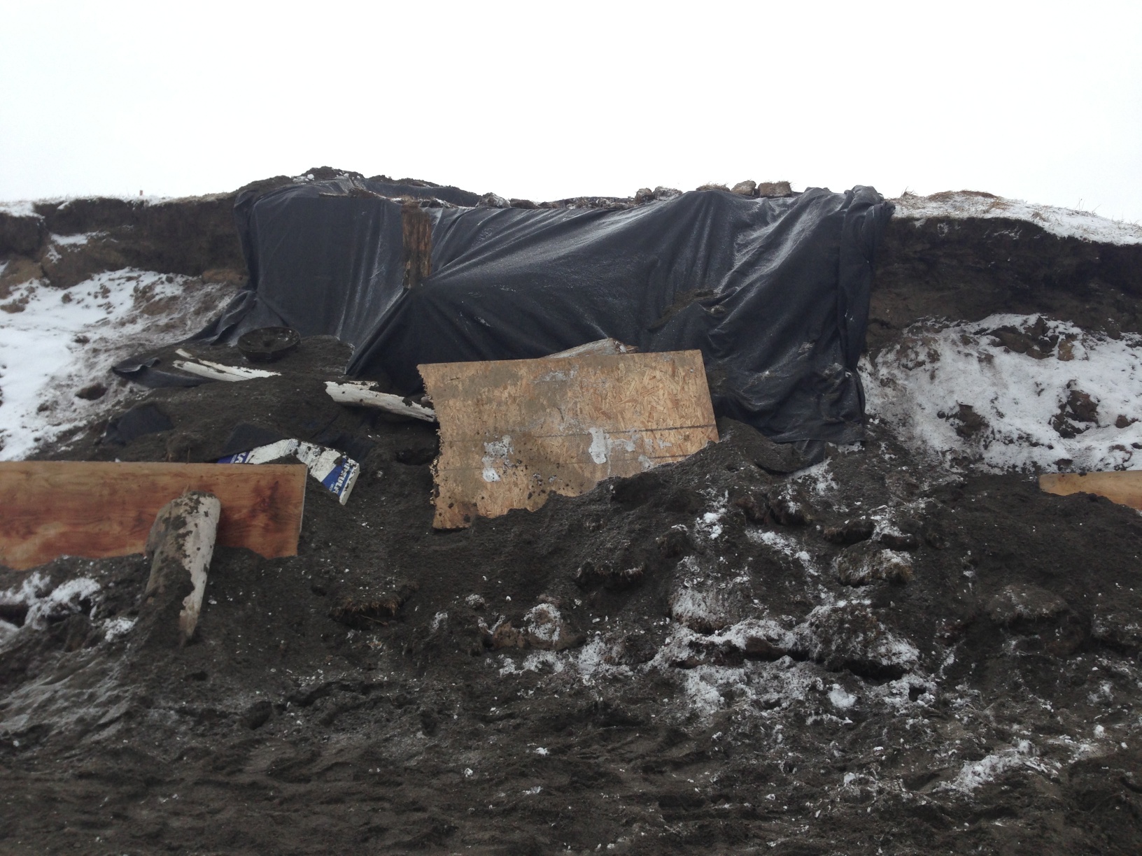
We put particle board along the erosion face of the site, and gathered sods from the beach to stack up to hold them in place. We also used upright driftwood to help hold this in place. By the end of the day, I concluded that things were freezing to the point where only a pickax would move dirt, which would sort of defeat the purpose of archaeological excavation, so we started hauling gear back to town that night.
We allowed the site to freeze more the next day, and Thursday we went down to put the site to bed & take down the tent.
We put a layer of whiteboard insulation on the top and front of the site, and then covered it with geotextile fabric, fastened in place with spikes. Then we covered that with the original sods which had been saved.
Excavation surface covered by whiteboard.Protecting the site with particle board, geotextile, sod and driftwood.Sod back on the site.
Once we had that taken care of, the gear had to be packed up and the tent taken down. We spray painted the hubs of the Arctic Oven frame so the next folks who set it up will have an easier time of it than we did doing it without instructions.
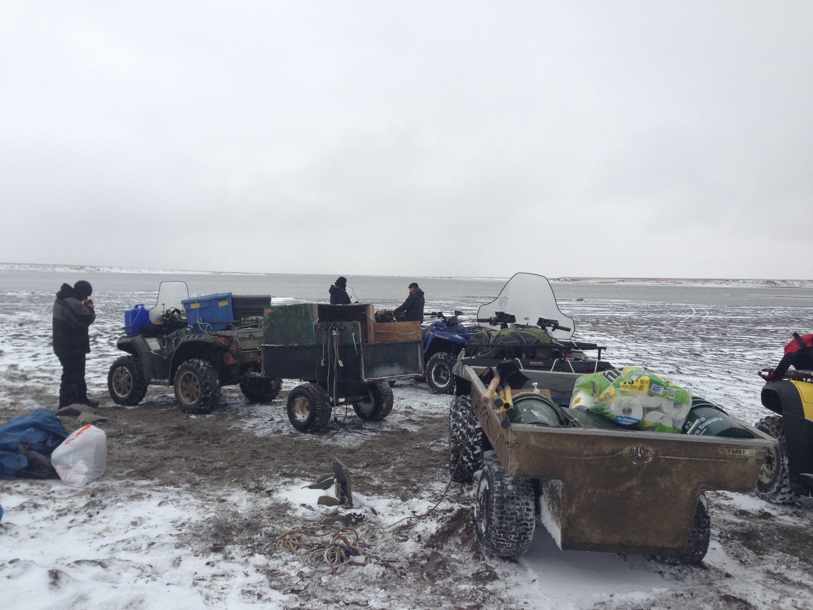
Tent & fly are packed and Jason Thomas is disassembling the frame.Packing the trailers. Riley Kalayauk brought his trailer down too, so we had 2.Happy hard-working crew ready to head home.
Now all we can do is hope and pray that there are no storms before the ocean freezes up that generate waves big enough to reach the site, and if there are, that they don’t last long enough to destroy the protection that we built. If we are fortunate, it will still be there next year, and we can learn more.
The water was a bit higher than yesterday on the way down, and we had to winch a couple of the 4-wheelers out of deeper mud, but we got to the site with not too much trouble. We put a stick in a the high water mark so we could see what the ocean was doing and went to work on the structure.
Yesterday, the strong winds made water screening where we have to do it a pretty sure ticket to hypothermia, so we tried just dry screening on the beach in the shelter of the bluffs, and it worked well.
Dry screening on the beach.
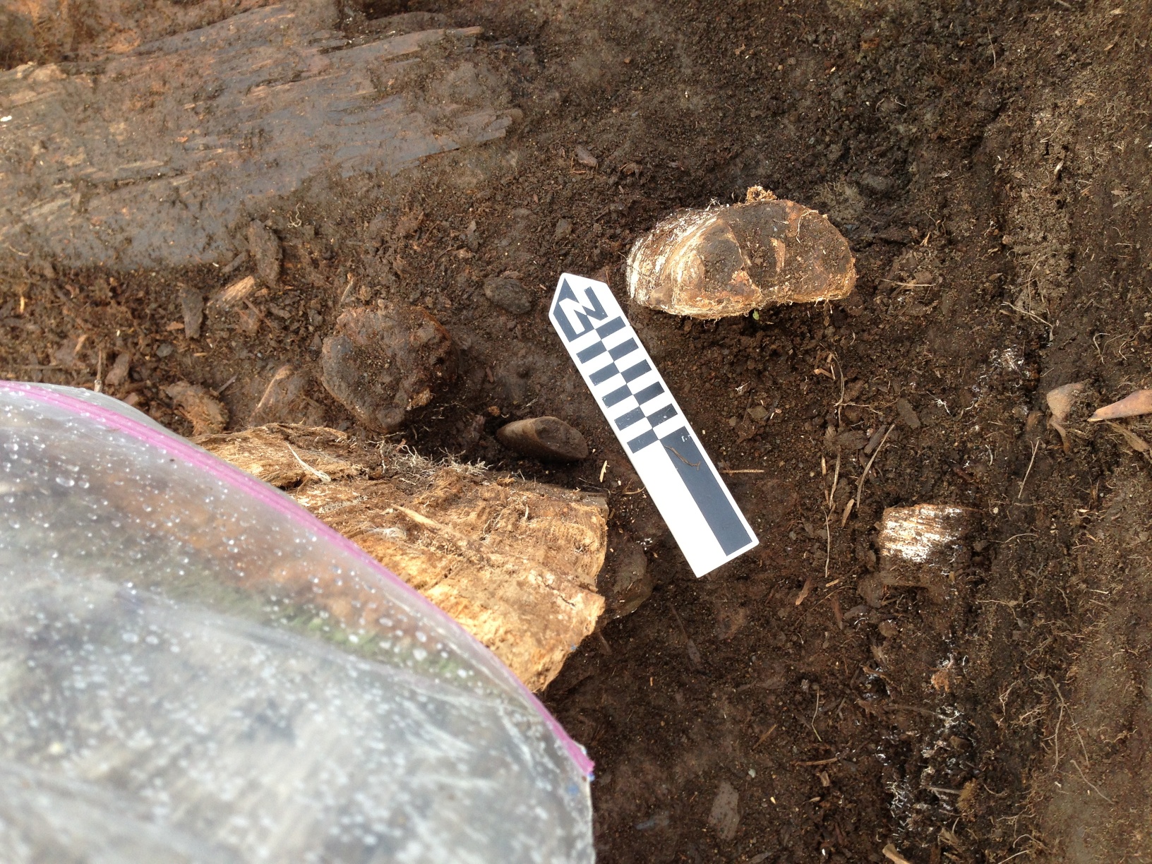
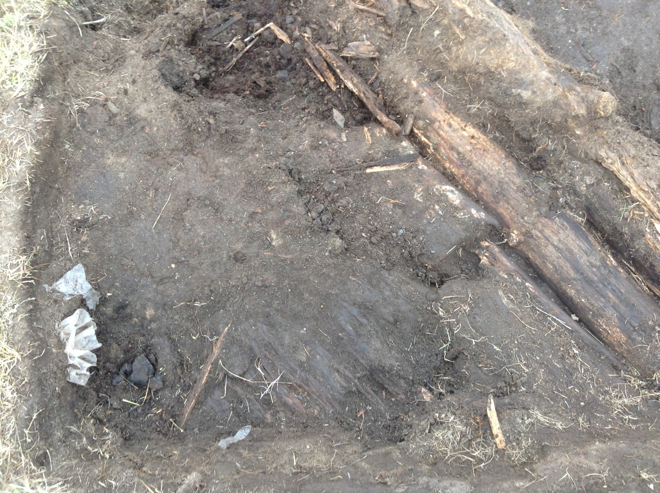
We made pretty good progress on the excavation. More logs were exposed in both of the parallel log features (fallen walls?). The area between the logs is getting soft, and seems to contain a lot of animal bones, many of which are lying in a way suggesting they were tossed into a depression. South of the southern logs, we uncovered what appears to be part of a plank floor, maybe for a tent, since it doesn’t seem deep enough for a house. Next to, but apparently not on it, there was a cluster of ceramic sherds, including a large rim sherd. This was right under an old looters pit, and their activity may have broken the pot.
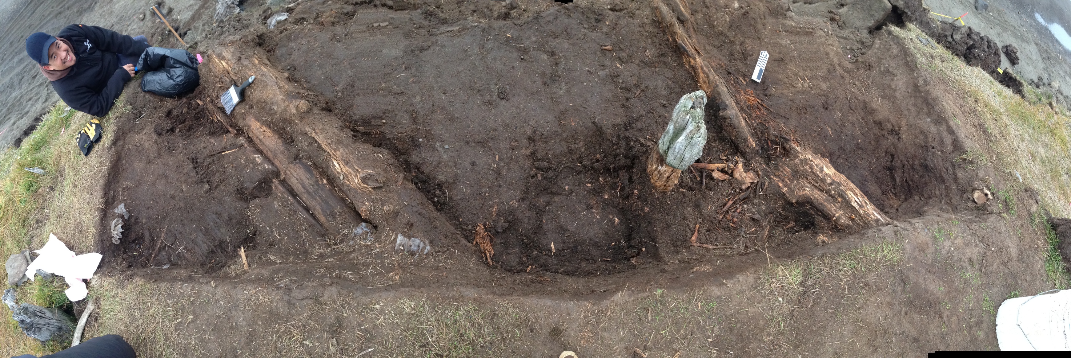
Panorama of the excavation.Ceramic sherds at lower left (with Visqueen sticking out of the wall above them), plank floor in lower center, south logs at right, and arrow shafts at top center.
Beside the logs, but again not on the plank floor, we found two arrow shafts, apparently associated with a strip of baleen, and a fragment of bird hide. A couple of pieces of hide, one sewn, had been found just above this. This could be the remains of a quiver, or possibly a work bag, since there was a ground slate knife blade fragment and a worked piece of chert nearby. We’ll continue there tomorrow.
We didn’t stay out as long as we might have, since the waves seemed to be coming higher up the beach. It turned out to be a good thing. Going back to town was a bit of an adventure for us, although only one of us got stuck, but even more so for a man & his son we met on the way. They were trying to head out towing a trailer, and had gotten really stuck in a deep soft spot. It looked like they had been there a while trying to get out. We were able to get one of the 4-wheelers with a winch to where we could pull them out, and then waited until they got turned around and back on the town side.
We made pretty good progress at Walakpa this week. This, despite a few challenges.
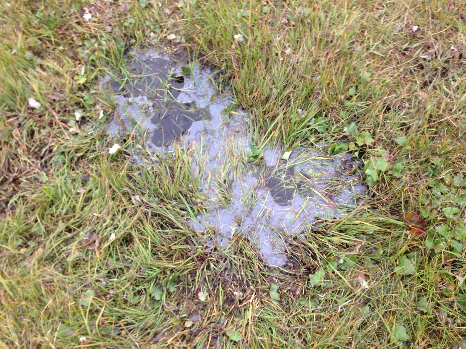
On Tuesday, we had a really small crew, due to a variety of circumstances. Only Trina, Mary Beth & I made it out. It was quite a cold day, with ice on the puddles when we got to Walakpa (or Monument).
Ice on a tundra pond.
We decided to leave the screening for another day and just excavate. It was cold enough that we actually took advantage of the removable floor in the Arctic Oven tent on site and used the Coleman stove inside, but on the ground.
The Arctic Oven on a cold day
The next morning, we had a bigger crew, but there was snow on the ground when we set off.
Snow on the tundra, seen across Middle Salt Lagoon.
We were not expecting to have a great day, but in fact it was warmer than the day before (no ice), and we started getting down to what seems to be structural wood from the house roof, so that was fairly satisfying. We got a lot of water screening done, as well. The beach had really stabilized, so we were able to go the whole way on hard sand, and even most of the lagoons had closed up, with sandbars across the entrances that we could just drive across. The commute to the site was much quicker.
Thursday did not go well. We headed out, only to find that for some reason, the waves were really coming up the beach and running into the lagoons, so that we were not able to get across the stream by the gravel pit. We went around and through the gravel pit, but then could not get across the stream by Nunavak. We did see a polar bear in the water near a dead walrus). I decided we should try to go around, since it was otherwise a nice day & I hated to lose it, but we didn’t have any extra gas along, and by the time we were half-way around, even cutting across country rather than following the shoreline, it was clear that some of the Polaris’s are sort of gas hogs. So back we went to the road, with only one minor mishap when the Tubby trailer bounced into a very wet low-centered polygon and dragged the ATV half-way in. I got my feet wet getting it unstuck, but we still went back down to the beach so that David Pettibone could get a picture of the bear, still in the water, from a safe distance.
Today, despite no major change in wind strength or direction, was very different. The beach was back to Wednesday’s shape, and we got to the site easily. It was quite sunny in the morning, and we got right to work. We had six people, so we started with 4 excavating and 2 screening.
View from the south end of the trench, where I was digging. Pretty well maxed out. L to R: Mary Beth Timm, JoAnn Akootchook and Michael Berger.
I played around with my iPad mini for taking pictures to supplement field notes & drawings. I don’t draw all that well, and used to take Polaroids and draw on them, but that technology is gone and wasn’t that stable anyway. I’ve use a couple of programs to annotate lab photos, but this was the first time I tried it in the field. I used iAnnotate PDF, which lets you put sound files on the image, associated with notes or drawings. They open fine in Acrobat. This will be quite handy.
I got back to Barrow to find snow on the ground. It hasn’t been that stormy here, but we had a coastal flood warning over the weekend, with part of the road to Nuvuk getting washed out, and waves getting over many of the berms. I am afraid that there may have been significant damage to the site beyond the 20 m we already lost in September. I would like to get out and take a look, maybe even shoot in the bluff, before I go to Valdez & Seattle, but that is not looking too likely.
Apparently, there is a likelihood of a storm surge from the Chukchi and flooding over the next few days, maybe until the 22nd or so. The North Slope Borough is quite worried, and sending out info on emergency kits & so forth. Not a great situation. The house I live in floated in the last really big storm surge event in 1963, and if it does it again, it could wind up in the NARL sewage lagoon. Yuck.
We’ll be prepared, but I don’t think it is that likely to get that bad. However, it most certainly is already damaging Nuvuk more. It has been blowing from the north and winds are picking up. It is a bit depressing given that erosion must nearly have reached the GPR returns that we think are Ipiutak features.
Not much to be done about it, so I just push on with writing proposals & papers. I’m going to a workshop on the Kurils & Aleutians, and am slightly belated working on the conference paper. Just as I got ready to really check out the other papers prior to doing the serious writing (the outline is done), it was discovered the website had lost the last 3 weeks of updates (explains where my stuff went–I thought they were just being slow getting it up), so I couldn’t get into it. I hope we don’t lose Internet later this week, and that I have decent connectivity in Valdez.
On Friday afternoon we headed to Point Barrow. I’d gotten KTUU set up with Aarigaa Tours, who picked them up in town at Top of the World Hotel, and then picked me up at my house at NARL on the way out to the point. I’d run home from work to change into my warm gear. A good thing, too, as will become clear later.
We’d been having a pretty strong blow from the NNW, and waves had actually been coming up onto the road. The road to the point had actually been closed right by Piġniq (Birnirk), because the waves had been breaking over the road and had done some significant damage. We were in a van equipped for off-road travel, so we were OK, but we had to detour through the cabin area. Once past there, the road was still in pretty good shape, but we could see water seeping in under the gravel berm. Once we got out a bit farther we could see a number of vessels & barges that had come into Elson Lagoon to anchor up and wait out the rough weather.
Barges in Elson Lagoon, seen from the trail by the marked graves.
Once we got to Nuvuk and got a look at the site, it was a bit depressing. However, it made a perfect example of coastal erosion in action, and made it really easy to illustrate how information about the past, which could have application to understanding what directions to take to have a sustainable future, is being lost. At least 10 feet (3 m) of the site had been lost to the ocean since couple weeks ago. The gravel slump that had been protecting the face was gone, and thawing permafrost was sticking out and undercut.
Exposed thawing Ipiutak level at Nuvuk.
And in that permafrost was the same strandline debris that has proven to be a marker for the Ipiutak occupation. There was a large patch of what looked like fur or peat (which often seems to be found on the floors of Ipiutak structures) and an area where the wood seemed to be far more aligned and level than is normal for a strandline, but would be quite typical for an Ipiutak floor. I tried to get decent pictures, but in the end decided I needed to try to get a sample. I tried walking down on the permafrost, but it was angled, and I couldn’t get close enough without falling off. There were big waves, and the bluff was undercut. If a really big one came at the wrong time, it could wash me off my feet.
Finally, I asked Ricky Bodfish, who was driving the tour van & giving the tour except for the archaeology part, if they had a rope. He did, so he dangled it down the bluff by me, we waited until right after big waves when it looked like a lull and I went down to check it out and try to get close-ups and a sample.
Sampled peat in Ipiutak layer. My finger for scale.
The patch of material turned out to be peat, which I was able to sample, and will send out for dating. My camera got some spray on it, but there was not way or time to clean the lens, so I just kept shooting. Unfortunately a pretty big wave came and dumped gravel on the surfaces just before I got a shot off of the wood, (I managed to turn so I caught it on the side where KTUU’s microphone pack wasn’t) and I could hear the next one was even louder. I ran, and made it into an area above the waves before the big one broke.
Edge of eroding Ipiutak layer showing some of the aligned wood. The white is the foam on the wave that is going under this layer into the bluff.
Fortunately, nothing soaked through the Carhartts so I just took them off for the rest of the trip.
We had been monitoring the tower we’d put out in June, and just a few days earlier had thought it would be fine. However, the storm had taken out a lot of the bluff, and I wound up calling & texting the guys who work on the ARM project for UICS. They wound up going out later that evening and hauling the whole thing about 50 feet (15m) farther back from the edge. Just in time, since by the time they got out there, they figured it was 2-3 feet (< 1m) from the edge.
Getting close to the edge.
After that, the KTUU fellow wanted to see the farthest North point and go to the bone pile to see if there were any bears. We set off, and almost immediately had to detour. The trail we normally use to get to the site, which is always dry, had water all over it from the storm surge.
Trail covered by storm surge.
We made it to the farthest North point, which was a bit less far North than previously. The storm surge had made it to the tip of one of the whale jawbones, and about 10 feet was missing here too. However, we did get some nice light, and the KTUU guys got busy.
Crew and van near Farthest North PointDan Carpenter gets ready to shoot at the Farthest North Point.
KTUU crew at Farthest North Point.
Unfortunately, the trip to the bone pile did not come off. The storm surge had caused it to nearly become an island. Ricky was not sure how solid the ground was, and we did not want to get stuck there, so we gave it a miss. On the way back to the road, it was really clear how much of the Chukchi side of the Point Barrow spit had been eaten. The ocean was almost up to the berm along the road, and there used to be a fairly wide strip of gravel there.