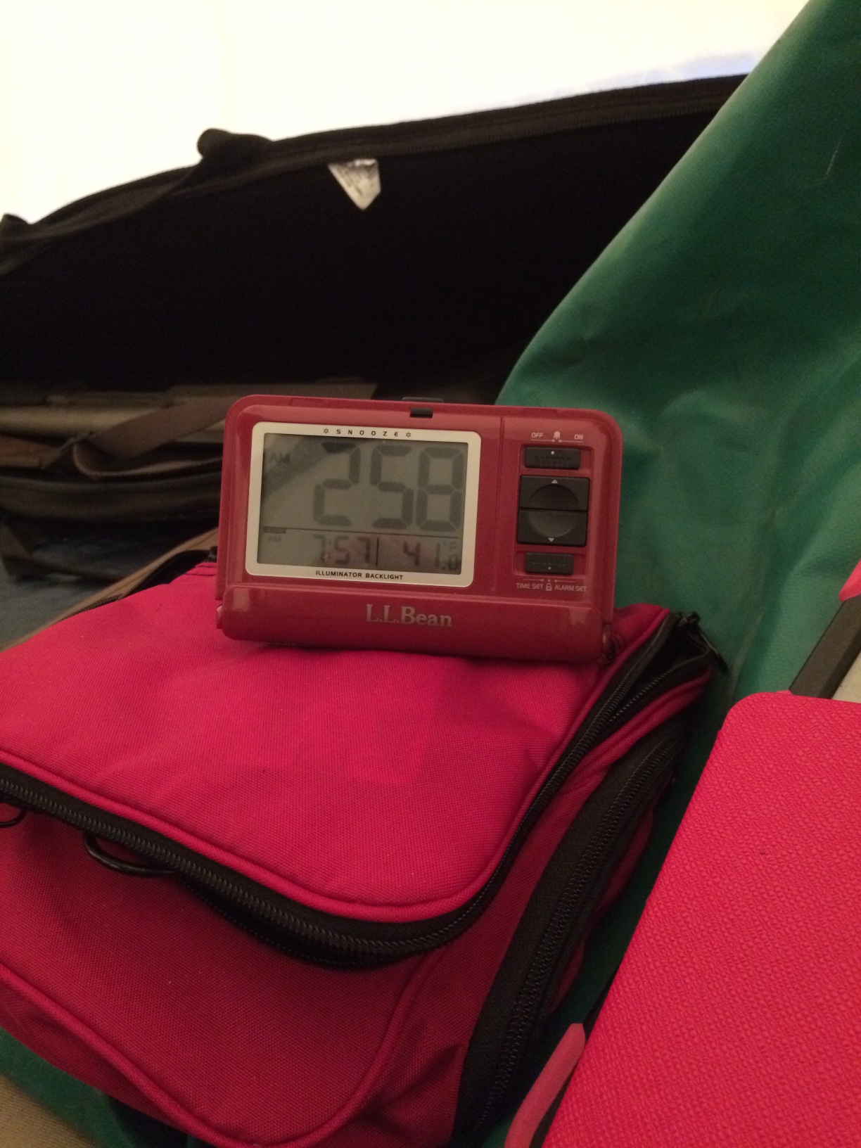
Last night was not particularly restful. The collapse had complicated matters quite a bit. However, after breakfast, we went back to work.
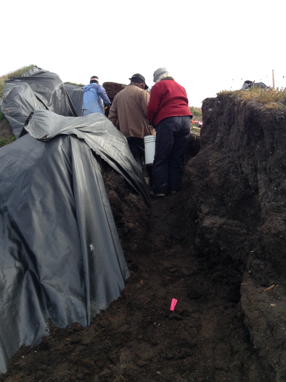
The old location was not viable, so I picked a new spot about a meter south, which became Column Sample 2 (CS 2). There was a bit of an overhang, and a very deep crack behind the bluff face. We needed to get all that material out of there. It took a bit of thought to figure out how to do it (not a usual archaeological operation, fortunately). Finally, we put a blue tarp down on the bottom of the main cleft so we could drag fill without anyone having to be under any overhangs or unstable areas, everybody got out of the way, and I cut the overhang back while standing as far back from it as possible. We then took the material out with a bucket brigade. Once that was done, I levered all the cracked material off, and we took it out the same way.
Bucket brigade in action.
Once that was done, I decided that we would excavate in levels labeled with letters, so we could proceed quickly, rather than wait for Owen to try to match levels in the detailed CS1 profile, which could have been a slow process. It seemed like the fairly warm, dry weather was letting the face dry out while detailed profiling was happening, and the longer it was exposed the more chance of another collapse. Owen would do another detailed profile after we got the column sample.
I also decided to make the sample a bit smaller in volume. CS 1 we had been trying for 75 cm x 75 cm (mostly because that size fit between some prior disturbances), but 50 cm x 50 cm seemed more manageable in the time we had left. One gallon from each sub level was retained as a bulk sample, and the remainder of sediment from the sub level was screened through 1/8″ and 1/4″ mesh.
We were just getting started when someone arrived to do a coastal DGPS survey that is part of the coastal mapping aspect of the Barrow Area Information Database project. He passed on a message that said my boss needed me to come back into town. (There is no effective connectivity at Walakpa, which is why this is being posted after the fact). I reviewed recording stratigraphy (or artifacts if any showed up) with Laura Crawford, made sure everyone knew how to use the InReach is needed, and headed back to Barrow by ATV around 1PM.
Something had come up with one of the compliance projects we are working on, and I needed to talk to people and draft some documents. I made it back to Walakpa around 10PM.
On the way, I met some folks out for an evening ride, and they stopped over to visit. One of them had spent a lot of time at Walakpa when she was younger, and had some great stories. I hope we can get them recorded for future generations.
The rest of the folks had managed to complete the column sample, so we talked about closing up shop tomorrow. We just need to finish screening, record the Test Units on the Pipe Monument midden, and backfill the TUs.
We went to work in earnest today. Owen went to work on recording the stratigraphy of the profile we had chosen for the column sample (CS 1). I had him marking the bottom of each level so we could continue excavation even after he went to sleep. Anne Garland and Laura kept working on the tests on the mound with the monument. The SW quad of the 1×1 came down on a cryoturbated sterile layer. There was metal throughout the cultural levels. We expanded northward to examine some wood in that wall.
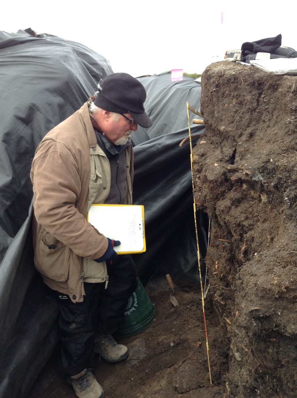
Owen Mason examining the profile of CS 1.
Meanwhile, I set up the transit and began shooting in the CS 1 profile, as well as the bluff edge. The NW quad of TU 1 had similar results, so we put some 50x50s closer to the bluff edge to see if we could find datable material and the edge of the feature.
Mary Beth Timm and I took naps, so we could stay up late and work on the CS 1 profile. After dinner, we shot in the upper levels of the CS 1 profile, as well as a polar bear jaw that was exposed in Level 12, so that it would not get stepped on. Mary Beth & I started excavating CS 1. We are excavating in natural stratigraphic levels, with any level that is more than 5 cm in depth broken into 5 cm sub-levels. One gallon from each 5 cm is being kept as a bulk sample, and we are screening the remainder.
Midnight double selfie. Anne & Mary Beth at work on CS 1.
We kept going until it go so dark that we really couldn’t see the soil colors, which was around 2 AM. We had accomplished a fair bit, so we headed off to bed.
Results of our labor.Off to bed.
The weather is often best at night. It was really beautiful. A pair of loons was swimming on the lagoon.
It was a great day in the field, with really lovely weather. Dennis O’Rourke got in last night and joined us, as did Rhett Herman, & his student Jared Palmer with the GPR gear.
Crew members at the start of the day
We started excavation of the burial that had been found in the road. As with most road burials it has suffered some disturbance. At first it looked like there was a large man (found part of his pelvis), then a neck vertebra from a small person showed up, then one skull, then another, and then the nasal area from a third (!) person. We still have more to do tomorrow, so this may change, but at the moment it looks like there may have been two burial side by side, and a third burial was dug across one of them at a later date.
Starting excavation of the burial
The GPR guys had a good workout. They had set up the units on carts, which had worked well yesterday on the beach near NARL, but something at Nuvuk must be different, because they described it as being like “pushing a shopping cart in sand.” Naturally, this meant that they got less done than they had hoped, but they saw some things and will have a plan view in the morning. I saw them this evening, and they’d already changed the configuration to a dragable sled, which seems like it might make tomorrow better for them.
GPR gear ("Eva") in foreground, with flagged survey grid in rearJared pushing the GPR lawnmower in a brief foggy period
The past couple of weeks have been really hectic. The local students have been working in the lab, and I’ve been dealing with logistics non-stop.
We’re at the point where we could go through the bags from the shovel test pits. In the early days of archaeology, only artifacts were collected, and sometimes only the unbroken ones, at that. The details of their provenience were often recorded in very broad term. As the discipline progressed, new methods kept developing, and it became clear that many of the things that had been discarded could have yielded information, had they only been collected. The pendulum swung toward keeping everything, including large volumes of samples, on the principle that someday methods would catch up, and then the information could be recovered. This is the same reason that practice moved toward only excavating part of a site, or even of a feature.
Now, however, it is becoming clear that museums cannot expand indefinitely, and that not everything can be kept. In fact, some places are deaccessioning items. Many places are being much more selective in what they will accept. There is a real storage space crunch in Barrow (particularly for climate controlled storage) so we need to be judicious about what is retained for the future.
At the same time, we are excavating with crews which include beginning excavators, in sometimes unpleasant weather. The only good way to make sure that important data (or artifacts) don’t get left in the field is to have people collect things even if they are not sure they are artifacts. And they do.
When the bags are gone through and the contents cleaned, obvious mistakes are discarded at that point. That still leaves an enormous volume of material. There simply isn’t place for it all, so some decisions have to be made in how to deal with it. The most rational approach is to discard the items with the least information potential first.
The Point Barrow spit has been used by people and animals for the entire period of its existence. Faunal remains have been dropped and scattered by humans and animals alike. Artifacts have been dropped and lost and refuse has been tossed. That’s true of most sites, but the post-depositional processes acting at Nuvuk are a bit different.
At the majority of sites, the site is built up like making a layer cake. The bottom layer goes on the plate first, then a layer of frosting, then another layer of cake, and so forth. The oldest layer is on the bottom, and the newest on top. If you put a piece of candy on the cake and push it down into the bottom layer, there are traces of that, so that it is possible to figure out that it was the last thing added.
At Nuvuk, on the other hand, the loose gravel matrix means that something can be dropped on the surface, stepped on twice and be 10 cm under the surface, covered with apparently undisturbed gravel, in 15 minutes. Digging can bring older items to the surface, as can frost heaving and the action of tires. In other words, there is no way to tell what was deposited before what. One can get relative dates for artifacts based on their style or even patent dates for trade items, but that doesn’t tell you anything about when they were deposited at the site. Faunal remains are even worse. There is no way to date them (C14 dates at $900/bone aren’t likely to happen) and since polar bears hunt the same animals as the Nuvukmuit (people of Nuvuk) did, and drop bones on site, we can’t even be sure the bones were introduced by humans. The only exceptions are areas where there was a sufficient amount of organic matter to support plant growth and soil development. These include the graves and middens (and the sod houses before they eroded away).
This difference was taken into account when we developed the protocols for shovel test pits. The excavators collected the artifacts and faunal material by natural levels. In most cases, the entire STP was in the same loose gravel level. This means that the materials from those STPs have much less information potential that the materials from the areas of the site with some soil development and stratigraphy. Any research questions that could be addressed with this material can also be addressed with material with better stratigraphic control, at far less cost and with more confidence in the results. That makes them an ideal place to start when trying to reduce the volume of the collections to be retained for the long-term.
We have been digging over 2000 STPs each season (and really hope the GPR will reduce that a lot). Some of them had nothing in them, but most had at least a few animal bones and artifacts. So we are working with the bags from STPs where there had been only an undifferentiated gravel level. Any particularly interesting or unique artifacts are being saved (although they are few and far between, most having been found during excavation). Recent trash (cigarette butts, juice boxes, etc), recent nails & metals straps, cloth gloves and the like are recorded and lab discarded. Items with maker’s marks or other markings that might allow identification and/or dating are being retained for further analysis, and others are being sorted, counted and recorded prior to lab discard. So far there seems to be a good collection of Pabst Blue Ribbon cans from the pull-tab era. We are also retaining items (gears, lock sets, etc) which look as if they might be further identified with the right documentation for additional analysis. The faunal material is being sorted. Modified items are being retained for further analysis, identifiable elements are being recorded and lab discarded (with particularly good examples being saved for a teaching collection), and unidentifiable fragments are being counted and lab discarded. This is good practice for the students, and since the STP material isn’t well-suited for future research (due to the issues mentioned above), overall this is a positive step.
The processing of the large bulk samples is proceeding. It’s slow going, but we are reducing the overall volume. We have found a few things that are noteworthy.
Claire has found some well-preserved wood that she was able to take samples of for species identification and possible tree-ring dating.
We also found one piece of coal with one flat, highly polished side. The rest of it looks like it broke naturally and got smoothed by being rolled in the water, but the one side looks different. It’s a maybe, but a pretty good one, although we’ll probably never know what it was or was going to be…
There are also a variety of marine worms, shells and what we think are marine plants. I just spoke to a friend of mine, “retired” biologist, Dr. Dave Norton, who used to live in Barrow and is fairly familiar with the contents of modern strand lines here. Claire is going to take the oddities we are sorting out down to Fairbanks (where he lives) tomorrow night, and he will look at the specimens and try to connect with the appropriate curators at the UAF Museum of the North. I’m going to Fairbanks (for shotgun refresher qualifications for a non-archaeology project I manage for Sandia National Labs) the week after next, and will go visiting the curators with him, in hopes of getting good IDs.
One of the great things about doing archaeology in the Arctic is that the preservation can be spectacular. Artifacts often froze the winter after they were abandoned, and only thawed when they were excavated. This means we get to find a lot of the bone, wood ivory and leather items that were undoubtedly part of most precontact people’s tool kits. We don’t have to guess at what people were using or extrapolate from a few stone tools that did manage to be preserved; we can see it firsthand.
This is not always an unmixed blessing. Arctic archaeology sometimes suffers from an embarrassment of riches.
Boxes with wood from the Driftwood Feature (DWF).
In the past, archaeologists generally only saved the artifacts from a site. Animal bones and soil were pretty much ignored, or at best documented in the field (there are a lot of excavated houses in the Arctic where the animal bones are still piled at the edge of the excavation where they were left decades ago). As archaeological science advanced (radiocarbon dating began about 60 years ago) and people began to do more things with faunal (animal) remains and soil samples, people began to collect a lot more, and to bring it back to museums to save, on the assumption that one day someone would be able to do something informative with it. The idea is still a good one in theory, but it is bumping up against various realities. For one thing, in most areas these sorts of things require storage in climate controlled conditions or they will deteriorate and become useless. They are often quite bulky compared to just the artifacts. Most museums simply don’t have any place to put all this stuff! Some of the better-funded places, like the Smithsonian Institution, have built large off-site storage facilities in areas where real estate is a bit less expensive, just to keep all this stuff. But such places require operational funds and new staff, and that costs money too. Most places can’t really afford that. Some institutions have started charging for putting collections there, but there are problems with that as well.
So part of the new reality for archaeology is that we can’t keep everything. The question is how to decide what to keep and what not to keep. In general, the artifacts are kept. No problem there. The issue is how to deal with the other things.
It’s even more complicated for the Nuvuk project. We have had several areas where massive amounts of organic material, with some artifacts and faunal remains mixed in, were encountered. While one might normally choose to excavate this all in the field, in a couple of cases the areas were right at the erosion face, and could literally have vanished overnight. Combine that with a very cold field situation, where mild hypothermia can dull excavators’ thought processes, it didn’t seem like that was the best plan, since it risked data in a variety of ways. I decided to take tightly-provenienced (with very accurate information on where they were from) bulk samples, which can then be processed in the lab, where it is warm and we have good lighting, magnifying lenses and water to wash the dirt and gravel off so we can get a good look at everything. If excavators recognize an artifact in the field, it gets recorded there, but the idea is that we’ll find the less obvious ones in the lab.
Contents of one bucket shot laid out on a tray.A closer look
One of the areas with a massive amount of organic material was what we called the Driftwood Feature. This level is about 1 meter (39 inches) below the Thule graves. It was actually permanently frozen, and therefore everything organic was in great shape. It looks like there was an Ipuitak dwelling (maybe there were more that had already eroded–we don’t know) on a ridge near the ocean. Sometime between 300-400 AD there was a huge storm, which washed all sorts of things (driftwood, bark, marine invertebrates, shellfish, peat, etc.) up onto the beach, all the way up to where the people were living. It left what is called a strand-line. It looks like they either left in a hurry and didn’t come back, or didn’t survive, since a number of artifacts were still there. The strand-line continued along what had been the beach ridge, and we wanted to see if there was any evidence of more human activity besides the one dwelling. Because there was so much wood, and a number of the artifacts at the dwelling had been wood, we had a needle in a haystack problem, with the haystack about to fall into the ocean (which it did the next winter). So we bulk sampled.
Close-up of the Ipiutak layer at DWF. We excavated many square meters of this!
Now we are going through some of the bulk samples. I’ve been very lucky to have Dr. Claire Alix, a French scholar who specializes in Arctic driftwood and its use by humans, involved with the project since the very early days. She was based in Fairbanks, Alaska, for many years, but has recently gotten a teaching and research position at the Sorbonne in Paris. This is wonderful, since Claire is a great person & really deserves it, but it certainly complicates the logistics of her research on this wood!
Dr. Claire Alix in the Nuvuk Lab
Claire arrived on this morning’s plane, and is already hard at work going through samples from 2009 which were excavated after she left the field. She is looking for all worked (altered by people) items, picking out things that we can’t yet identify for further examination, and recording amounts & types of wood, bark, and other identifiable organics. The non-worked identified material is then being lab discarded. I’ve got the computer map up and color-coded so Claire can look at it when she needs to, Laura is unwrapping the samples, and I’ll probably end up doing the data entry in the catalog. She leaves again on Wednesday night, and won’t be back in the US until sometime after January, so we’ve got a lot to do, and not much time to do it.
Claire and Laura hard at work.Lab discards--on closer examination they turned out not to be cultural.
Later this fall we are going to start going through soil samples and so forth. We hope to be able to reduce the volume they take up. Some of that will be done by separating the actual sample material of interest from the gravel matrix. Where that isn’t possible (for example with large logs or whalebone) we will have to sub-sample, retaining only a portion of the total sample volume. Otherwise, we’re going to run out of room.