I have been really busy the last month, trying to finish several reports and papers, plan for the summer, and get ready for a research visit from Tony Krus of SUERC, who was a member of the 2008 Nuvuk field crew before he headed off to grad school. He is now Dr. Krus, and was able to get a grant to come over and work on Bayesian modeling for Barrow area dates, as well as attempting to improve the value for DeltaR (a correction factor used with radiocarbon dates on marine organisms to compensate for the excess older carbon found in the oceans). Between the massive amount of writing I was doing and smashing a finger getting luggage out of the overhead coming back from a trip, I’ve not been blogging.
I hope to catch up with things a bit; there’s been considerable activity on the DONOP/global change threats to cultural and natural heritage front, as well as planning for Walakpa.
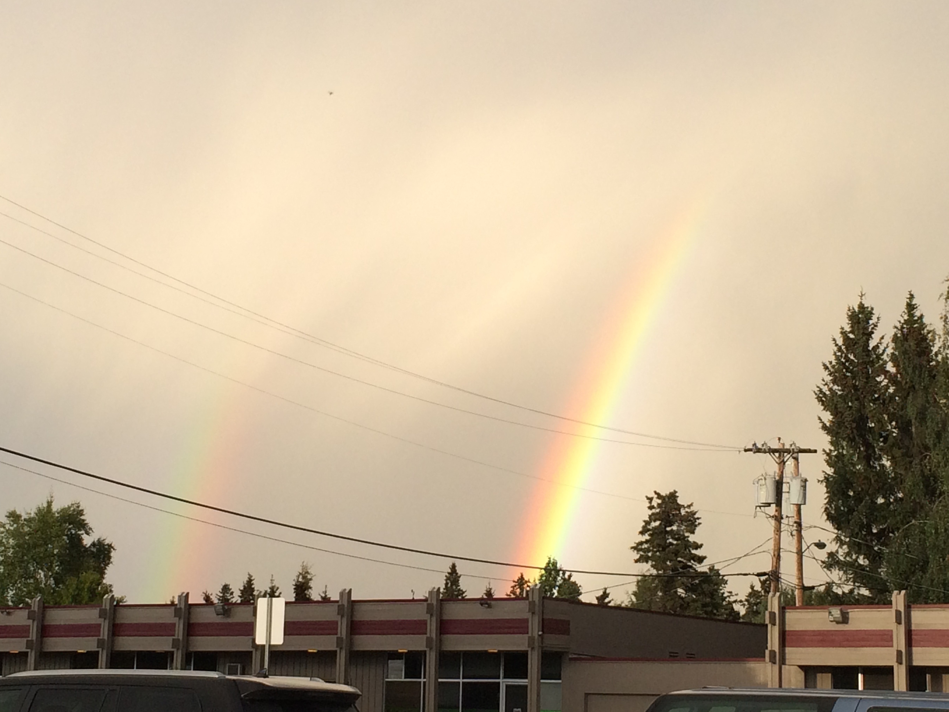
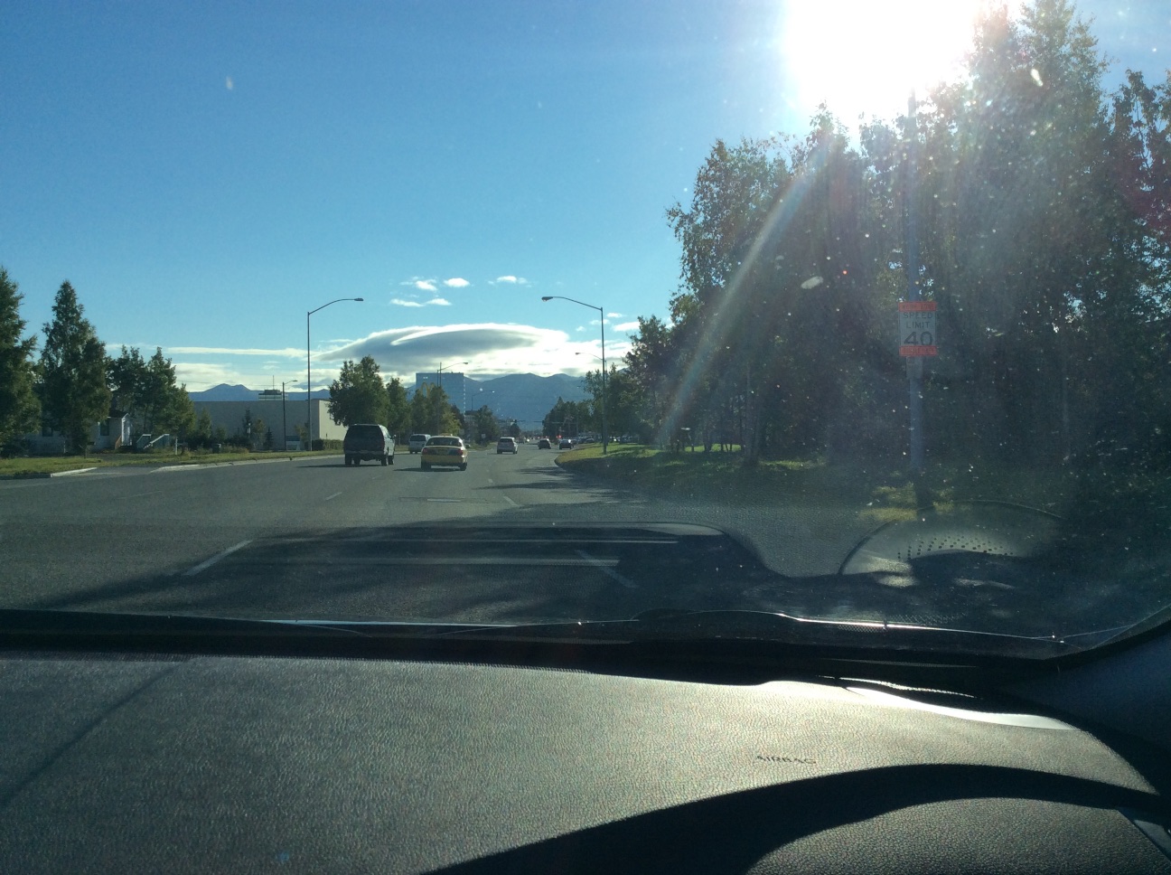
We went to Glasgow where the 2014 European Archaeology Association was held, by way of Anchorage and Reykjavik. Because flights from Barrow are disrupted fairly frequently, we went down a bit early, and had a chance to visit with our daughter. There was a pretty amazing double rainbow and a nice lenticular cloud.
The rainbowCloser shot of the rainbowLenticular cloud over the Church Mts.
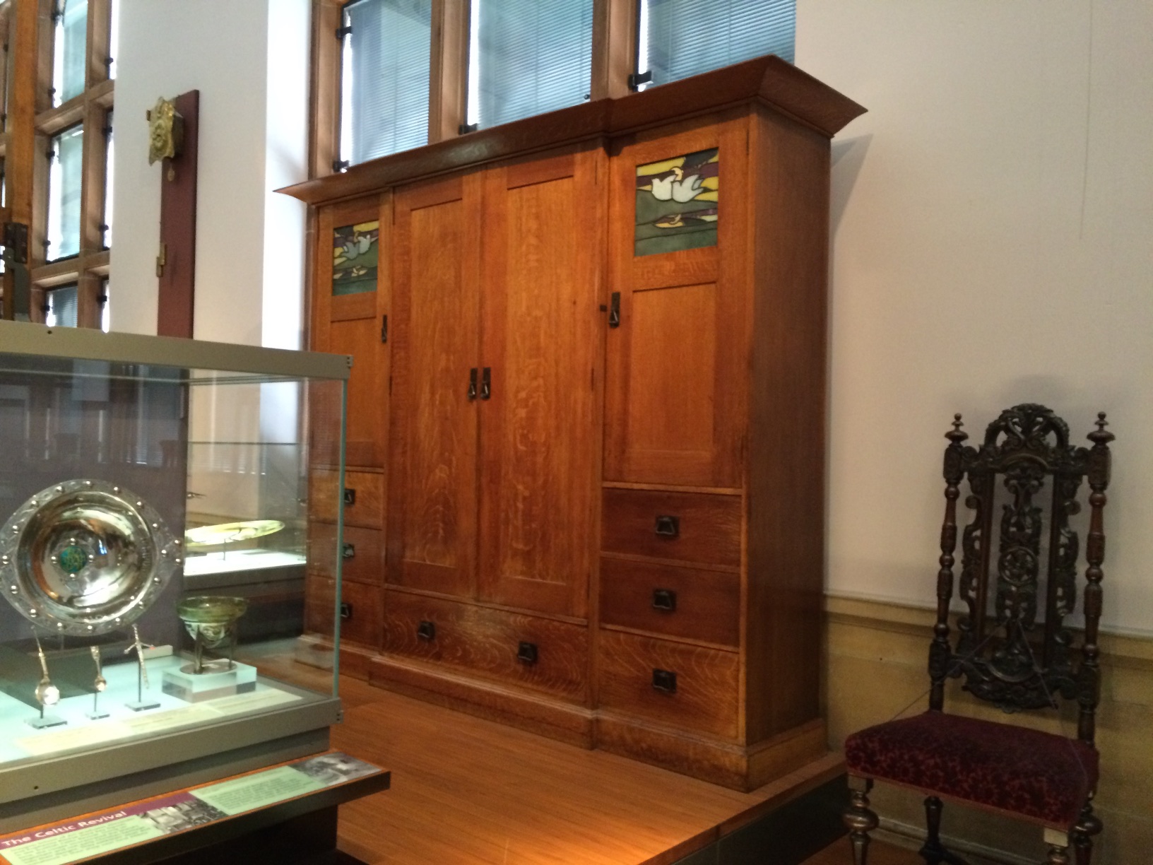
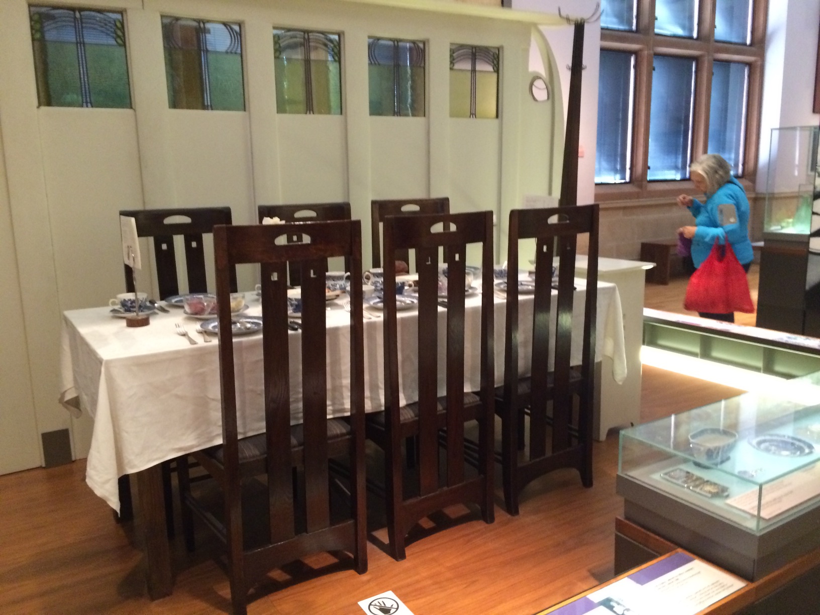
We flew Icelandair to Reykjavik and then from there to Glasgow. Glasgow was great. The people who live there seem really proud of their city. The cab driver on the way in from the airport was recommending museums, and in particular Christ of Saint John on the Cross by Dali at the Kelvingrove Art Gallery & Musuem. Glasgow was once the second most prosperous city in the UK, and the residents seem to have been very civic-minded. The Kelvingrove was built to house the collections that were donated by prominent Glaswegians, using funds from an international exposition and public subscriptions. It houses a fair bit of Charles Rennie Mackintosh material. We got in a good visit our last day there. Unfortunately, some of the other Mackintosh venues were under renovation.
The Kelvingrove Art Gallery and MuseumCharles Rennie Mackintosh cabinetCharles Rennie Mackintosh table & chairs from one of the famous tea room interiors.
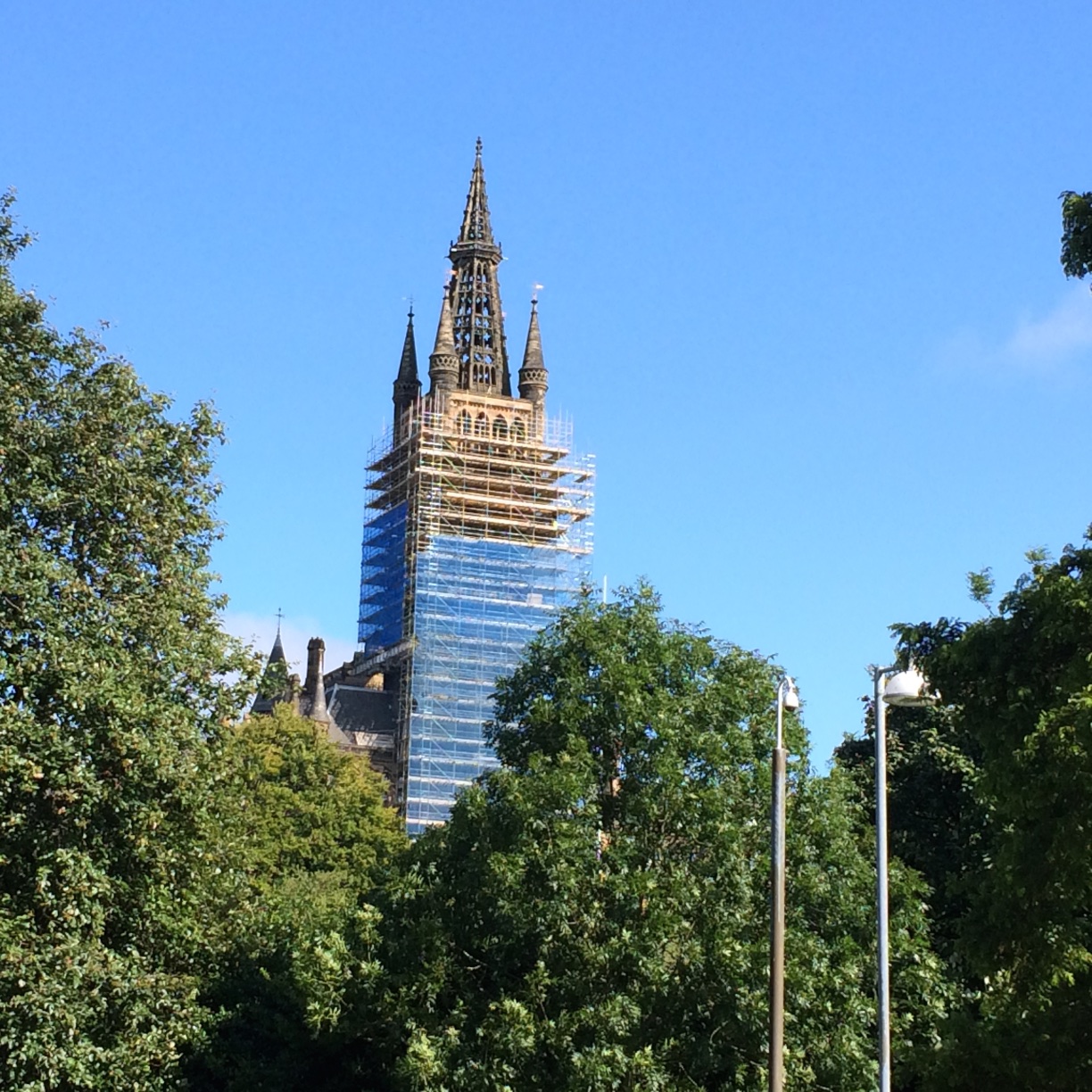
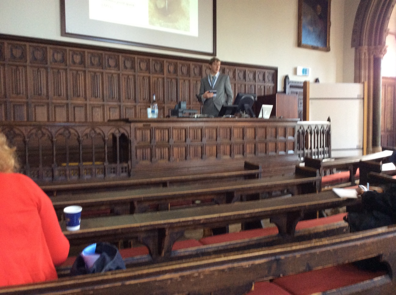
The meetings were held in various venues at the University, including some very old lecture halls and more modern buildings.
University of Glasgow Main Building towerNuvuk Archaeology Project alum Dr. Tony Krus chairing a session in a centuries-old lecture hall
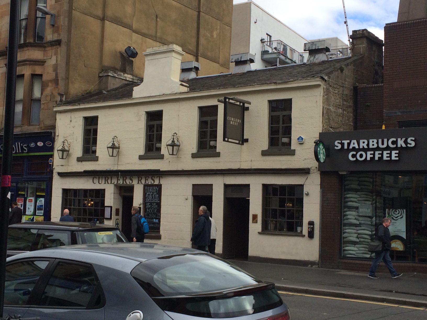
We spent most of our time around the University. There were a number of good restaurants & pubs, particularly along Ashton Lane. We tried a bunch of them. We never made it to this one,which was apparently an isolated inn before Glasgow got so big, near a pond where local curlers used to throw rocks. This is apparently where they went afterwards back then, as curlers are wont to do :-).
Curler’s Rest
Our session (Archaeology and Climate Change) was heavily advertised. Tom Dawson, the organizer, had managed to get leaflets put up all around campus before the session, so it was very well attended. As you can see, there were participants from all over. I talked about the threats to frozen coastal sites from climate change, with an emphasis on the Barrow area. I was able to incorporate images from the storm that had happened the week before. There were some other pretty bad situations, but none that were worse. On the other hand, some people are making strides in dealing with these issues with public help, which is good given the turn-around time for even successful funding applications.
Poster for our session on Archaeology and Climate Change.
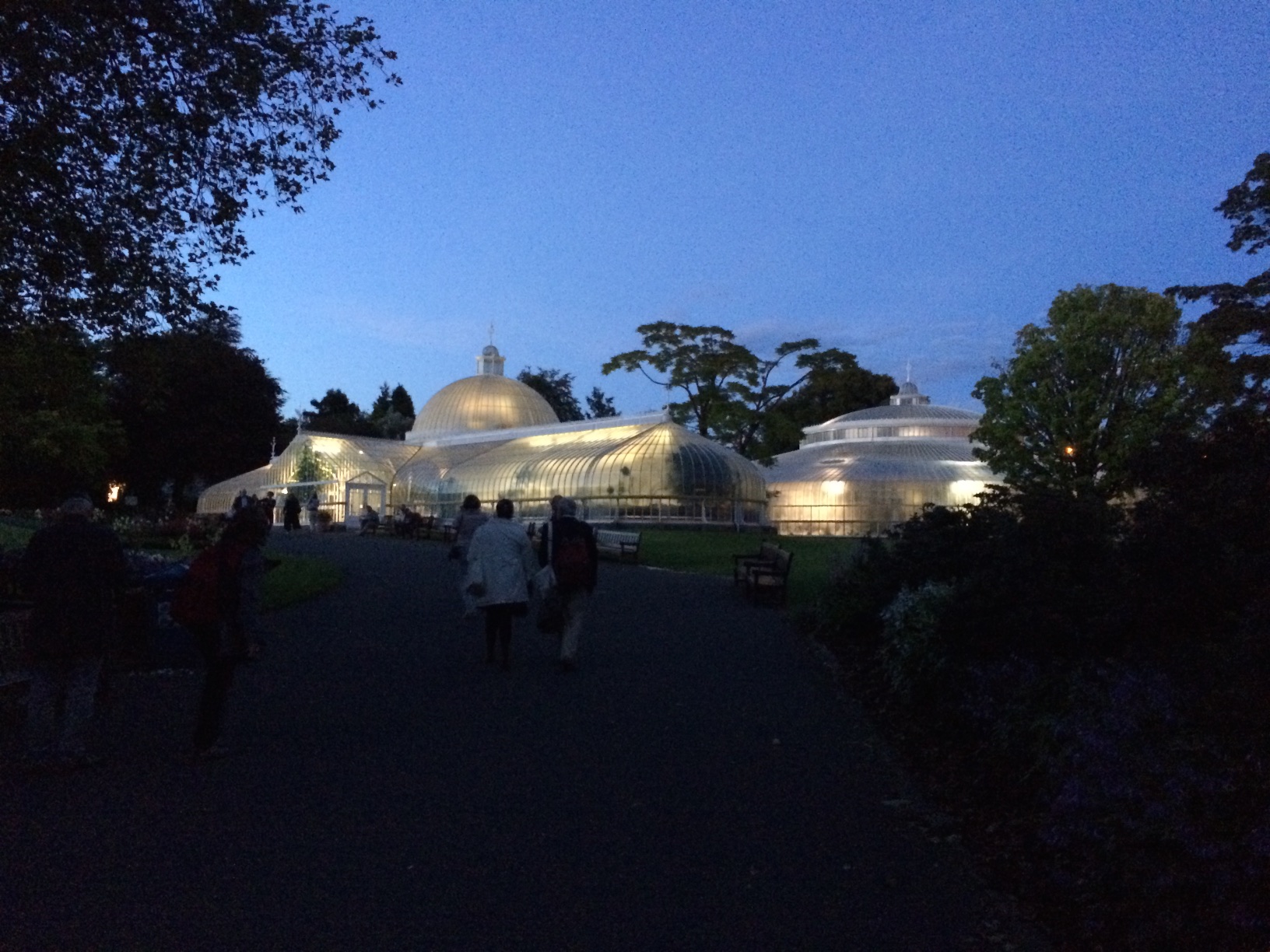
The conference featured a very nice party, spread across two venues, both within a block of our hotel! One was Òran Mór, a converted church which now houses performance space and a bar. The upstairs had been rented for the party. It had obviously been redone from its days as a church. The other was the glass house at the Glasgow Botanic Gardens, just across the way.
Òran Mór from the outside, with a blue halo on the tower.Interior space at Òran Mór, with a crowd of EAA delegatesApproaching the Glass House at the Glasgow Botanic Garden
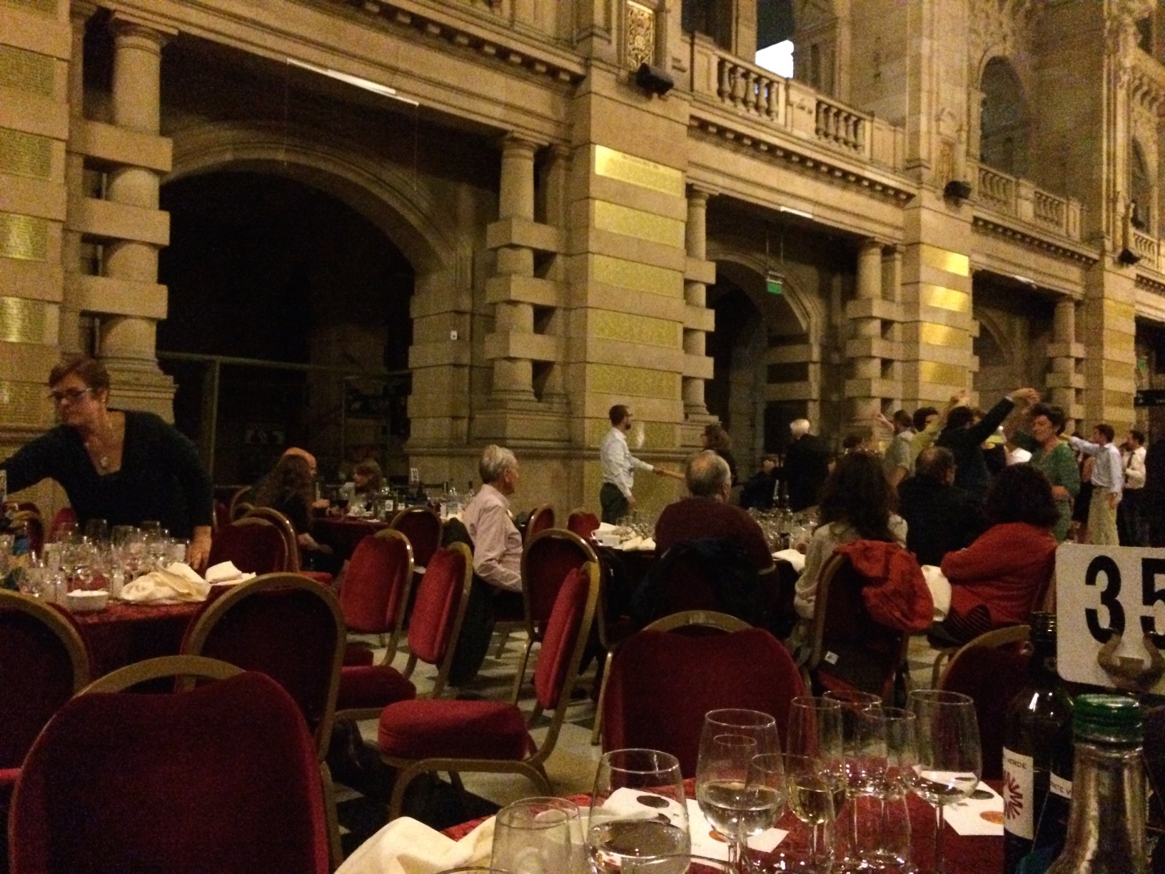
The conference banquet was held in the main hall at the Kelvingrove. It was sponsored by Glenmorangie (the distillery near Glasgow) so there were samples of a couple of their special products. After the speeches and dinner, there was a fine band and dancing.
Dancing at Kelvingrove. BT Wygal and Katie Krazinski by pillar at center.
There is a very large storm, with winds up to 50 mph and big waves from the west battering the Chukchi coastline from Barrow south. It has created a major storm surge, with big waves and coastal erosion. An emergency has been declared in Barrow due to flooding and road damage.
I flew back from Wainwright yesterday evening, and even through the storm was just building, the waves were already hitting Walakpa. I couldn’t get pictures but it did not look good.
Today was much worse. Late this afternoon, I got a series of calls about something washing out at Ukkuqsi, where the little frozen girl Aġnaiyaaq was found. Aqamak Okpik from IHLC got things organized, with Morrie Lemen coming out to NARL in a bigger truck than mine to take me in to take a look. The North Slope Borough Fire Department came over, and two firefighters suited up and tied a rope onto me so I could go down and take a look.
View of Ukkuqsi from the north side.
The big concern was that a burial was eroding out, since there have been several in that area. In the end, it looked like part of a house (maybe two superimposed) with a whalebone and a baleen toboggan. We retrieved a few bones and a piece of structural wood that were going to fall in any minute, and hope to be able to get a radiocarbon date or two. I only got hit by one big wave.
Closeup of eroding structure from the beach.
Hope to get some video or at least frame grabs available soon.
We made pretty good progress at Walakpa this week. This, despite a few challenges.
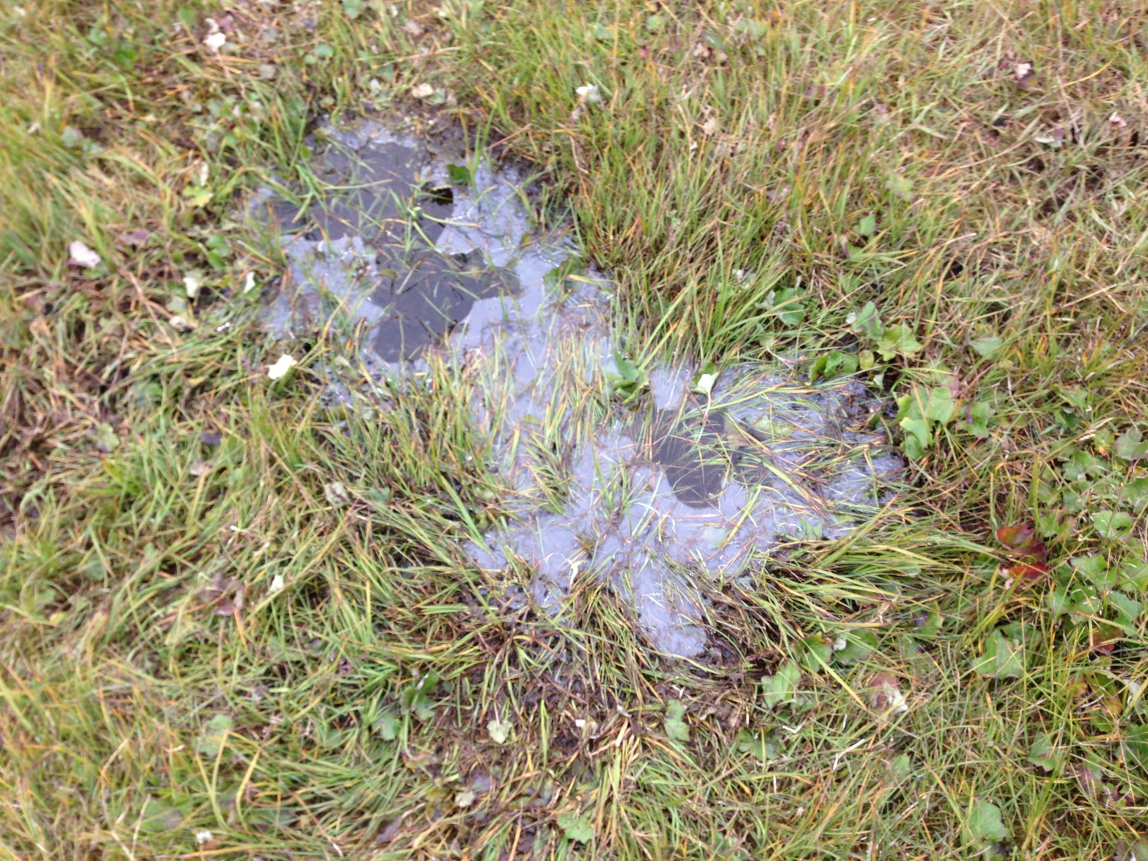
On Tuesday, we had a really small crew, due to a variety of circumstances. Only Trina, Mary Beth & I made it out. It was quite a cold day, with ice on the puddles when we got to Walakpa (or Monument).
Ice on a tundra pond.
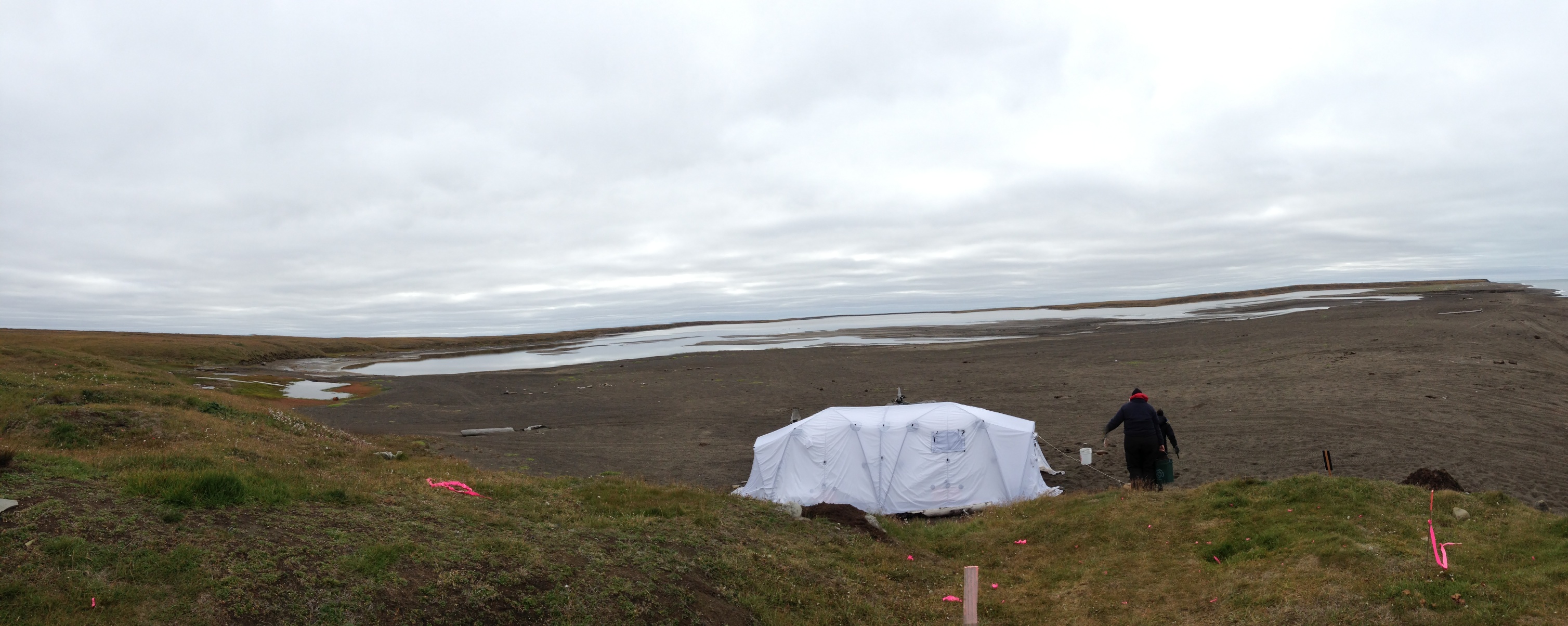
We decided to leave the screening for another day and just excavate. It was cold enough that we actually took advantage of the removable floor in the Arctic Oven tent on site and used the Coleman stove inside, but on the ground.
The Arctic Oven on a cold day
The next morning, we had a bigger crew, but there was snow on the ground when we set off.
Snow on the tundra, seen across Middle Salt Lagoon.
We were not expecting to have a great day, but in fact it was warmer than the day before (no ice), and we started getting down to what seems to be structural wood from the house roof, so that was fairly satisfying. We got a lot of water screening done, as well. The beach had really stabilized, so we were able to go the whole way on hard sand, and even most of the lagoons had closed up, with sandbars across the entrances that we could just drive across. The commute to the site was much quicker.
Thursday did not go well. We headed out, only to find that for some reason, the waves were really coming up the beach and running into the lagoons, so that we were not able to get across the stream by the gravel pit. We went around and through the gravel pit, but then could not get across the stream by Nunavak. We did see a polar bear in the water near a dead walrus). I decided we should try to go around, since it was otherwise a nice day & I hated to lose it, but we didn’t have any extra gas along, and by the time we were half-way around, even cutting across country rather than following the shoreline, it was clear that some of the Polaris’s are sort of gas hogs. So back we went to the road, with only one minor mishap when the Tubby trailer bounced into a very wet low-centered polygon and dragged the ATV half-way in. I got my feet wet getting it unstuck, but we still went back down to the beach so that David Pettibone could get a picture of the bear, still in the water, from a safe distance.
Today, despite no major change in wind strength or direction, was very different. The beach was back to Wednesday’s shape, and we got to the site easily. It was quite sunny in the morning, and we got right to work. We had six people, so we started with 4 excavating and 2 screening.
View from the south end of the trench, where I was digging. Pretty well maxed out. L to R: Mary Beth Timm, JoAnn Akootchook and Michael Berger.
I played around with my iPad mini for taking pictures to supplement field notes & drawings. I don’t draw all that well, and used to take Polaroids and draw on them, but that technology is gone and wasn’t that stable anyway. I’ve use a couple of programs to annotate lab photos, but this was the first time I tried it in the field. I used iAnnotate PDF, which lets you put sound files on the image, associated with notes or drawings. They open fine in Acrobat. This will be quite handy.
I’m heading to Akureyri, Iceland, to take part in a workshop and a NABO Open Meeting. It’s a fairly long trip from Barrow to anywhere, but Icelandair is now flying direct Anchorage-Reykjavik, so that’s a help. Not surprisingly, seats on the July 4th departure were very, very cheap, so it was more cost effective to fly me to Iceland then, and put me up in Reykjavik for a couple of days before I head to Akureyri.
When I left Barrow, the ice had come back in. I got a good shot of the only operational heavy icebreaker in the US fleet, USCG Polar Star lying off Barrow. You can see masts belonging to much smaller vessels off her bow. They are a French group who are trying to take a catamaran to the North Pole (it apparently can move over ice as well as water, or they hope so). They beat Polar Star to Barrow by a couple days.
USCG Polar Star off Barrow in the ice.
The flight from Anchorage leaves at 3:15 PM AKDT, and gets in at 6AM local (GMT) which is before bedtime in Alaska, so I didn’t get much sleep. I was wiped, so I took a nap, planning to get up and go wandering about Reykjavik. Alas, the weather didn’t cooperate. When I got up, it was raining & blowing 25+.
View out the living room window of the B&B
So I confined my walking to a trip to the grocery store and bakery. Lots of nice local vegetables for good prices–geothermal greenhouses can do wonders.
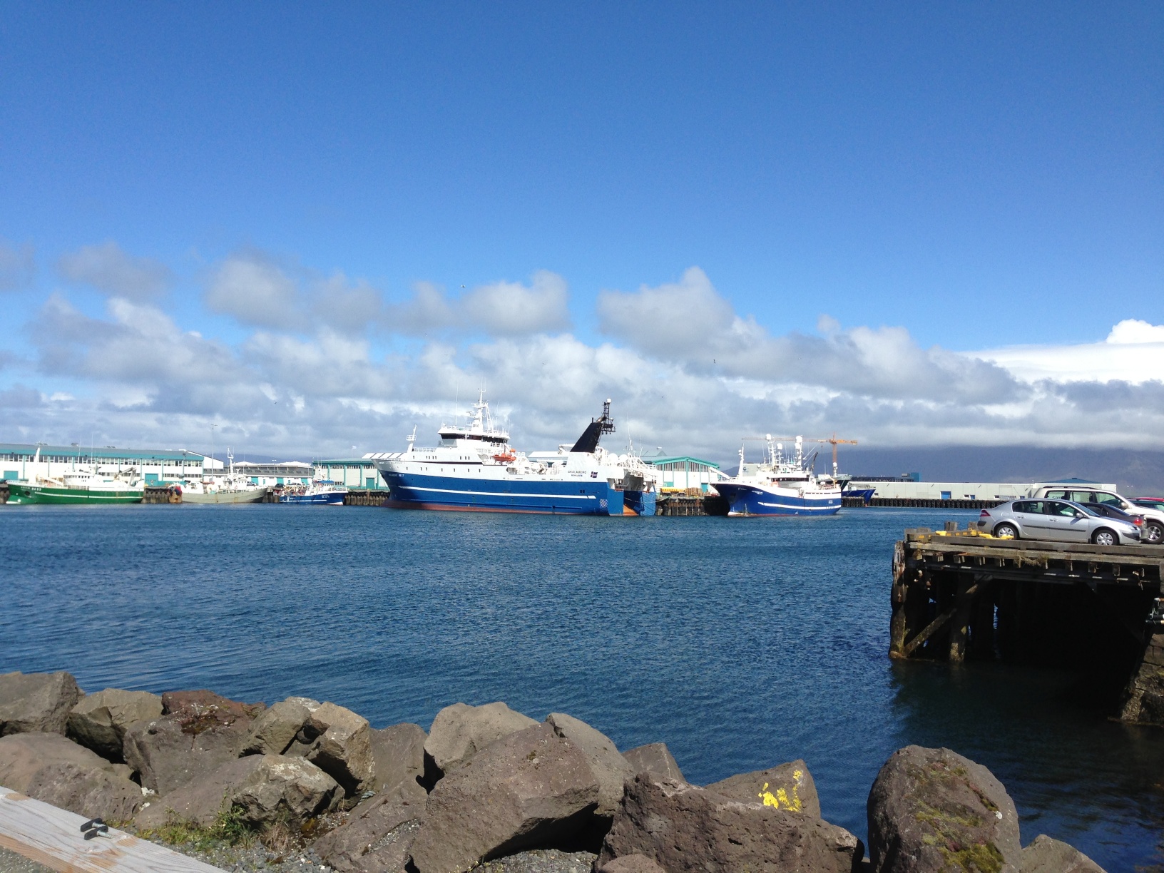
This morning the weather had improved, so I headed out to see some sights. I had intended to check out a Danish restaurant, but wound up doing something else entirely. I found a food truck selling grass-fed beef hamburgers, which smelled wonderful. So that’s what I had. Then I wound up heading down to the harbor.
Reykjavik harbor
The green buildings on the left are former (mostly) fishmongers’ stalls that have been converted to shops & restaurants. I wound up getting a bracelet made of wolfish leather. There are still the old ladders, presumably for self-rescue by unfortunate fishermen who fell in on the way back to the ship.
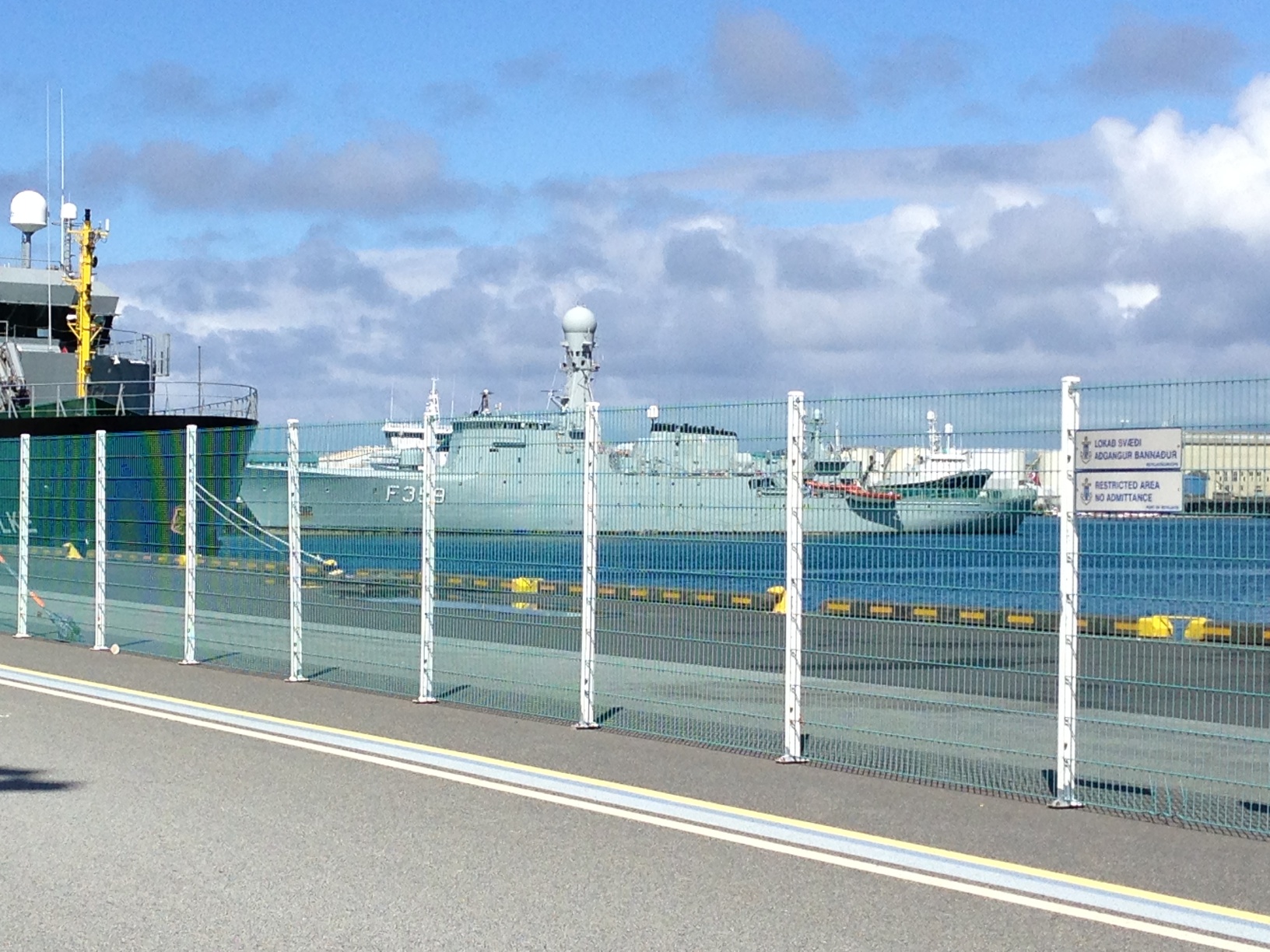
Ladder in the old harborTrawler in Reykjavik harbor.
There were the expected Icelandic coast guard ships. There were also a Danish naval ship and a German Fisheries Protection ship tied up.
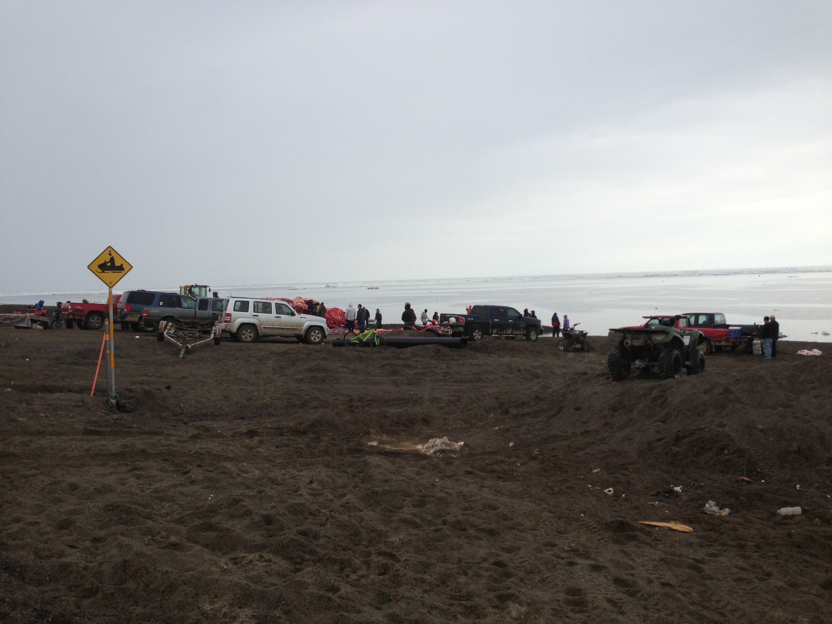
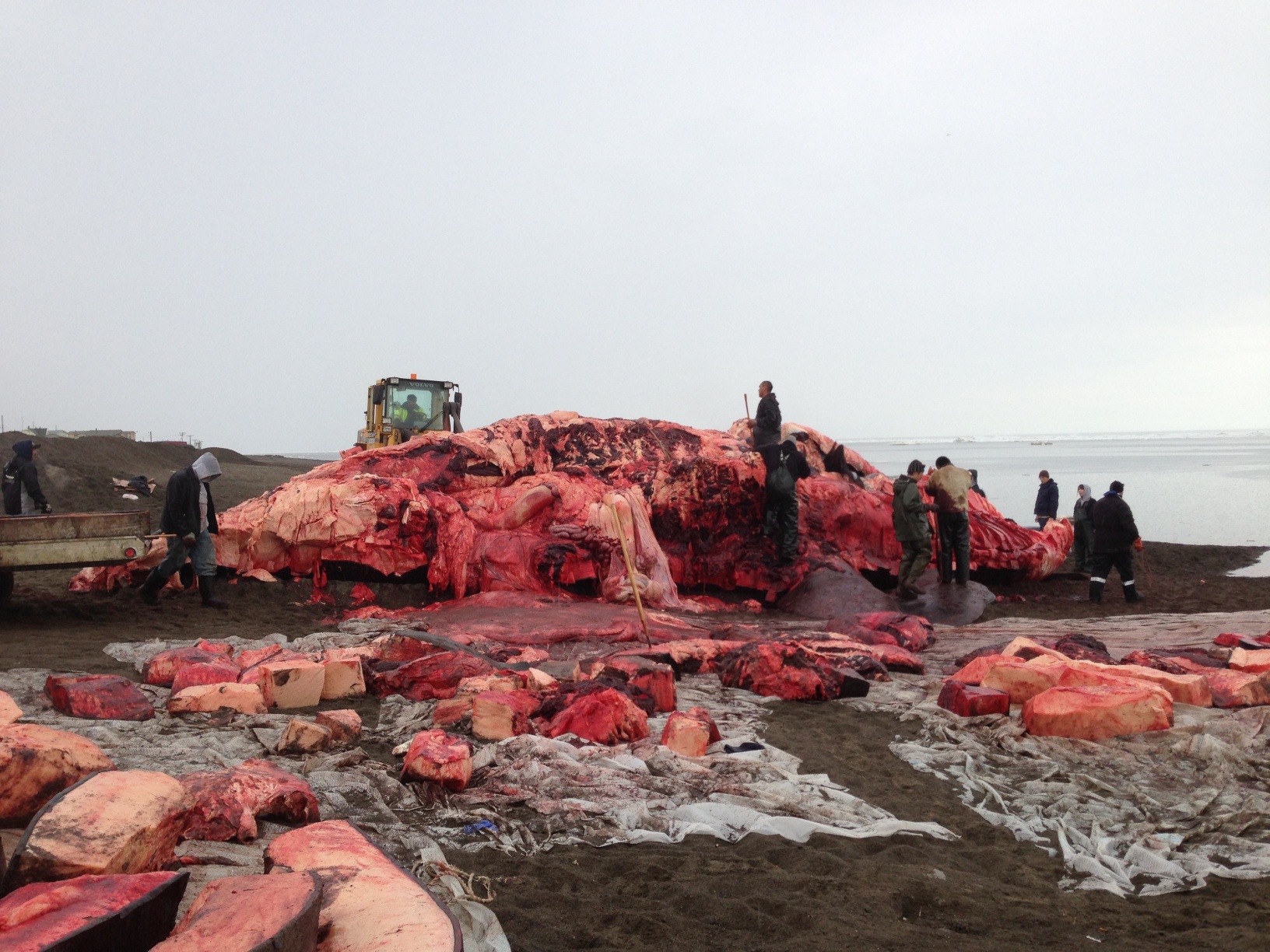
Yesterday and today were great days for Barrow. Last night, showing real persistence in the face of very discouraging conditions this spring, a number of crews went out. Anagi crew took a 54 footer, the first whale taken in Barrow this spring (or summer, as some of my Facebook friends pointed out). The whale reached the beach just after midnight, according to Coby, who took a picture of the landing at 12:05 AM.
I had gone to bed early, trying to make up for sleep lost due to something or other wrong with my shoulder, and slept right through it. None of my co-workers did. I got a call at 7AM from Trina, who had been helping all night and had realized she couldn’t stay awake for work (or give rides to the others). I headed for town. I stopped at the whale first. As you can see, the weather wasn’t great, as it often isn’t in the morning in summer, and it actually started raining pretty hard while I was there.
Approaching Anagi crew’s whale.About 9 hours into the butchering.Shares of maktak waiting to be put away.
A bowhead whale weighs roughly a ton a foot, so cutting up a whale this big involves a tremendous amount of labor. People had been working for about nine hours at this point, and still had a way to go. The maktak (skin & blubber–very tasty indeed) was mostly off. There was a bit waiting to be taken either to the captain’s cellar to be put away or divided as shares, but a lot of it had clearly already been taken care of and put away.
I thought a panorama of the scene might be interesting, so–thanks iPhone.
Panorama of Anagi whale being cut up on beach in Browerville, June 27, 2013.
After that, I got Coby, who had apparently only been at the whale until 2:30 AM, & we tried to find RJ, with no luck. Went back to the BARC to discover a message from my assistant Tammy, who had been at the whale until 4AM, saying she would be late. Since she is Michael’s ride, he wasn’t there either. Coby & RJ started working, and I started trying some VZAP troubleshooting, which required running a logger while trying to access the site and then forwarding the logs to the VZAP team at ISU. I hope it helps, and we don’t discover the problem is just awful connectivity. Jan, the middle school teacher who is volunteering, wasn’t in, but she rides her ATV to the lab, so we figured she had decided the rain was a bit much. After I finished with the logging on the computers, I fired up my email, to discover one from Jan saying she had apparently slept right through her alarm, because she’d been at the whale until after 2 AM! Coby and RJ decided to call it a day around noon, to go back to the whale.
All this made for limited progress in the morning. A good bit of the afternoon was taken up with things connected with various non-archaeology projects I manage.
The weather warmed up a good bit later, and the south wind was actually ablating the snow in the drifts by the snow fences, making fog billow off them. It was pretty spooky looking.
Fog coming off the snow banks.
ADDED 7/1/2013: If you don’t think people should hunt whales, well, it’s a free country and you are entitled to your opinion. But before you try to post a rude comment, please check here and here.
I got back to Barrow to find snow on the ground. It hasn’t been that stormy here, but we had a coastal flood warning over the weekend, with part of the road to Nuvuk getting washed out, and waves getting over many of the berms. I am afraid that there may have been significant damage to the site beyond the 20 m we already lost in September. I would like to get out and take a look, maybe even shoot in the bluff, before I go to Valdez & Seattle, but that is not looking too likely.
Apparently, there is a likelihood of a storm surge from the Chukchi and flooding over the next few days, maybe until the 22nd or so. The North Slope Borough is quite worried, and sending out info on emergency kits & so forth. Not a great situation. The house I live in floated in the last really big storm surge event in 1963, and if it does it again, it could wind up in the NARL sewage lagoon. Yuck.
We’ll be prepared, but I don’t think it is that likely to get that bad. However, it most certainly is already damaging Nuvuk more. It has been blowing from the north and winds are picking up. It is a bit depressing given that erosion must nearly have reached the GPR returns that we think are Ipiutak features.
Not much to be done about it, so I just push on with writing proposals & papers. I’m going to a workshop on the Kurils & Aleutians, and am slightly belated working on the conference paper. Just as I got ready to really check out the other papers prior to doing the serious writing (the outline is done), it was discovered the website had lost the last 3 weeks of updates (explains where my stuff went–I thought they were just being slow getting it up), so I couldn’t get into it. I hope we don’t lose Internet later this week, and that I have decent connectivity in Valdez.
On Friday afternoon we headed to Point Barrow. I’d gotten KTUU set up with Aarigaa Tours, who picked them up in town at Top of the World Hotel, and then picked me up at my house at NARL on the way out to the point. I’d run home from work to change into my warm gear. A good thing, too, as will become clear later.
We’d been having a pretty strong blow from the NNW, and waves had actually been coming up onto the road. The road to the point had actually been closed right by Piġniq (Birnirk), because the waves had been breaking over the road and had done some significant damage. We were in a van equipped for off-road travel, so we were OK, but we had to detour through the cabin area. Once past there, the road was still in pretty good shape, but we could see water seeping in under the gravel berm. Once we got out a bit farther we could see a number of vessels & barges that had come into Elson Lagoon to anchor up and wait out the rough weather.
Barges in Elson Lagoon, seen from the trail by the marked graves.
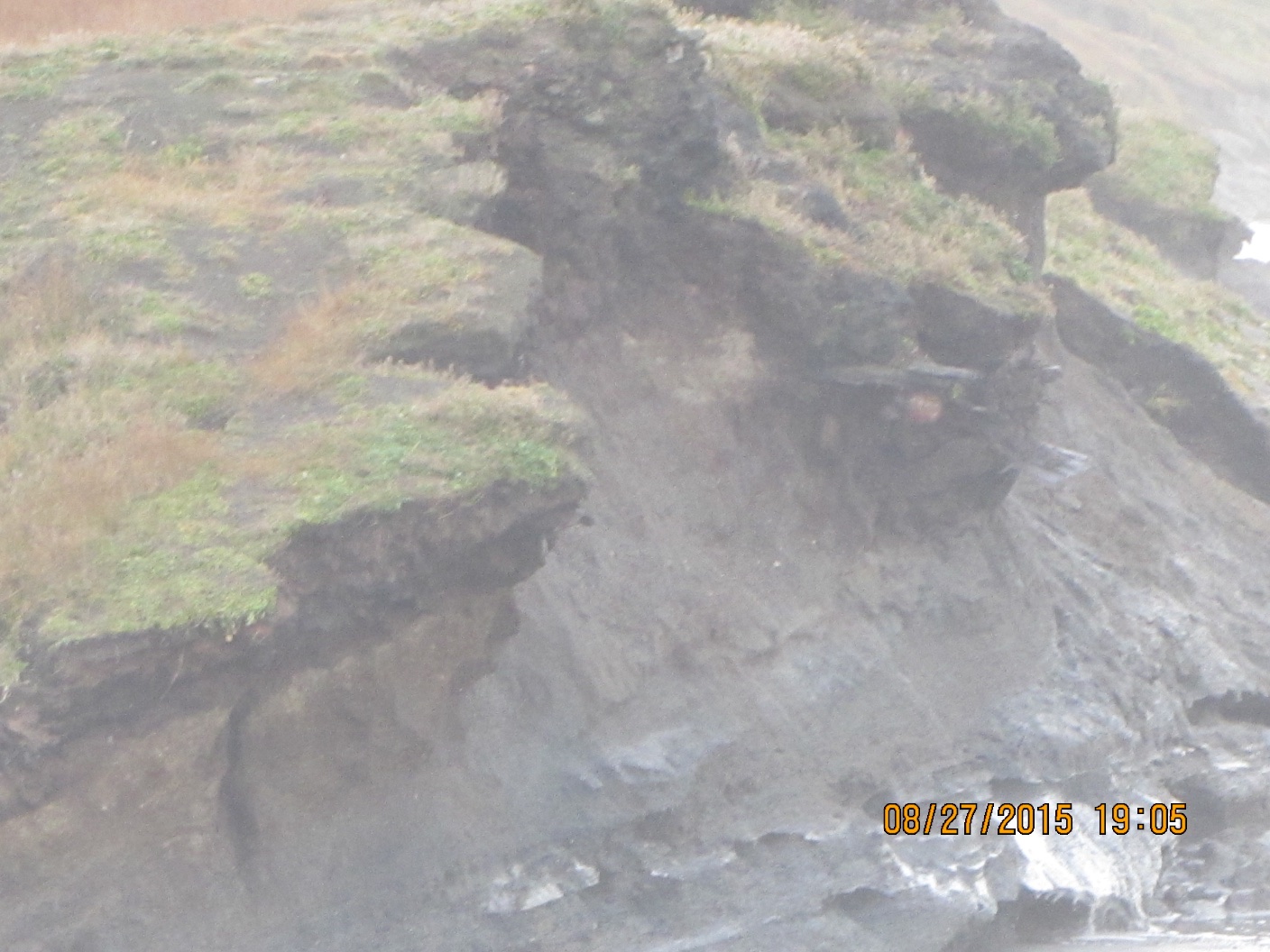
Once we got to Nuvuk and got a look at the site, it was a bit depressing. However, it made a perfect example of coastal erosion in action, and made it really easy to illustrate how information about the past, which could have application to understanding what directions to take to have a sustainable future, is being lost. At least 10 feet (3 m) of the site had been lost to the ocean since couple weeks ago. The gravel slump that had been protecting the face was gone, and thawing permafrost was sticking out and undercut.
Exposed thawing Ipiutak level at Nuvuk.
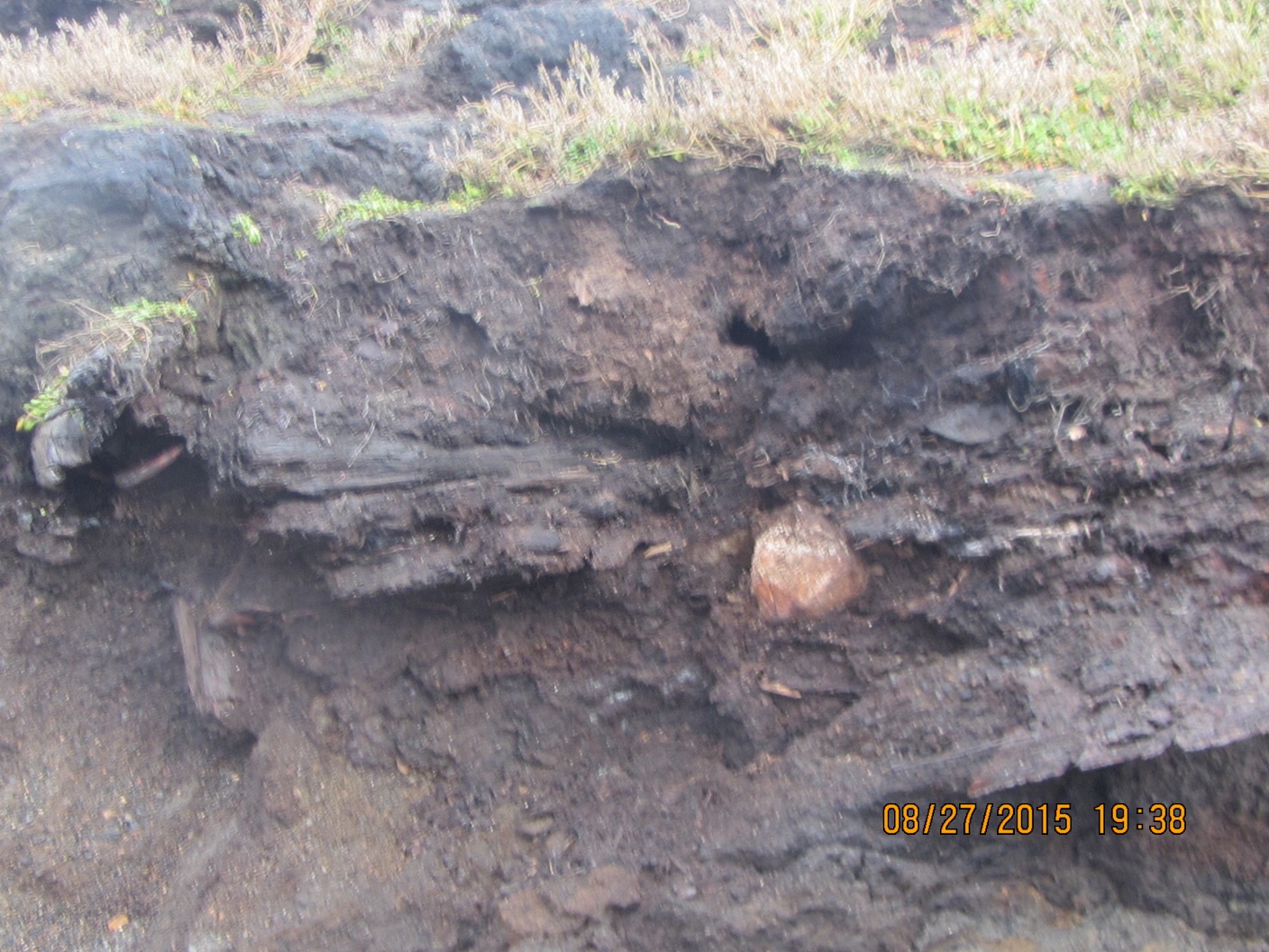
And in that permafrost was the same strandline debris that has proven to be a marker for the Ipiutak occupation. There was a large patch of what looked like fur or peat (which often seems to be found on the floors of Ipiutak structures) and an area where the wood seemed to be far more aligned and level than is normal for a strandline, but would be quite typical for an Ipiutak floor. I tried to get decent pictures, but in the end decided I needed to try to get a sample. I tried walking down on the permafrost, but it was angled, and I couldn’t get close enough without falling off. There were big waves, and the bluff was undercut. If a really big one came at the wrong time, it could wash me off my feet.
Finally, I asked Ricky Bodfish, who was driving the tour van & giving the tour except for the archaeology part, if they had a rope. He did, so he dangled it down the bluff by me, we waited until right after big waves when it looked like a lull and I went down to check it out and try to get close-ups and a sample.
Sampled peat in Ipiutak layer. My finger for scale.
The patch of material turned out to be peat, which I was able to sample, and will send out for dating. My camera got some spray on it, but there was not way or time to clean the lens, so I just kept shooting. Unfortunately a pretty big wave came and dumped gravel on the surfaces just before I got a shot off of the wood, (I managed to turn so I caught it on the side where KTUU’s microphone pack wasn’t) and I could hear the next one was even louder. I ran, and made it into an area above the waves before the big one broke.
Edge of eroding Ipiutak layer showing some of the aligned wood. The white is the foam on the wave that is going under this layer into the bluff.
Fortunately, nothing soaked through the Carhartts so I just took them off for the rest of the trip.
We had been monitoring the tower we’d put out in June, and just a few days earlier had thought it would be fine. However, the storm had taken out a lot of the bluff, and I wound up calling & texting the guys who work on the ARM project for UICS. They wound up going out later that evening and hauling the whole thing about 50 feet (15m) farther back from the edge. Just in time, since by the time they got out there, they figured it was 2-3 feet (< 1m) from the edge.
Getting close to the edge.
After that, the KTUU fellow wanted to see the farthest North point and go to the bone pile to see if there were any bears. We set off, and almost immediately had to detour. The trail we normally use to get to the site, which is always dry, had water all over it from the storm surge.
Trail covered by storm surge.
We made it to the farthest North point, which was a bit less far North than previously. The storm surge had made it to the tip of one of the whale jawbones, and about 10 feet was missing here too. However, we did get some nice light, and the KTUU guys got busy.
Crew and van near Farthest North PointDan Carpenter gets ready to shoot at the Farthest North Point.
KTUU crew at Farthest North Point.
Unfortunately, the trip to the bone pile did not come off. The storm surge had caused it to nearly become an island. Ricky was not sure how solid the ground was, and we did not want to get stuck there, so we gave it a miss. On the way back to the road, it was really clear how much of the Chukchi side of the Point Barrow spit had been eaten. The ocean was almost up to the berm along the road, and there used to be a fairly wide strip of gravel there.
I’ve noticed I’ve been getting more hits on search terms relating to those whales, probably since the movie “Big Miracle” just was released. So, since I’m kinda busy with the Super Bowl, I thought I’d put up a few links to the real story.
1) Bill Hess’s blog, where he is doing a series on the whole event. Bill took what were probably the first professional pictures of the whales, including some may probably recognize. This features a lot of Bill’s really fine photographs.
2) An article in the Fairbanks New-Miner which has interviews with many of the folks in Barrow who were involved in the original event, including biologist Geoff Carroll.
3) An article in the Anchorage Daily News by Richard Mauer, who covered the original story and hauled out his notes to write this one.