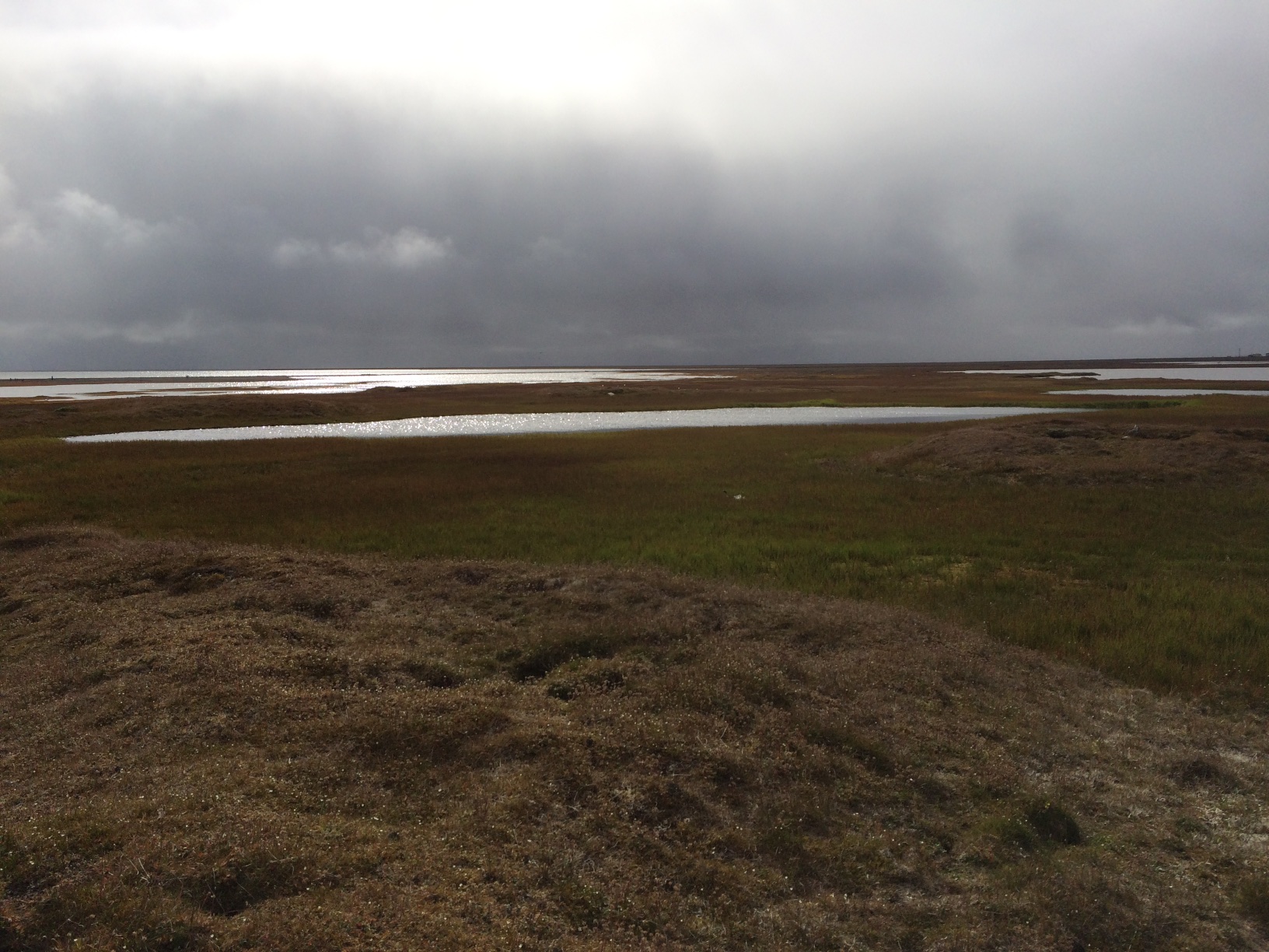
There is a very large storm, with winds up to 50 mph and big waves from the west battering the Chukchi coastline from Barrow south. It has created a major storm surge, with big waves and coastal erosion. An emergency has been declared in Barrow due to flooding and road damage.
I flew back from Wainwright yesterday evening, and even through the storm was just building, the waves were already hitting Walakpa. I couldn’t get pictures but it did not look good.
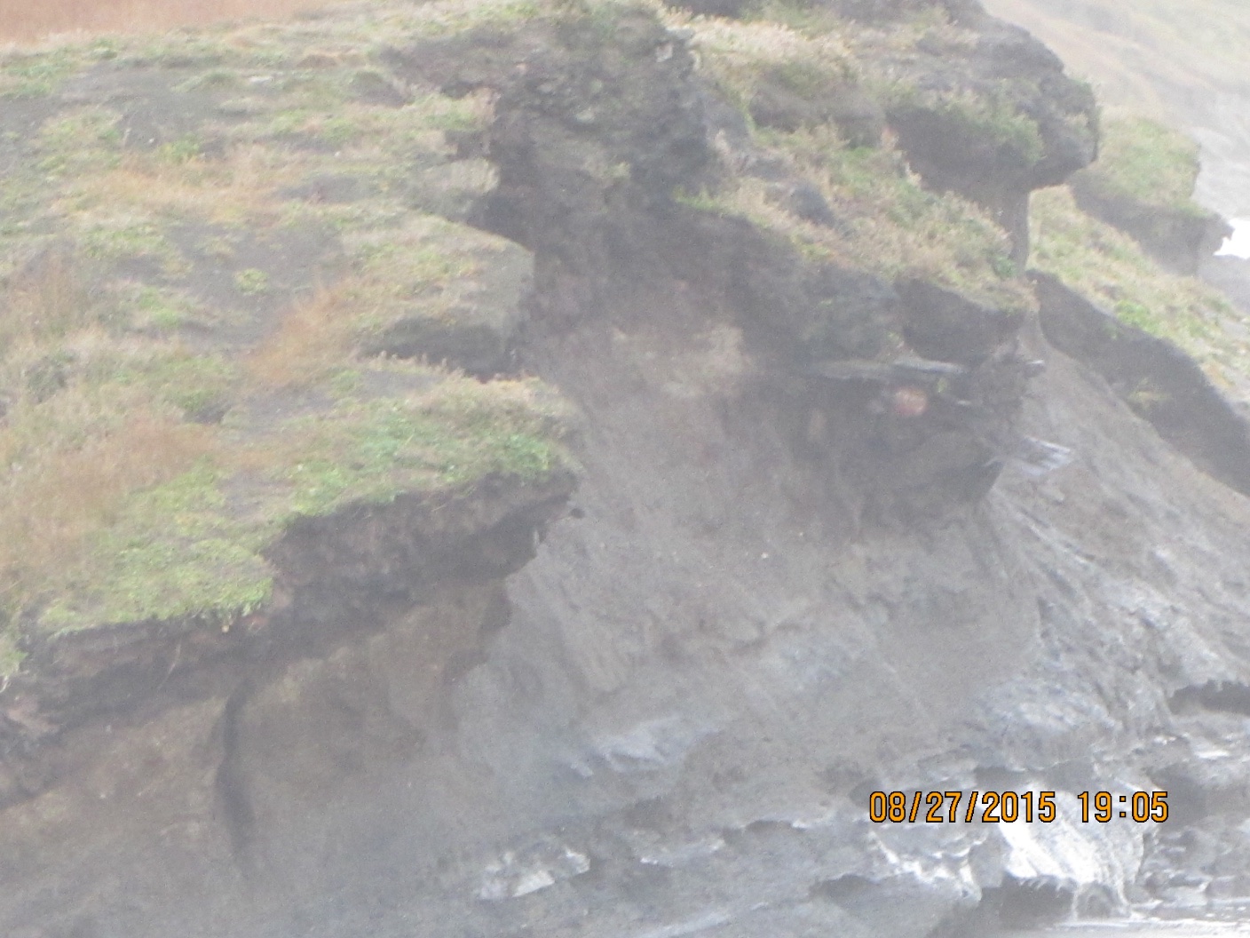
Today was much worse. Late this afternoon, I got a series of calls about something washing out at Ukkuqsi, where the little frozen girl Aġnaiyaaq was found. Aqamak Okpik from IHLC got things organized, with Morrie Lemen coming out to NARL in a bigger truck than mine to take me in to take a look. The North Slope Borough Fire Department came over, and two firefighters suited up and tied a rope onto me so I could go down and take a look.
View of Ukkuqsi from the north side.
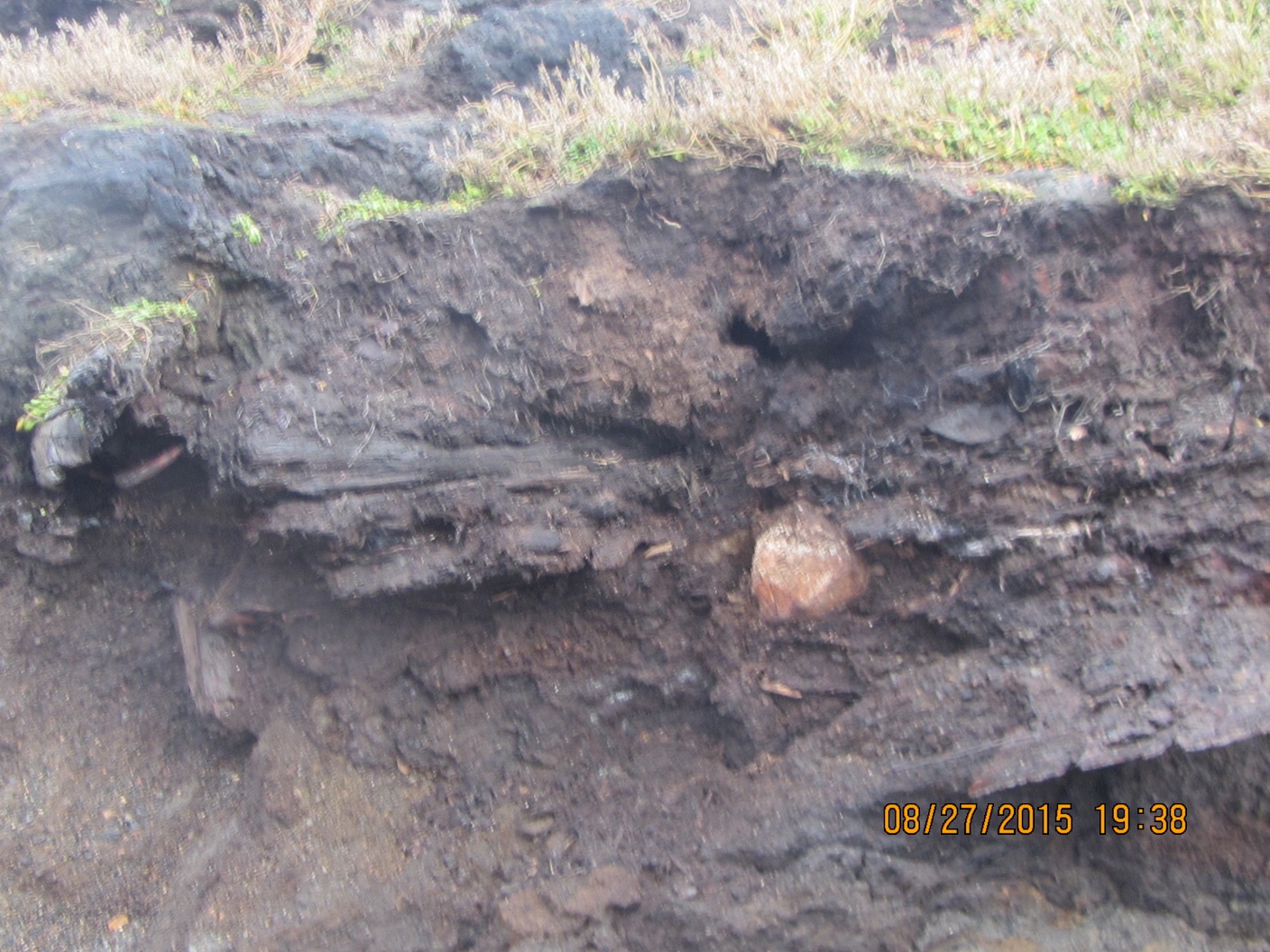
The big concern was that a burial was eroding out, since there have been several in that area. In the end, it looked like part of a house (maybe two superimposed) with a whalebone and a baleen toboggan. We retrieved a few bones and a piece of structural wood that were going to fall in any minute, and hope to be able to get a radiocarbon date or two. I only got hit by one big wave.
Closeup of eroding structure from the beach.
Hope to get some video or at least frame grabs available soon.
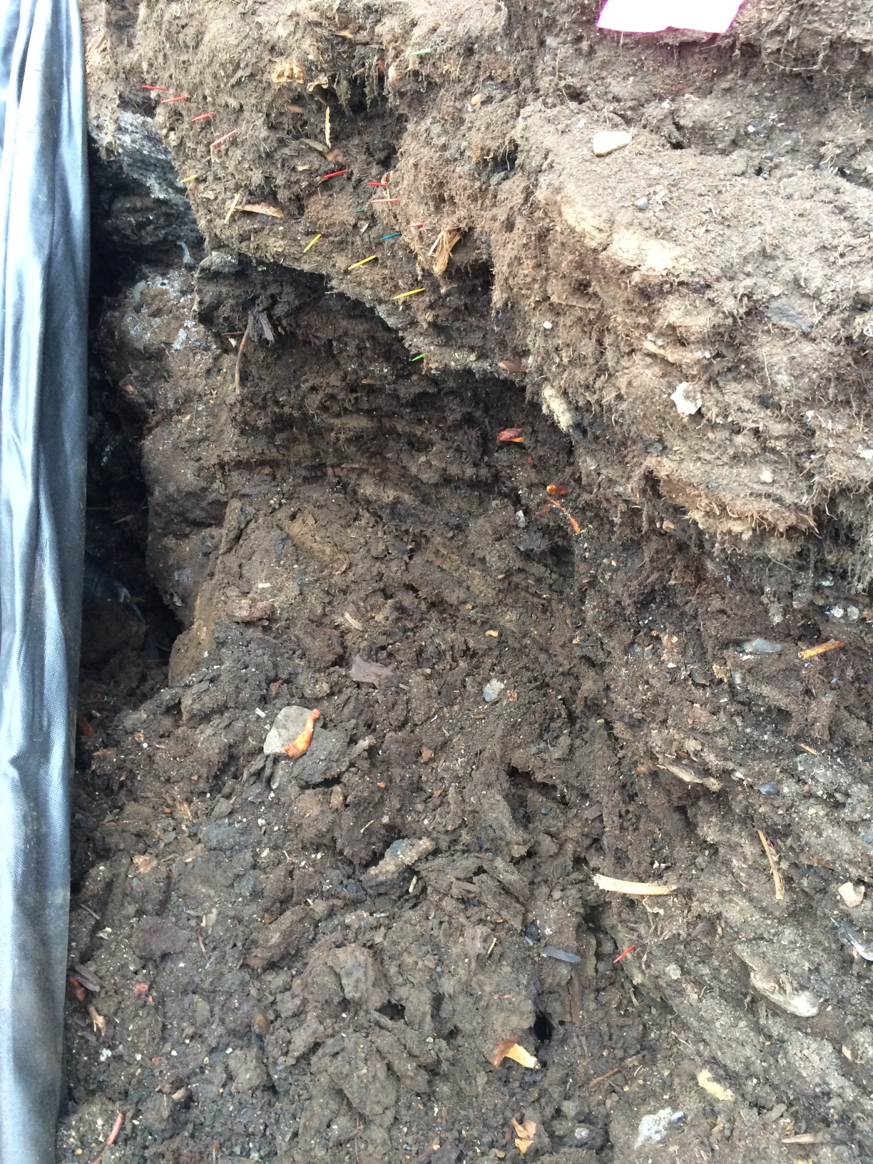
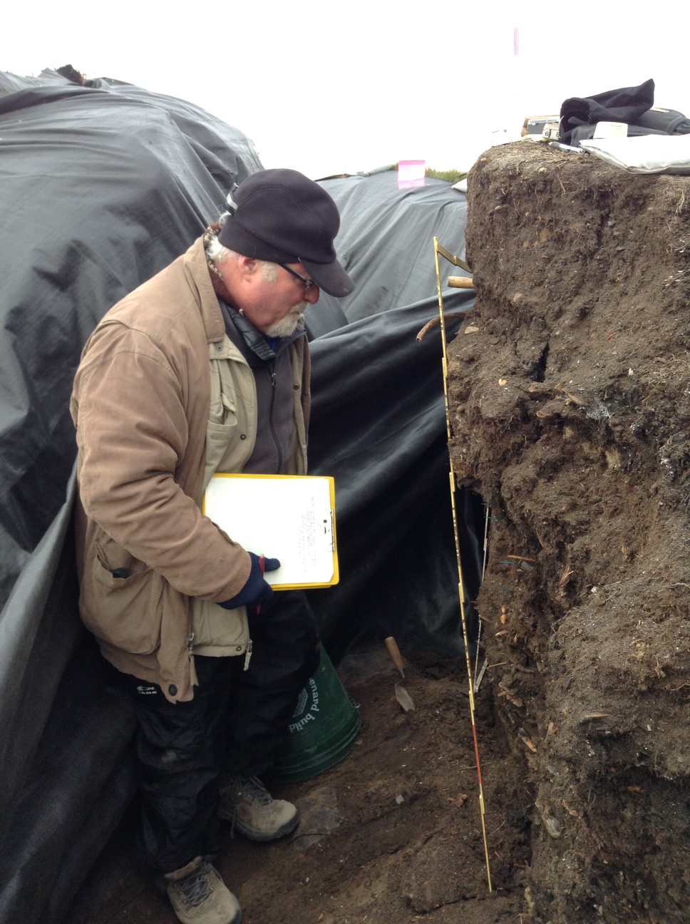
We got up with the goal of getting packed up. It wasn’t clear if the UICS logistics staff would be able to come and get us today, but we decided to finish all the field work, and pack up as much as possible. We got right on the screening, and recording of the edges of the midden and the units on the Pipe Monument mound. Owen went to work on a detailed profile of CS 2.
CS 2 after excavation and preparation for detailed profiling.
Once that was well in hand, it still wasn’t clear if we would be able to get home. I needed to go in to Barrow to make sure everything was progressing with the other project, so we decided I could take trailer load of field gear, samples and some of my gear back to town. That way, we would need less help getting back, and if the pickup wasn’t going to happen until tomorrow, I could bring back my sleeping bag and sleep in the mess tent.
Once I got to town, I unloaded and did some more work on the other project. It turned out that some logistics folks were available, so I went back down with them, and we managed to get everything back to town, and into the UICS yellow building. Everybody got to sleep in a real bed.
Last night was not particularly restful. The collapse had complicated matters quite a bit. However, after breakfast, we went back to work.
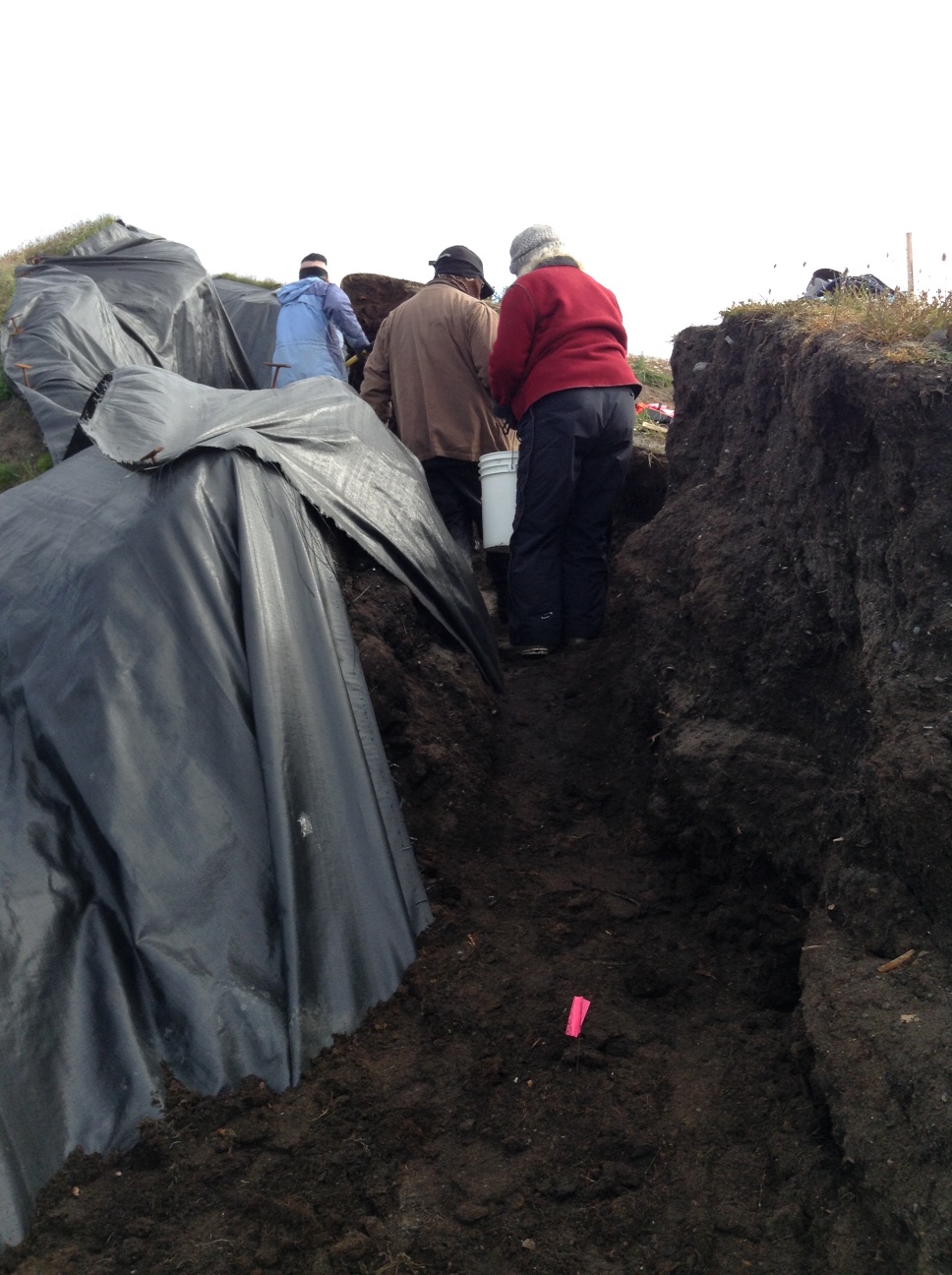
The old location was not viable, so I picked a new spot about a meter south, which became Column Sample 2 (CS 2). There was a bit of an overhang, and a very deep crack behind the bluff face. We needed to get all that material out of there. It took a bit of thought to figure out how to do it (not a usual archaeological operation, fortunately). Finally, we put a blue tarp down on the bottom of the main cleft so we could drag fill without anyone having to be under any overhangs or unstable areas, everybody got out of the way, and I cut the overhang back while standing as far back from it as possible. We then took the material out with a bucket brigade. Once that was done, I levered all the cracked material off, and we took it out the same way.
Bucket brigade in action.
Once that was done, I decided that we would excavate in levels labeled with letters, so we could proceed quickly, rather than wait for Owen to try to match levels in the detailed CS1 profile, which could have been a slow process. It seemed like the fairly warm, dry weather was letting the face dry out while detailed profiling was happening, and the longer it was exposed the more chance of another collapse. Owen would do another detailed profile after we got the column sample.
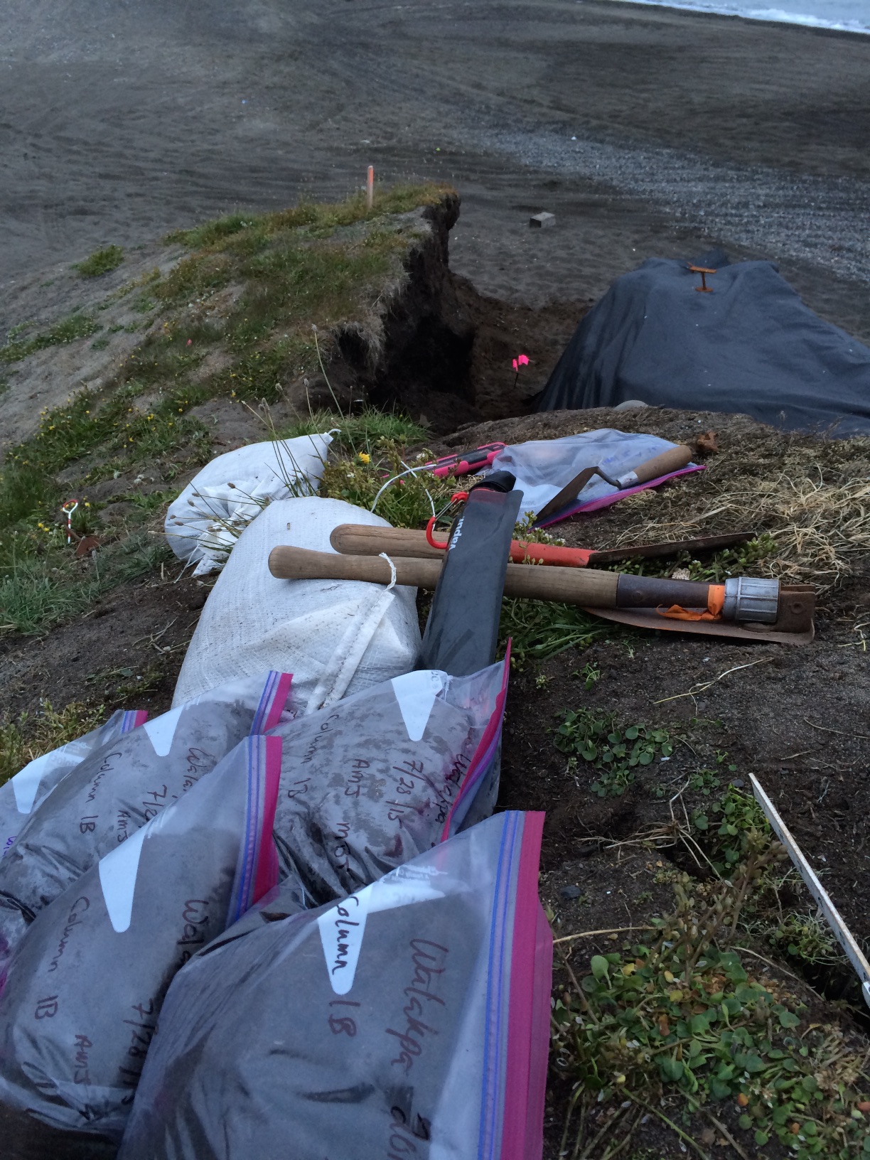
I also decided to make the sample a bit smaller in volume. CS 1 we had been trying for 75 cm x 75 cm (mostly because that size fit between some prior disturbances), but 50 cm x 50 cm seemed more manageable in the time we had left. One gallon from each sub level was retained as a bulk sample, and the remainder of sediment from the sub level was screened through 1/8″ and 1/4″ mesh.
We were just getting started when someone arrived to do a coastal DGPS survey that is part of the coastal mapping aspect of the Barrow Area Information Database project. He passed on a message that said my boss needed me to come back into town. (There is no effective connectivity at Walakpa, which is why this is being posted after the fact). I reviewed recording stratigraphy (or artifacts if any showed up) with Laura Crawford, made sure everyone knew how to use the InReach is needed, and headed back to Barrow by ATV around 1PM.
Something had come up with one of the compliance projects we are working on, and I needed to talk to people and draft some documents. I made it back to Walakpa around 10PM.
On the way, I met some folks out for an evening ride, and they stopped over to visit. One of them had spent a lot of time at Walakpa when she was younger, and had some great stories. I hope we can get them recorded for future generations.
The rest of the folks had managed to complete the column sample, so we talked about closing up shop tomorrow. We just need to finish screening, record the Test Units on the Pipe Monument midden, and backfill the TUs.
Owen and Laura got up early and screened what we had dug last night. Owen worked to finish the profile. There is an apparent marine level at Level 13.
CS 1 profile
We had problems with both transit and radio batteries. Despite that, I showed Laura how to run the transit, so I don’t have to be awake all the time. We shot in the remaining levels of CS 1, as well as the new test units on the mound.
Laura and Owen continued taking CS 1 down. Unfortunately, after the dinner break, they returned to find that the bottom of the profile had collapsed.
The view after dinner.
It was a pretty depressing situation. It left an overhang, so there was no way to just continue safely. It mean that we would have to start over again in the morning.
We went to work in earnest today. Owen went to work on recording the stratigraphy of the profile we had chosen for the column sample (CS 1). I had him marking the bottom of each level so we could continue excavation even after he went to sleep. Anne Garland and Laura kept working on the tests on the mound with the monument. The SW quad of the 1×1 came down on a cryoturbated sterile layer. There was metal throughout the cultural levels. We expanded northward to examine some wood in that wall.
Owen Mason examining the profile of CS 1.
Meanwhile, I set up the transit and began shooting in the CS 1 profile, as well as the bluff edge. The NW quad of TU 1 had similar results, so we put some 50x50s closer to the bluff edge to see if we could find datable material and the edge of the feature.
Mary Beth Timm and I took naps, so we could stay up late and work on the CS 1 profile. After dinner, we shot in the upper levels of the CS 1 profile, as well as a polar bear jaw that was exposed in Level 12, so that it would not get stepped on. Mary Beth & I started excavating CS 1. We are excavating in natural stratigraphic levels, with any level that is more than 5 cm in depth broken into 5 cm sub-levels. One gallon from each 5 cm is being kept as a bulk sample, and we are screening the remainder.
Midnight double selfie. Anne & Mary Beth at work on CS 1.
We kept going until it go so dark that we really couldn’t see the soil colors, which was around 2 AM. We had accomplished a fair bit, so we headed off to bed.
Results of our labor.Off to bed.
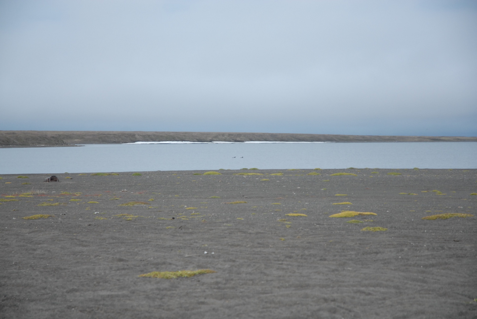
The weather is often best at night. It was really beautiful. A pair of loons was swimming on the lagoon.
Jeff Rasic from the National Park Service, along with Rebekah DeAngelo from Yale and her grad student Brooke Luokkala are in town to do some work, along with Laura Crawford, at the Birnirk National Historic Landmark site, which is on UIC lands (and yes, the actual name of the place is Piġniq, but the site has been written about as Birnirk, so I’m using that name for the site). Becky and Brooke got in Sunday, after travel from the east coast, and Jeff got in yesterday. However, the weather was pretty bad, so we postponed real fieldwork until today.
I did see them in the field briefly yesterday. I had to take a quick trip to the point to check on something for UIC Lands. On the way back, I met them near the Birnirk site, unfortunately a bit stuck in gravel. They were successfully extracted and continued their tour of Barrow.
Today we went out to Birnirk. We looked at all the mounds, Jeff got GPS points on mounds and other reference points, and Laura did quite a bit of coring. I flagged the perimeter of a “box” that we hope to have some of Craig Tweedie’s crew do detailed DGPS measurements on. That data can be used to make a contour map of the site, which can then be compared to the map James Ford made in the early 1950s, when he was there with Carter. It should be interesting to see how much sea level has changed. It clearly has risen since the earliest houses were occupied, and even since the early aerial photos, but the question is, how much?
Sun on water at Birnirk.Part of the crew visiting one of the mounds at Birnirk.
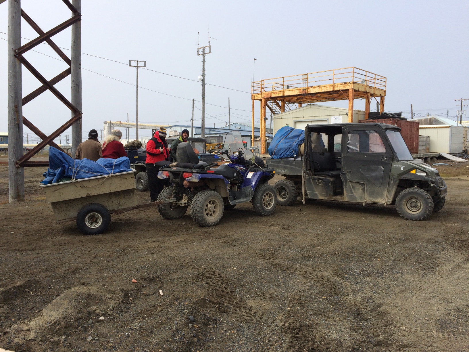
The crew (Owen Mason, Anne Garland, Mary Beth Timm, Laura Crawford and myself) gathered out at NARL, at a small yellow warehouse. We were using UIC Science archaeological gear. IHLC & Ilisagvik College let us use some tents, sleeping pads & kitchen gear. We managed to get everything packed into side-by-sides and trailers and headed off to Walakpa with Sean Gunnells, Oona Edwardsen and Ray Kious of the UICS logistics staff who weren’t otherwise occupied.
Loading up to head to Walakpa
We got to Walakpa around 2PM. We got camp set up, with a slight hitch because some of the tents had not been repacked properly when last used. However, the logistics staff dealt with it, and headed back to town.
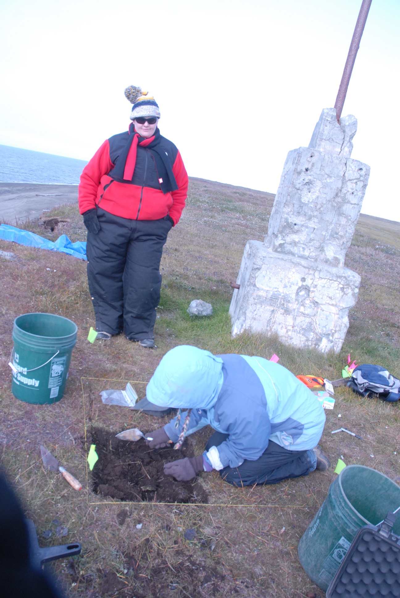
We uncovered portions of the bluff so that we could examine the profiles and decide where we want to take the column sample. While walking the beach examining the bluff profiles, we noticed that there was a cultural layer exposed in the mound with one of the two monuments on it. Anne Garland laid out a 1×1 meter test, well back from the edge of the bluff, to see if it continued across the mound.
Laura Crawford excavating the SW quadrant of a 1×1 while Mary Beth Timm looks on. View NE along the coast toward Barrow.
It was clear that we couldn’t safely do a profile in the central area where the meat cache had been, since there was still an overhang. In addition, some of the geotextile fabric protecting the site was pinned by collapse of bluffs, preventing its removal. Eventually, after cleaning profiles on either side of the overhang, we picked a spot and Owen went to work on a detailed drawing.
We had visitors in the early morning, a young couple whose ATV had a flat, and were hoping that we had a tire pump. Unfortunately, we didn’t, so they headed on up the coast with both of them on one side of the ATV.
We’re back from Walakpa, most of the gear is cleaned up and put away, and initial sample processing is done. We couldn’t post from the field, so I’m going to put the posts up a day at a time.
After a rather long, drawn-out saga, everything is in place and I can draw on funds so I can work on the WALRUS project. The delays have been really frustrating for everyone involved. Once I get the interns on board in Barrow, we’ll get back to going through the faunal material we have there for walrus samples.
We are trying to get samples from a wide range of sites. Since the sampling is destructive, we don’t want to use artifacts if that can be avoided. Ideally we want unmodified walrus parts, bone or tooth, or if we can’t get enough of them, manufacturing discards. As a fallback, we may wind up sampling things like shovels or bola weights, assuming we can get the museum’s permission, since they are common types of artifacts, and not diagnostic (or something that is likely to be displayed). We currently can’t use tusk parts, since there have been no modern studies to compare their chemistry to that of bones and teeth, so interpretation of results would be problematic. (If any carvers would be able to contribute some scraps from tusks along with a sample of bone and/or a tooth from the same animal, it would be a really big help). We are also looking for caribou or some terrestrial plant material from the same place in the site for radiocarbon dating, since marine mammals incorporate old carbon and the dates are hard to interpret.
More recent archaeological projects tend to have excavated faunal material in the same way as everything else, with decent stratigraphic control, and also tend to have brought it back from the field. However, in the early days, that was not often the case. Even if material was brought back, it often wasn’t cataloged in any detail, so reports are almost no help in figuring out if there is any walrus to be had in archaeological collections. A bit of walrus shows up in catalogs, but most of it is in the form of artifacts. A lot of walrus artifacts (particularly bone, since ivory was clearly an item of trade) suggests that the inhabitants of a site were hunting walrus, so the potential for walrus parts to exist in the collection is there.
Many of the classic sites on the coast of Alaska have strong indications that walrus were being caught by the people who lived there, but they were excavated decades ago, and finding suitable samples in the collections was not something that could just be done by getting someone to pull a particular bag or catalog number. It pretty much requires looking through mixed lots of artifacts and bags of bones. So I’m in Fairbanks doing just that.
We are mostly working in the museum, but it is closed on the weekend, so we got permission to bring a collection of faunal material to the PI (Nicole Misarti)’s lab, and we went through it yesterday. It took some doing, but we got though it, and should have plenty of samples. It was an adventure. We had 24 boxes, most of them full of bags like this:
Nicole holds a bag from which the bones on the tray burst forth (like a scene from Alien) when she took it out of the outer bag. Sadly, these were almost all ringed seal parts. Other bags from that box are on the right.
Not all of the bags were correctly labeled, or at least the labels often didn’t specify species, just element, so we had to look.
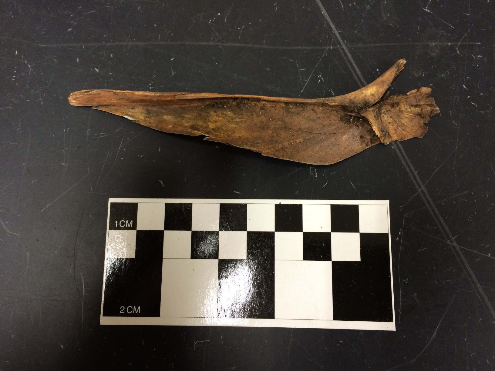
We found a few other interesting things in the process, including this really large fish bone from Point Hope.
Really big fish bone.The other side of the really big fish bone.
I’m pretty sure it’s some sort of cod (Gadid) but exactly what sort? It’s really big. If I have time, I’ll talk to the curator of fish, but the mission is walrus samples at the moment.