
About a month ago, Tracey Sinclaire and Beth Verge from Anchorage TV station KTUU came to Utqiagvik to do a number of weather/climate-related stories. One was on the effects of coastal erosion. I took them out toward Nuvuk/Point Barrow as far as seemed prudent for the vehicle I had, and got interviewed. The weather was quite challenging while they were here, but they hung in and got stories on the NOAA site, and the blue football field which is endangered by coastal erosion.
Category: media
Getting closer
Time is flying before the field season. It has been insanely busy trying to get some projects to a point that they can be left for a few weeks while we’re in the field, while at the same time getting set to actually go to the field. We have been ordering things, and waiting for them to get here so we can build things, or pack things or prep meals or… And of course, this being the Arctic, shipping delays abound. However, we have gotten the replacement cover for a Weatherport, all the recalled transit batteries, extra new batteries for the handheld radios, Rite in the Rain paper for field forms, the refurbished iPads, the nice new big First Aid kits, chaining pins, Sharpies (lots of Sharpies) and a bunch of other goodies. I got my new tent stuff sack (the original lasted one trip, and all the duct tape in the world isn’t enough to hold what’s left together if I actually put the tent in it) and my InReach. We are still waiting on the parts for a water screening station, and the dry goods.
The lab looks a mess, because everything is still out from the inventory, and needs to be packed, but some of the things to pack it in are part of the freight. Not optimal, but it will sort itself out.
The freeze and chill food got in, and Kaare will be working with the volunteers to prep a lot of meals to freeze before we head down. That is, once there are enough volunteers here.
The first of the volunteers were to get in Tuesday night, but the plane couldn’t land, so they all wound up heading back to Anchorage, getting in quite late. One got on the early flight today on standby, but the rest are now coming tomorrow morning. I figured maybe 2 nights in Anchorage would be a student budget-buster (having slept under some stairs once when stranded in England for a week on the way home from the field–Laker had raised ticket prices over the summer and I didn’t have a credit card), so I posted on a couple of northern archaeology Facebook groups, and had 5 offers of places to stay from folks in Anchorage within a couple of hours. In the end, folks couldn’t get refunds for the nights they paid for (a downside of online booking, I guess), but if anyone else gets stranded overnight on the way in or out, at least I’ve got a bunch of phone numbers and we should be able to help out. Gotta love Alaskan archaeologists.
Kaare made it to Walakpa, although there is still snow on the beach. There has been a good bit more slumping, but it looks like the overhanging block that was making access so dangerous has fallen, which is a good thing indeed. The plan is to try to take some of the heavy stuff down tomorrow, although that may change depending on if the freight makes it in.
We’ve also got a survey to finish before we go (only got the go-ahead a week ago) and maybe a desktop study as well, depending on their timeframe (just got the go-ahead today). Oh, and a proposal, which was just requested yesterday.
And I need to finish making sense of a bunch of dates which I have calibrated for the WALRUS project. It looks like we have decent ranges for many of the sites based on the caribou dates. There are a couple of sites that are confusing (possible reverse stratigraphy in big mounds) and I haven’t been able to get copies of the field notes or talk to the excavators yet. I’ve calibrated the walrus dates using the marine curve, and it is clear there is not a standard offset from the terrestrial dates. I’m redoing it using the best available local delta R, but I know the one for Barrow is off by several hundred years (if you use it there are a lot of bones from archaeological sites that it indicates will be dying in a couple of centuries!) and there is one site in the walrus study where one pair of dates on associated caribou and walrus is several hundred years farther apart that the other pair. Since walrus move around, some probably more than others, it may not make sense until we figure out where the individuals were feeding.
Archaeology at Disney World. Seriously.
I am writing this from Disney World, where I have gone to talk about archaeology, particularly global change threats to the archaeological and paleoecological records. The Society for American Archaeology is having its 81st Annual Meeting here, so I am sitting on the 11th floor of a hotel with a view across a lot of fairly low lying land. It might be high enough to survive several meters of sea level rise, but by 20m, the Orlando airport looks like it gets iffy.
I organized a session on, surprise, global change threats to the archaeological and paleoecological records. It should be good, with people presenting on various aspects of the problem in various part of the world (mostly the North), and some possible solutions being tried as well. The session is Saturday morning, and we’ve got Ben Fitzhugh from UW as discussant, as well as a 15 minute discussion slot. I hope we get good attendance, because this is a critical issue for the future of the discipline (and maybe of people in general). Of course, in their infinite wisdom, the schedulers put us directly opposite the session in honor of Lou Giddings, which deals with coastal Alaska. I actually have to read a paper for someone because the primary author couldn’t travel and the second author is giving a paper in the Giddings session at the same time! Meanwhile, I’d already gone to most of the papers I want to see today by 10:30 AM.
Last night I went to the President’s Forum, which was on Climate Change and Archaeology. Dan Sandweiss had organized a nice set of speakers. One of them was Paul Mayewski,who specializes in ice cores and their analysis. He talked about some new software they have, and then he described a new instrument they have which can sample cores in tiny increments, so they can actually see individual storms thousands of years ago in the right type of core! I introduced myself afterwards, and asked if it might work on ice wedges, following up on a suggestion Vlad Romanovsky had made during ASSW. He thought so, and offered to pay to ship a trial wedge sample to his lab so they could try it. Now I just have to get a good sample. Hopefully it works, but either way it will be interesting.

I’ve got a meeting later today (and another on Saturday for those who can’t make today’s) for folks who want to help with 2016 Walakpa Archaeological Salvage (WASP 2016). Today we meet at 5PM at registration, and anyone who is interested is free to come along. Now I have to run off and find the meeting of the newest SAA committee, Climate Change Strategies and Archaeological Resources (CCSAR).
Getting the word out–or the library is on fire!
Folks who have been reading this blog are aware that erosion of archaeological sites due to global change effects (warming, sea level rise, etc.) is a huge problem where I live and work. Rapid decay of the exquisitely preserved organic contents of the sites is also a huge problem. But a blog only reaches so many people and actually dealing with the sites and otherwise doing my day job means that I can’t spend endless time on outreach. So when a member of the media is interested, I take the time to talk to them. Sometimes something comes of it, other times not.
Last summer Eli Kintisch, who writes for a number of scientific publications came up and spent a few days in Barrow. He managed to spend a day at Walakpa, although his schedule meant he couldn’t be there for the whole thing. He’s been working on it since, and I think the result is pretty engaging. The resulting article was just published by Hakai Magazine here and simultaneously by the Smithsonian website here. Hakai focuses on coastal issues and just recently published an article on Tom Dawson and SCAPE’s work in Scotland dealing with similar problems (minus the permafrost thawing and sea ice retreat).
It’s a big problem, and one that will take a considerable input of human and financial resources to deal with. We’ve only got a few decades (less in many cases) before all the cultural heritage and paleoenvironmental information in these sites is gone for good.
A radio interview
Yesterday was supposed to be a big day for interviews. One of the Alaska TV stations has someone coming to Barrow who wanted an interview, and Joe Schuldenrein was scheduled to prerecord an interview with me for his internet radio show on archaeology, Indiana Jones: Myth, Reality and 21st Century Archaeology. Unfortunately for them, the TV folks went on a tour of the entire state, except Barrow, courtesy of Alaska Airlines and didn’t get in until after 7 PM. We may reschedule.
The radio interview did happen, and will be broadcast today, 1 PM EDT, 4PM AKDT. I believe you should be able to access the archived version here after the broadcast. If you want to listen live, I think you can log in here and do so, but I don’t know the details, since I have only tried the saved version of the show.
Now for some time in the lab, and maybe another interview…
|
|
||||||||||||||||||||||||||||||||||||||||||||||||||||||||||||||||||||||||||||||||||||||||||||||||||||||||||||||||||||||||||||||||||||||


Some media attention, and why it can be a double-deged sword
For some reason, this year there has been quite a bit of media interest in Barrow and archaeology. To begin with, there were several film crews in Barrow while we were working at Walakpa, two of which actually came out to the site and filmed as well as filming in the lab. Only one of them has anything out yet. PBS filmed for several both in the field and in the lab, and a little bit of it made it into this piece, and a shot in the slideshow that they put up on the web in conjunction with the series on sea ice change. It was a very buggy day in the field, and it was quite the challenge not to be swatting mosquitoes all the time.
Oh, and the buoy experiment that Ignatius Rigor is working on in the film clip is supported by UIC Science staff (not that they have to do much, the idea is to see how the buoys do with no servicing). Their data can be compared to data from ARM’s established serviced meteorological instruments. That way, when scientists get buoy data, they have an idea how reliable it is, and if there are any special considerations in interpretation (becoming uncalibrated over time, etc.)
We’ve also gotten interest from the press. Abra Stolte-Patkotak, one of our volunteers writes for the Arctic Sounder, and did a piece on the Walakpa excavations, which is on-line here. For some reason, they don’t have the picture that was published up on-line, but I will ask Abra if I can put it up here & add it if so.
I am currently working with a free-lancer who has interviewed me and asked me to fact check the article before he goes further. A very good idea, as many years ago I was interviewed by a reporter who mis-heard my answer to the question of how far back in time human occupation of the Barrow area was archaeologically demonstrated to extend. I said “maybe 4 to 5 thousand years” which was what people thought reasonable for Denbigh at the time. He refused fact-checking help, and published an article in which I was directly quoted as saying “45,000 years”. Although Glenn & I could never get the Arctic Sounder to mail our subscription to us in Pennsylvania, apparently Tiger Burch could. I got a very puzzled email from him after the article came out, in which I believe he was politely trying to ask me if I’d lost my mind. Fortunately, he had enough experience with the press that he believed the explanation.

August 15th at Walakpa–78 years ago and today
Seventy-eight years ago, it was a foggy day at Walakpa. The Okpeaha family was camping there. A floatplane descended out of the fog, and two men asked how to get to Barrow, since they had lost their bearings in the fog. Getting directions, the got back in the plane and took off. The engine failed, and the nose-heavy aircraft crashed into the lagoon and flipped. Unable to reach the plane to help the men, Clare Okpeaha ran all the way to Brower’s Trading Post in Barrow, over 12 miles of very rough going, to get help. When boats got back to Walakpa & they got to the plane, it became clear the men had been killed instantly. They were Will Rogers, a noted humorist and political commentator, who was traveling around Alaska to get stories for the newspapers, and Wiley Post, probably the most famous American aviator of the time after Charles Lindbergh.
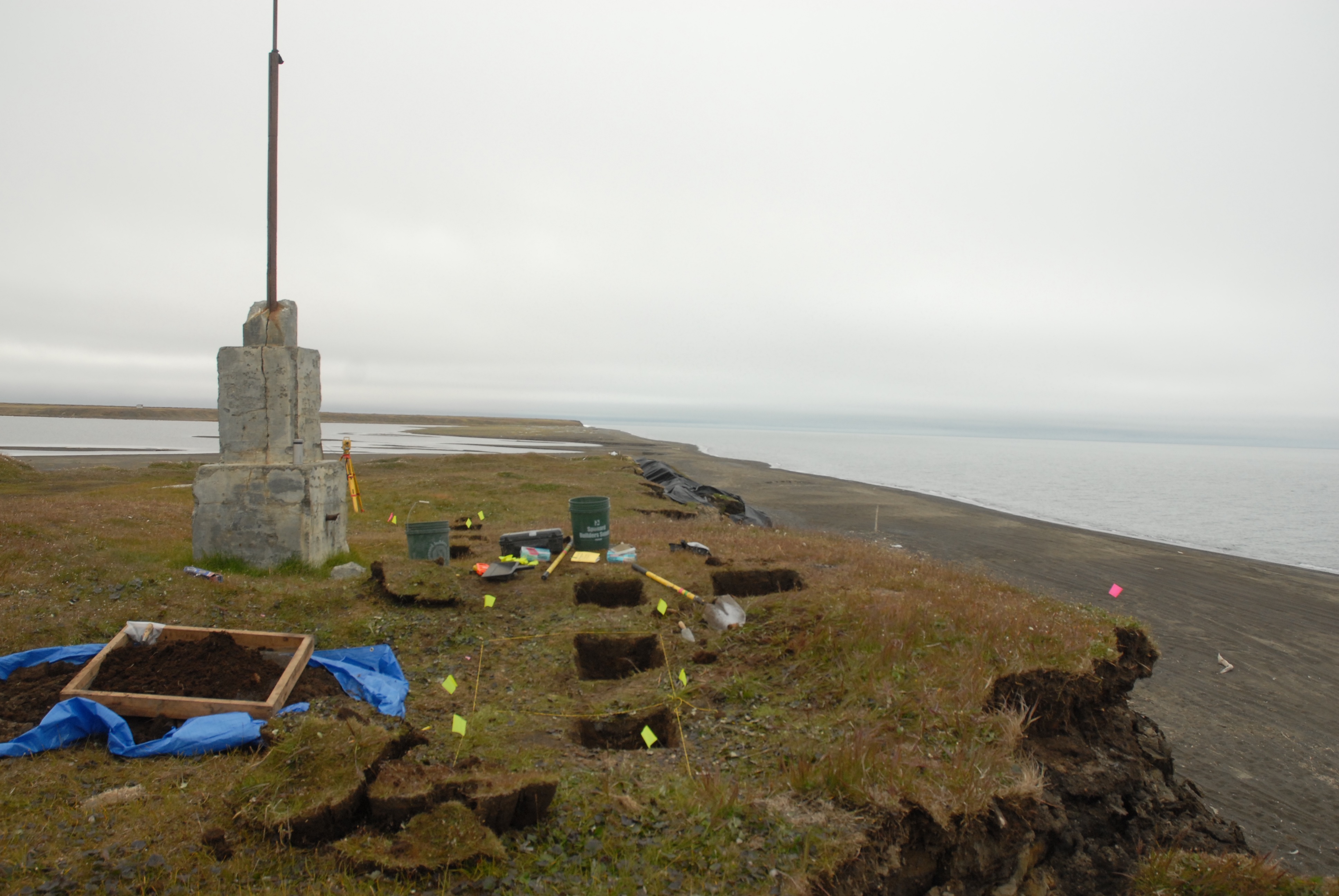
The crash was national news at the time, and a few years later a monument was erected near the site, followed some time later by another one. These are the monuments that show up in some of the pictures of the site. For some reason, these are on the National Register of Historic Places, but the archaeological site isn’t.

- The first monument , looking out over the lagoon where the crash occurred.

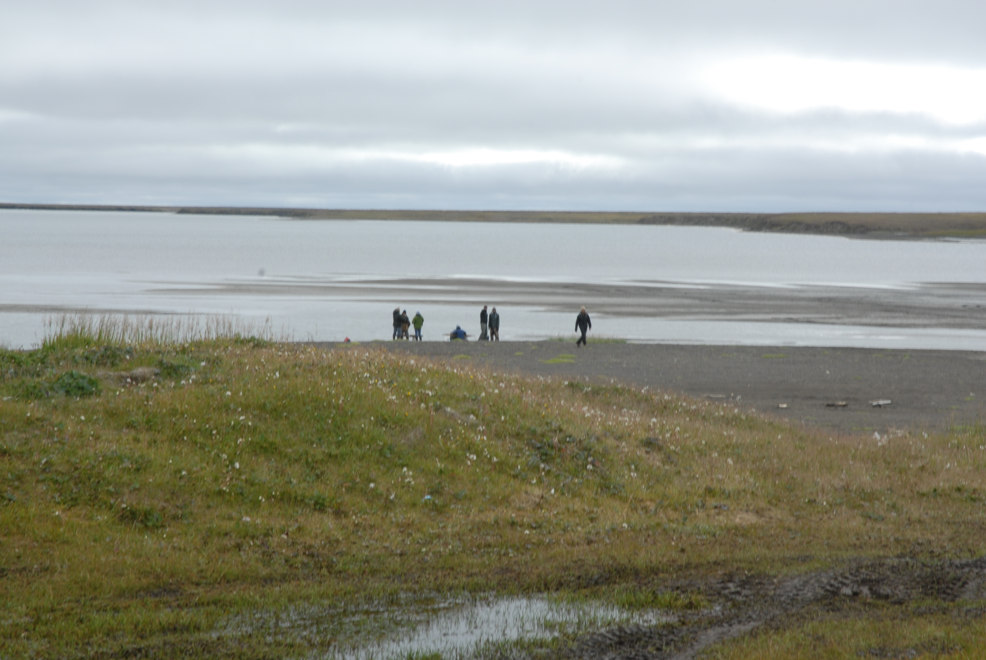
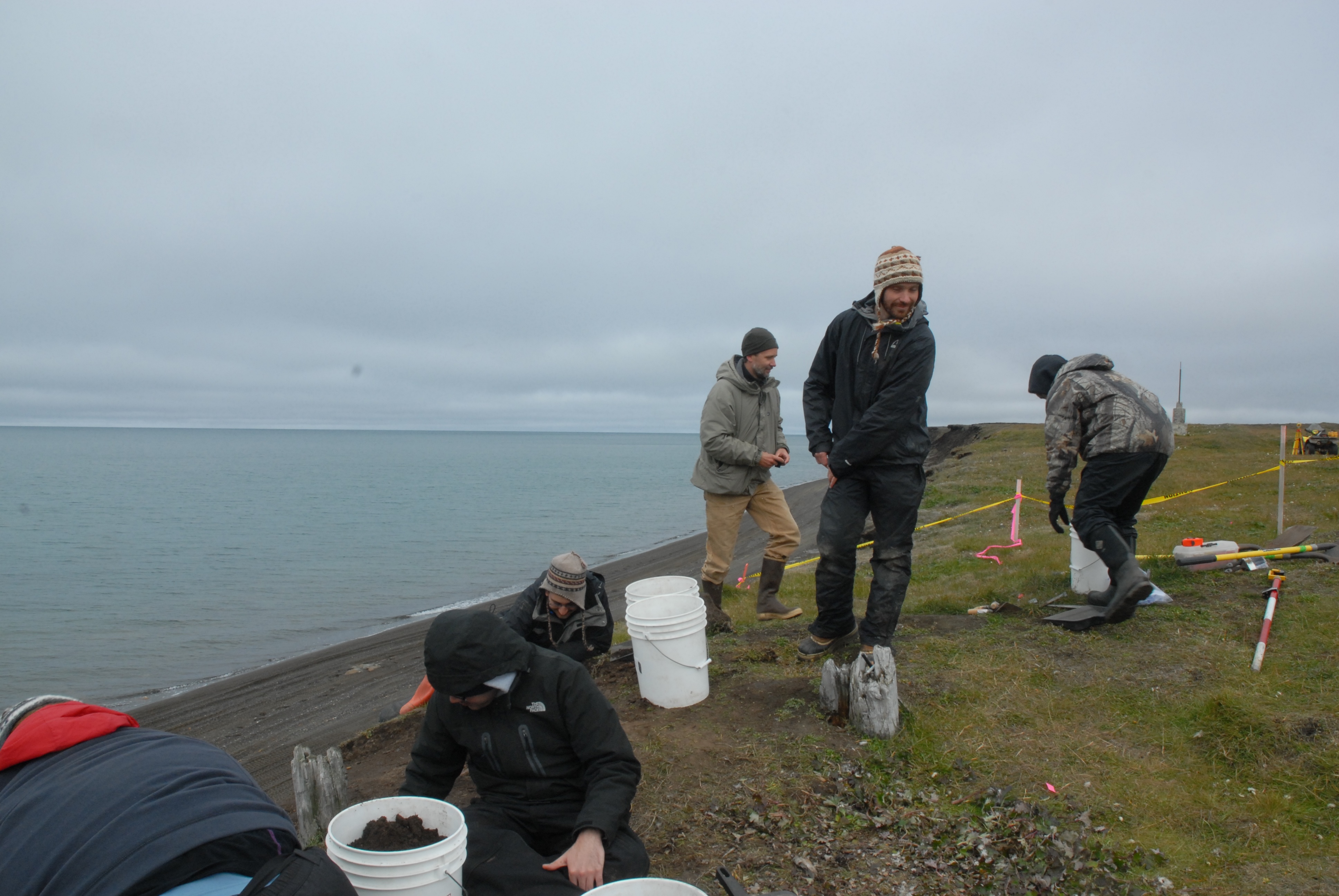
Today was a much better day at Walakpa. We headed down with 7 volunteers, including David Pettibone, Michael Berger, dental extern Temurkin Cucukov, and the entire Von Duyke family, plus Marybeth Timm from the Inupiat Heritage Center. The stream was running high and fast at Nunavak, but we got across, although not before I got my boot wet. With that many people, it seemed worth getting the water screening going, so we did, using a small pump to take water out of the lagoon. Alan & Scott Kerner happened by on an ATV ride and pitched in for a while as well.

- Wet screeners in action by the lagoon.
The rest of us continued with taking down the rather disturbed level under the sod. It would be a lot easier if we could just shovel it out, but the bluff doesn’t seem that stable & we’re afraid we’ll knock the whole thing down if we shovel, especially since there are still a lot of roots holding things together at this level.
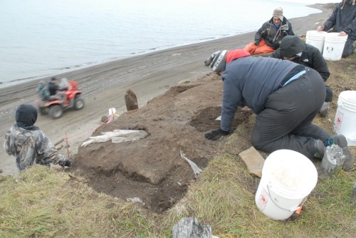
- Excavating the disturbed layer. Note the Visqueen.
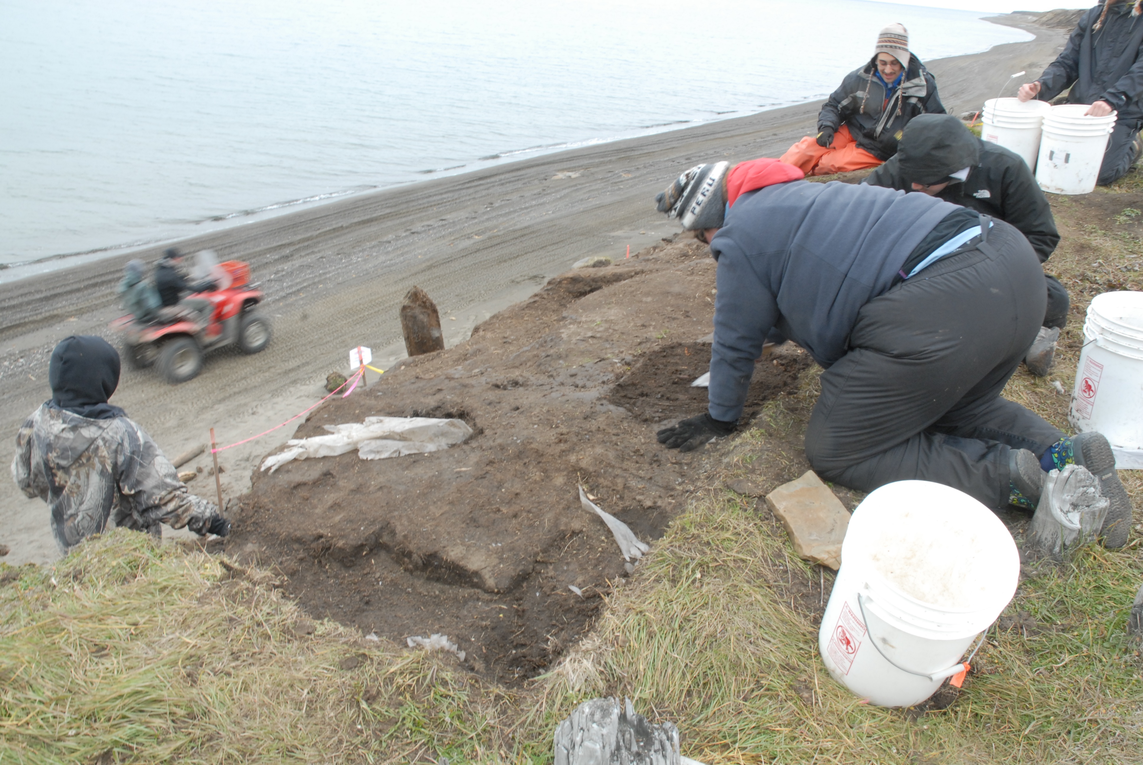
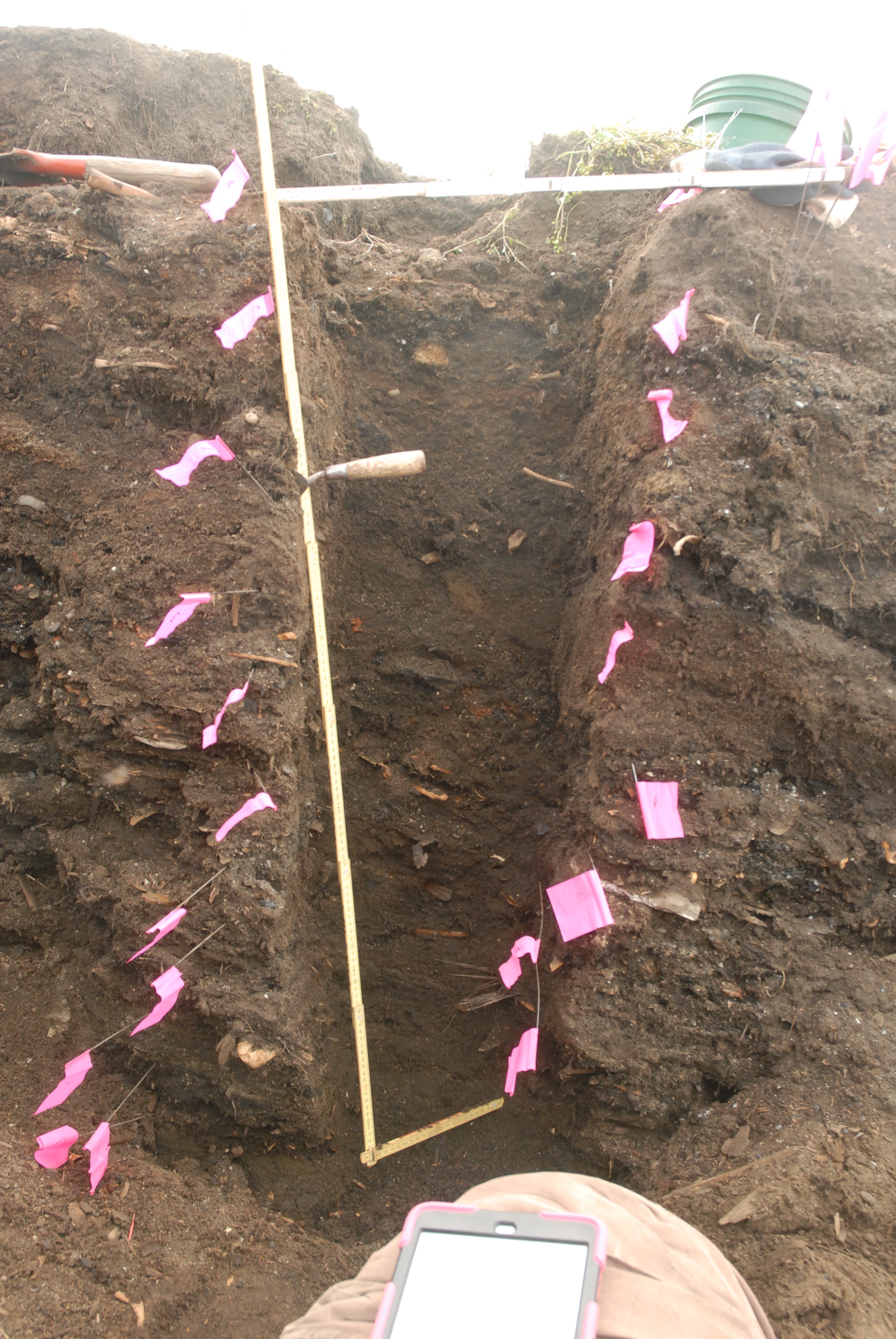
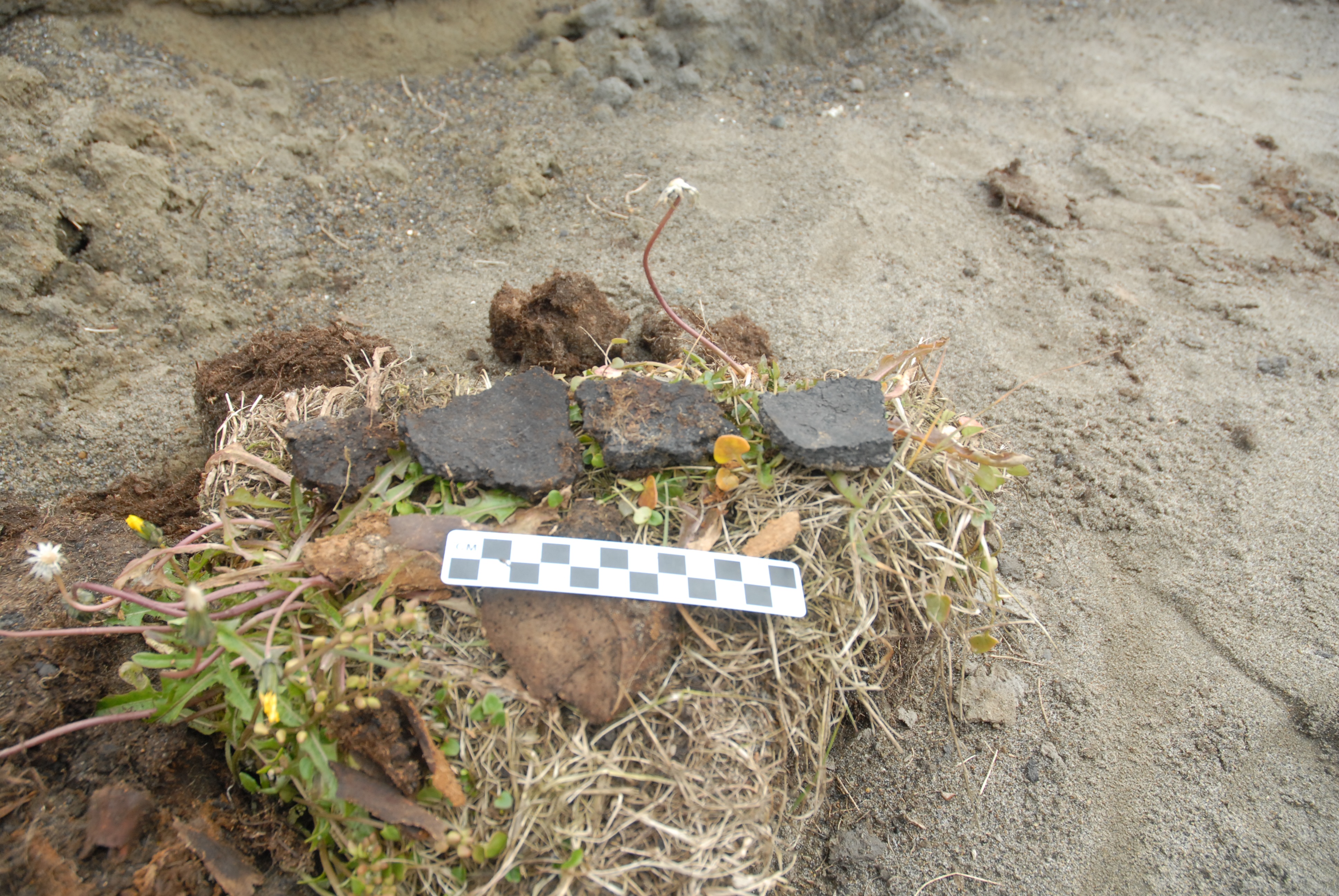
A while after we got there, a boat pulled in, and Jeff Rasic from the National Park Service (in town for a meeting at the Inupiat Heritage Center) Patuk Glenn (IHC) and Kunneak Nageak (IHLC) appeared. They got a good tour, and spent a bit of time wandering around. Jeff found a big sod with a lot of artifacts in it, including several very nice potsherds, one with residue, which we collected.

- Excavation at Walakpa. L. to R. Marybeth Timm, Temerkin Cucukov, Michael Berger, Jeff Rasic, David Pettibone & Trina Brower.

- Potsherds.
The ride home was even more exciting. Nunavak wasn’t too bad, but they were unloading a barge on the beach, so we took the old Nunavak “road” back to town. It has pretty much disappeared back into the tundra on the middle section the last few years, and it was a very muddy ride!
A trip to the Point
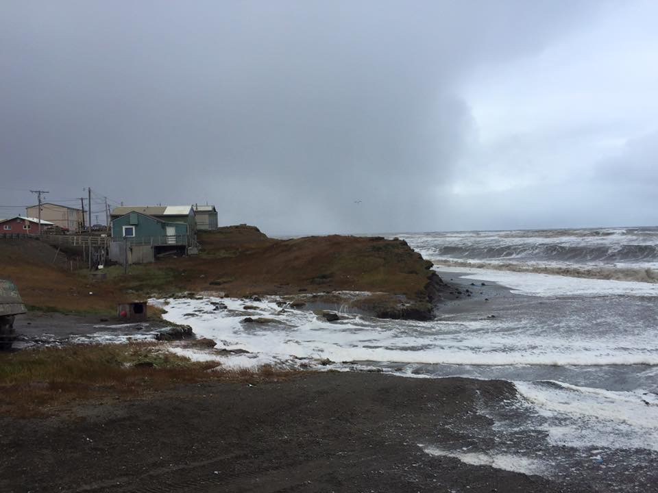
On Friday afternoon we headed to Point Barrow. I’d gotten KTUU set up with Aarigaa Tours, who picked them up in town at Top of the World Hotel, and then picked me up at my house at NARL on the way out to the point. I’d run home from work to change into my warm gear. A good thing, too, as will become clear later.
We’d been having a pretty strong blow from the NNW, and waves had actually been coming up onto the road. The road to the point had actually been closed right by Piġniq (Birnirk), because the waves had been breaking over the road and had done some significant damage. We were in a van equipped for off-road travel, so we were OK, but we had to detour through the cabin area. Once past there, the road was still in pretty good shape, but we could see water seeping in under the gravel berm. Once we got out a bit farther we could see a number of vessels & barges that had come into Elson Lagoon to anchor up and wait out the rough weather.

Once we got to Nuvuk and got a look at the site, it was a bit depressing. However, it made a perfect example of coastal erosion in action, and made it really easy to illustrate how information about the past, which could have application to understanding what directions to take to have a sustainable future, is being lost. At least 10 feet (3 m) of the site had been lost to the ocean since couple weeks ago. The gravel slump that had been protecting the face was gone, and thawing permafrost was sticking out and undercut.

And in that permafrost was the same strandline debris that has proven to be a marker for the Ipiutak occupation. There was a large patch of what looked like fur or peat (which often seems to be found on the floors of Ipiutak structures) and an area where the wood seemed to be far more aligned and level than is normal for a strandline, but would be quite typical for an Ipiutak floor. I tried to get decent pictures, but in the end decided I needed to try to get a sample. I tried walking down on the permafrost, but it was angled, and I couldn’t get close enough without falling off. There were big waves, and the bluff was undercut. If a really big one came at the wrong time, it could wash me off my feet.
Finally, I asked Ricky Bodfish, who was driving the tour van & giving the tour except for the archaeology part, if they had a rope. He did, so he dangled it down the bluff by me, we waited until right after big waves when it looked like a lull and I went down to check it out and try to get close-ups and a sample.

The patch of material turned out to be peat, which I was able to sample, and will send out for dating. My camera got some spray on it, but there was not way or time to clean the lens, so I just kept shooting. Unfortunately a pretty big wave came and dumped gravel on the surfaces just before I got a shot off of the wood, (I managed to turn so I caught it on the side where KTUU’s microphone pack wasn’t) and I could hear the next one was even louder. I ran, and made it into an area above the waves before the big one broke.

Fortunately, nothing soaked through the Carhartts so I just took them off for the rest of the trip.
We had been monitoring the tower we’d put out in June, and just a few days earlier had thought it would be fine. However, the storm had taken out a lot of the bluff, and I wound up calling & texting the guys who work on the ARM project for UICS. They wound up going out later that evening and hauling the whole thing about 50 feet (15m) farther back from the edge. Just in time, since by the time they got out there, they figured it was 2-3 feet (< 1m) from the edge.

After that, the KTUU fellow wanted to see the farthest North point and go to the bone pile to see if there were any bears. We set off, and almost immediately had to detour. The trail we normally use to get to the site, which is always dry, had water all over it from the storm surge.

We made it to the farthest North point, which was a bit less far North than previously. The storm surge had made it to the tip of one of the whale jawbones, and about 10 feet was missing here too. However, we did get some nice light, and the KTUU guys got busy.


- KTUU crew at Farthest North Point.
Unfortunately, the trip to the bone pile did not come off. The storm surge had caused it to nearly become an island. Ricky was not sure how solid the ground was, and we did not want to get stuck there, so we gave it a miss. On the way back to the road, it was really clear how much of the Chukchi side of the Point Barrow spit had been eaten. The ocean was almost up to the berm along the road, and there used to be a fairly wide strip of gravel there.

A visit from the media
The important but not overly exciting routine of proposal preparation & writing on my part, and cataloging on Coby’s part was broken on Friday. KTUU TV, the Anchorage NBS affiliate, sent a crew to Barrow for a few days. They were covering the football team, and wanted to get some practice footage, but that left them with lots of free time, so they had to get as many other stories as possible, and they decided to go for science stories.
I know they did an interview with George Divoky, who had just made it in off Cooper Island (the weather has been really awful–not boating weather at all). They also shot some footage about Nuvuk and coastal erosion.
First they stopped into my lab for an hour or so. They shot a fair bit of footage of Coby Hatcher (who is going to HS on-line and therefore was working in the lab when they were there) doing various things one does in an archaeology lab, including re-bagging cataloged artifacts and entering storage locations for artifacts in the catalog database so they can be found again.

With a big collection, this is pretty important, since otherwise it can be very hard to retrieve things. It actually came up because I was trying to find the bird bone from the Ipiutaq levels that had been used to make needle blanks. A number of folks think it looks like it is an albatross bone, which is interesting if true, since there aren’t many albatross around here. One of them is involved in a project which is doing ancient DNA work, and offered to run some of this bone to see if it really is albatross. There was no storage location in the catalog, so we had to look a bit. We found it and I’ll mail it out, and Coby put updates in the catalog.
Then they shot some footage of me showing some of the artifacts, and some of me doing an interview about the project and what one can learn through archaeology. That lead into what gets lots when sites are lost to coastal erosion and/or warming and permafrost thawing.


After that, they headed off to do something else. In the late afternoon, we headed out to Point Barrow for them to get some shots of the site and, as it turned out, coastal erosion in action. That’s a story in itself, so that will be the next post.
