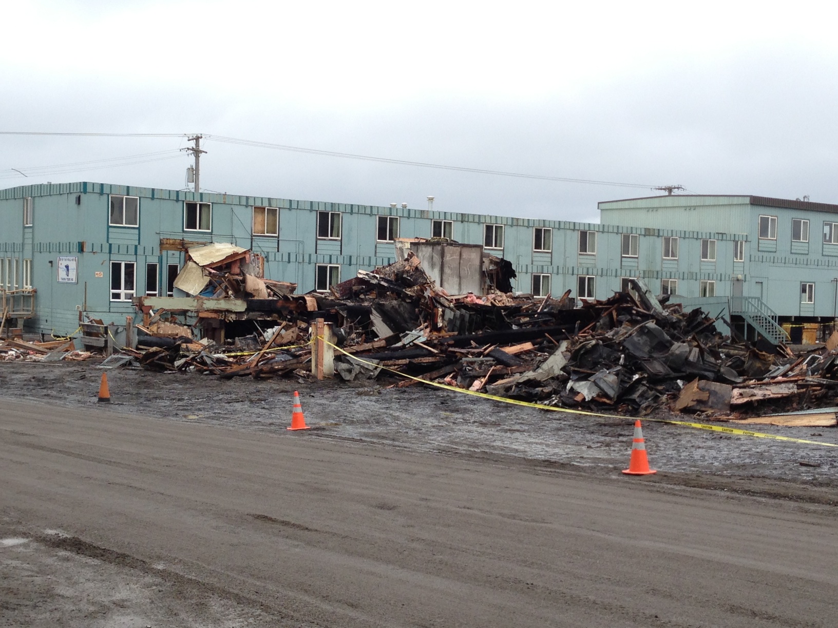
Thursday, we had an even more exciting trip to Walakpa, which really messed up my back, so I was pretty much flat on my back when not actually working. I was going to do a post about that this morning, but when I woke up, there was very sad news. Pepe’s North of the Borderburned to the ground last night.
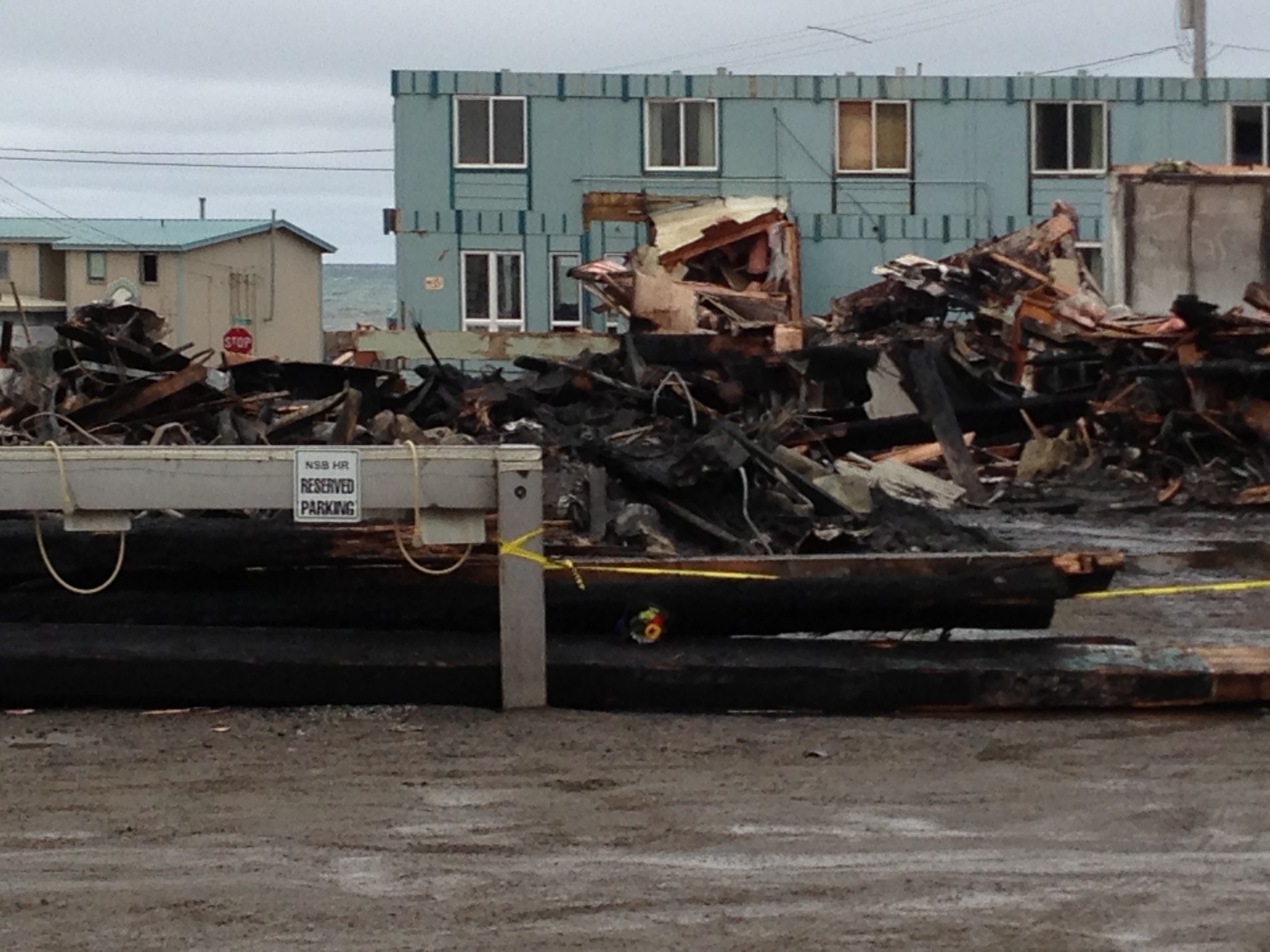
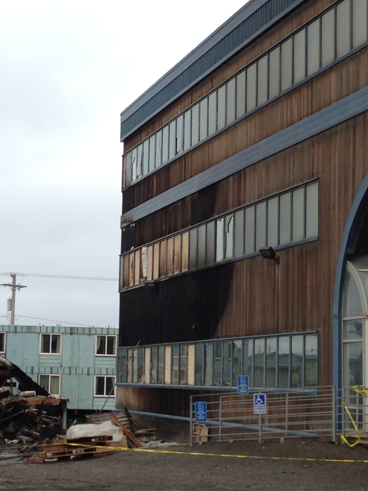
All that’s left of Pepe’sThe remainsTop of the World Hotel in the backgroundBurned beamsThe bank building almost caught on fire too. Great save NSBFD!
There was some damage to the Top of the World Hotel, including the destruction of the entrance. As you can see, the bank building nearly caught fire as well. It’s charred and a lot of windows are broken, but the North Slope Borough Fire Department managed to save it. Much credit to them.
Fran Tate, who started and owns Pepe’s is quite ill, and in Anchorage for medical treatment. She’s donated a lot to her adopted hometown (free meals for school sports teams, food for bereaved families, fund-raising for children’s hospitals, just for starters) and here’s hoping some way can be found to help resurrect Pepe’s. We are going to be hurting for restaurant seats and catering here in Barrow if not.
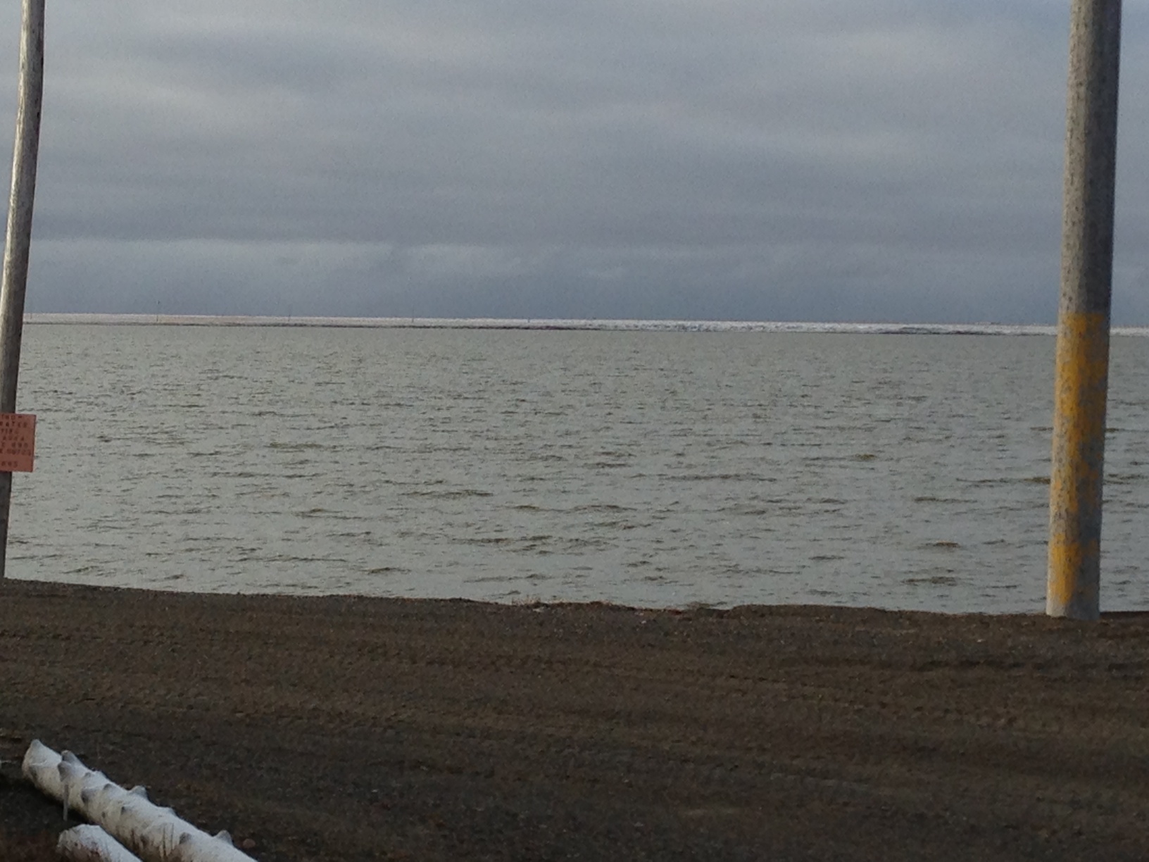
The water was a bit higher than yesterday on the way down, and we had to winch a couple of the 4-wheelers out of deeper mud, but we got to the site with not too much trouble. We put a stick in a the high water mark so we could see what the ocean was doing and went to work on the structure.
Yesterday, the strong winds made water screening where we have to do it a pretty sure ticket to hypothermia, so we tried just dry screening on the beach in the shelter of the bluffs, and it worked well.
Dry screening on the beach.
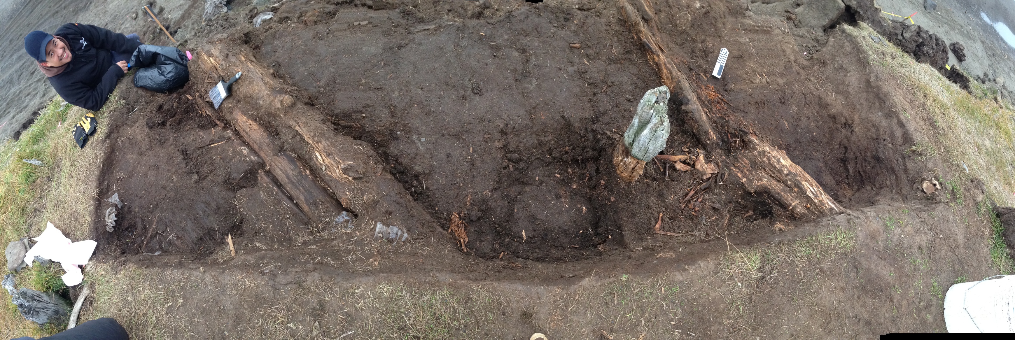
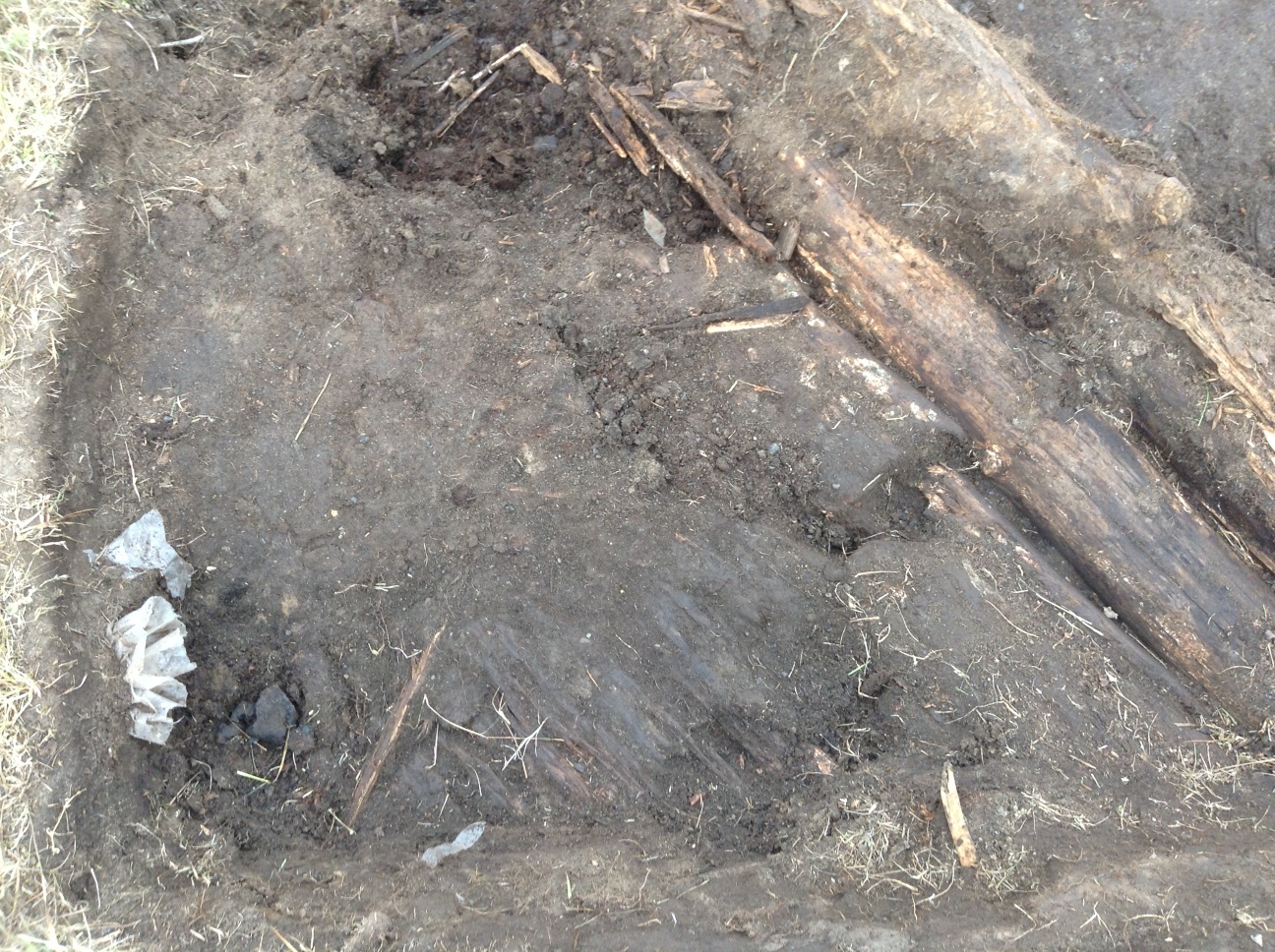
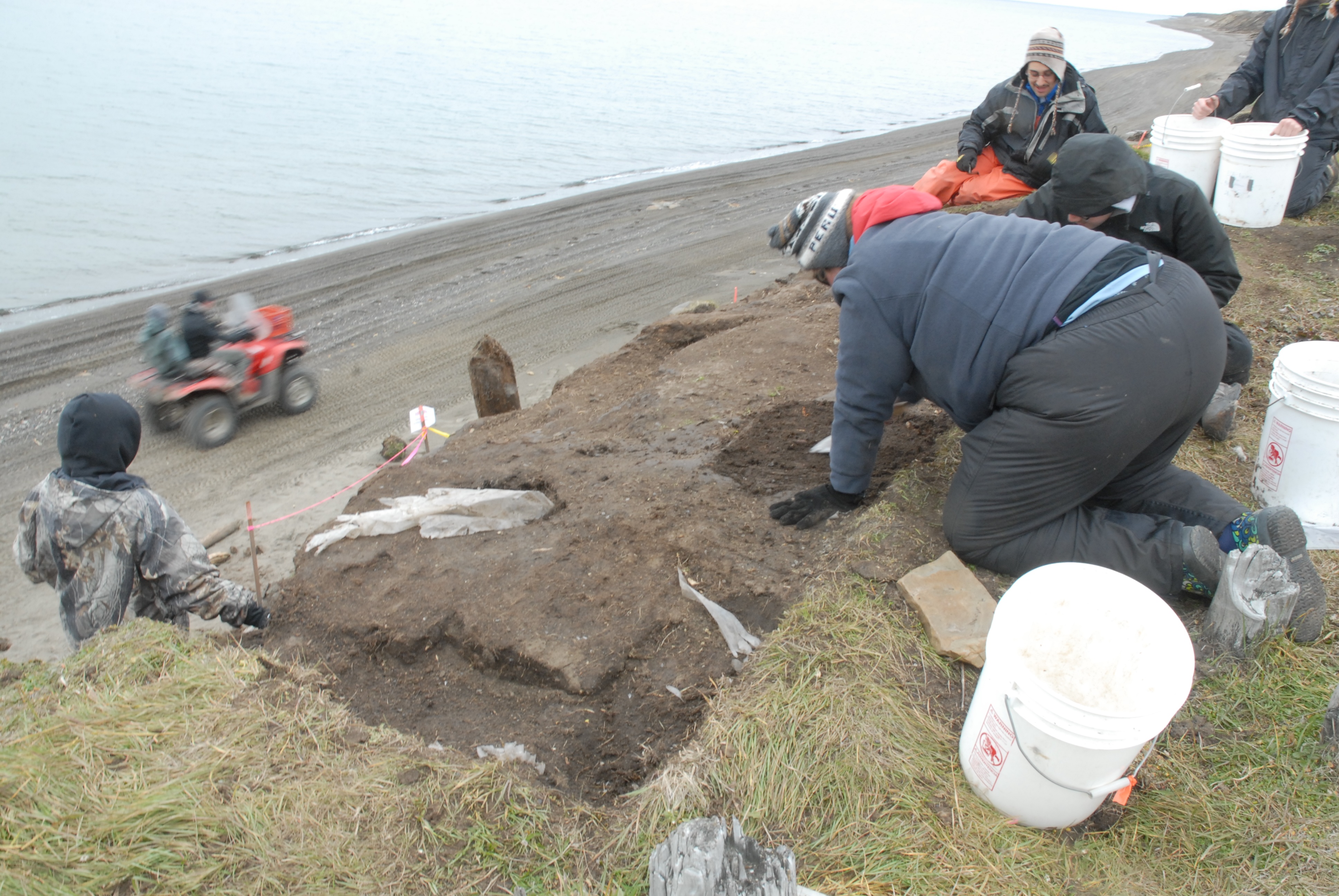
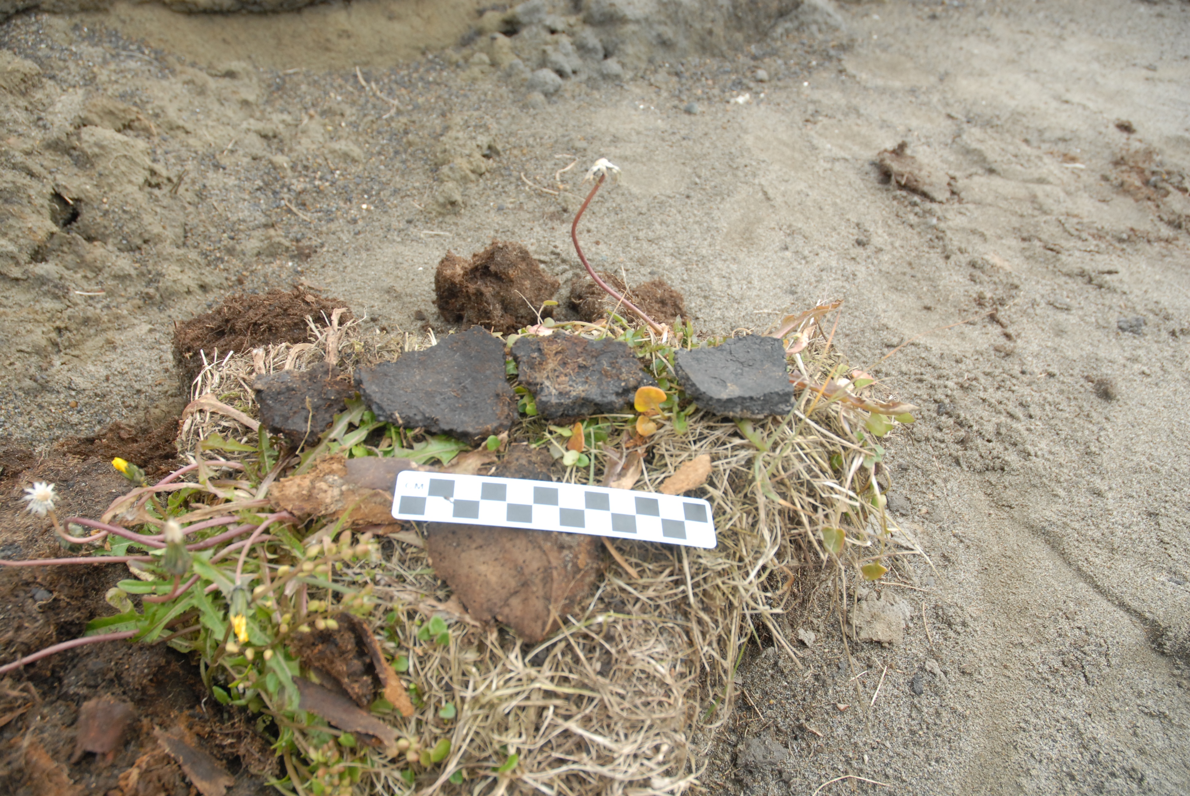
We made pretty good progress on the excavation. More logs were exposed in both of the parallel log features (fallen walls?). The area between the logs is getting soft, and seems to contain a lot of animal bones, many of which are lying in a way suggesting they were tossed into a depression. South of the southern logs, we uncovered what appears to be part of a plank floor, maybe for a tent, since it doesn’t seem deep enough for a house. Next to, but apparently not on it, there was a cluster of ceramic sherds, including a large rim sherd. This was right under an old looters pit, and their activity may have broken the pot.
Panorama of the excavation.Ceramic sherds at lower left (with Visqueen sticking out of the wall above them), plank floor in lower center, south logs at right, and arrow shafts at top center.
Beside the logs, but again not on the plank floor, we found two arrow shafts, apparently associated with a strip of baleen, and a fragment of bird hide. A couple of pieces of hide, one sewn, had been found just above this. This could be the remains of a quiver, or possibly a work bag, since there was a ground slate knife blade fragment and a worked piece of chert nearby. We’ll continue there tomorrow.
We didn’t stay out as long as we might have, since the waves seemed to be coming higher up the beach. It turned out to be a good thing. Going back to town was a bit of an adventure for us, although only one of us got stuck, but even more so for a man & his son we met on the way. They were trying to head out towing a trailer, and had gotten really stuck in a deep soft spot. It looked like they had been there a while trying to get out. We were able to get one of the 4-wheelers with a winch to where we could pull them out, and then waited until they got turned around and back on the town side.
It was a very windy morning, so much so that we started out by securing the tent even more, since it was actually working enough that one of the anchor logs had rolled off! We owe someone some parachute cord, but we’ve got a bunch of rock dead-men in now.
The rest of the morning went to screening, and after lunch the wind had dropped enough that we could start excavating. We finally are down far enough that the structure is starting to emerge. So far we have what appear to be two walls made of horizontal log, parallel to each other, both of which appear to have toppled to the north.
Part of North log wall.Part of South log wall
I actually took both of the pictures above with my iPad Mini, which then allows me to move them into iAnnotate PDF and draw on them & add voice notes (easy on the carpal tunnel, that).
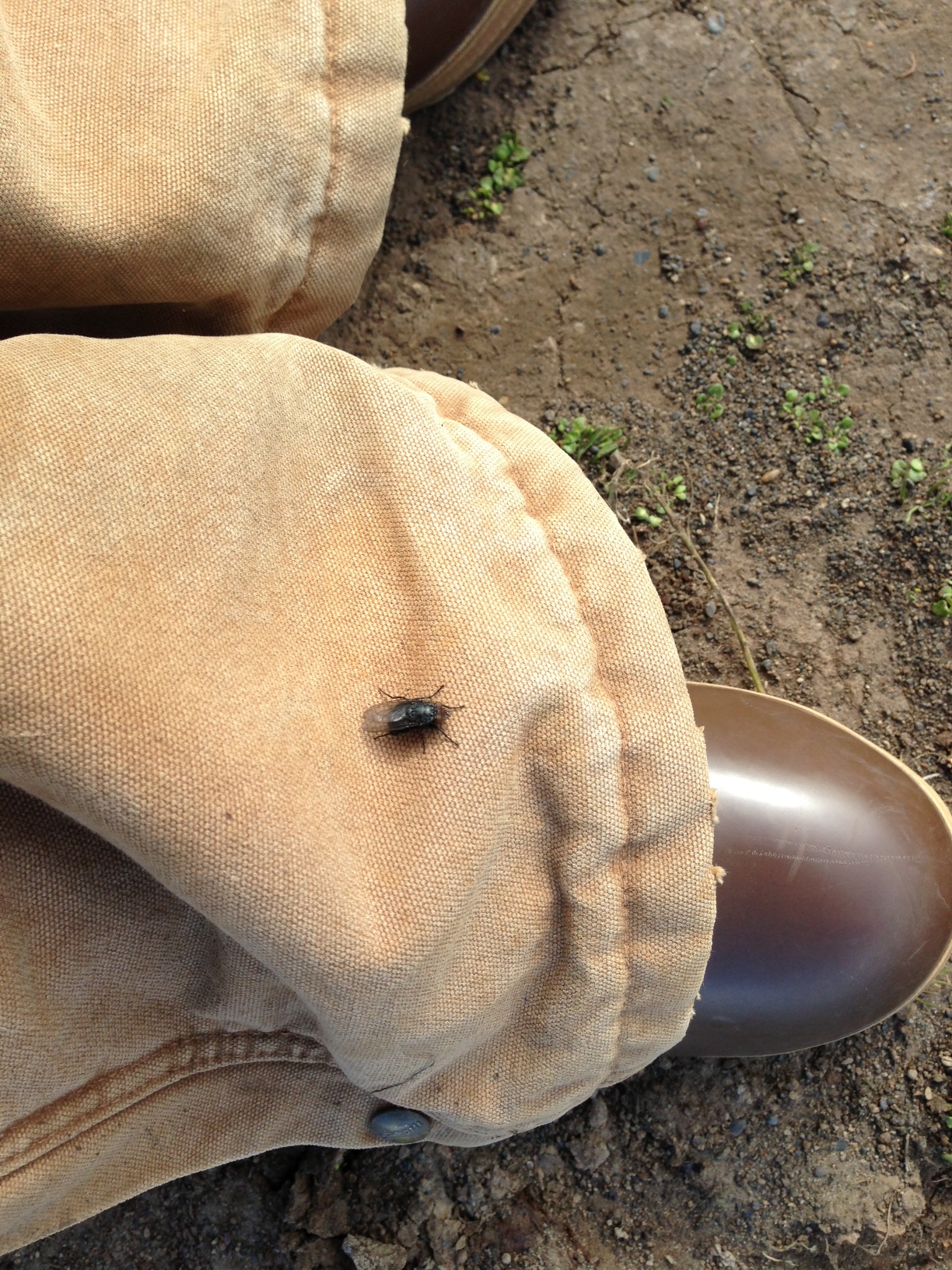
While taking those pictures, all of a sudden several of the crew were looking at my foot in some dismay! I looked down, expecting to see blood or something (it didn’t hurt, but with the broken screw in my back that isn’t a good guide), but fortunately it was just this guy.
We made pretty good progress at Walakpa this week. This, despite a few challenges.
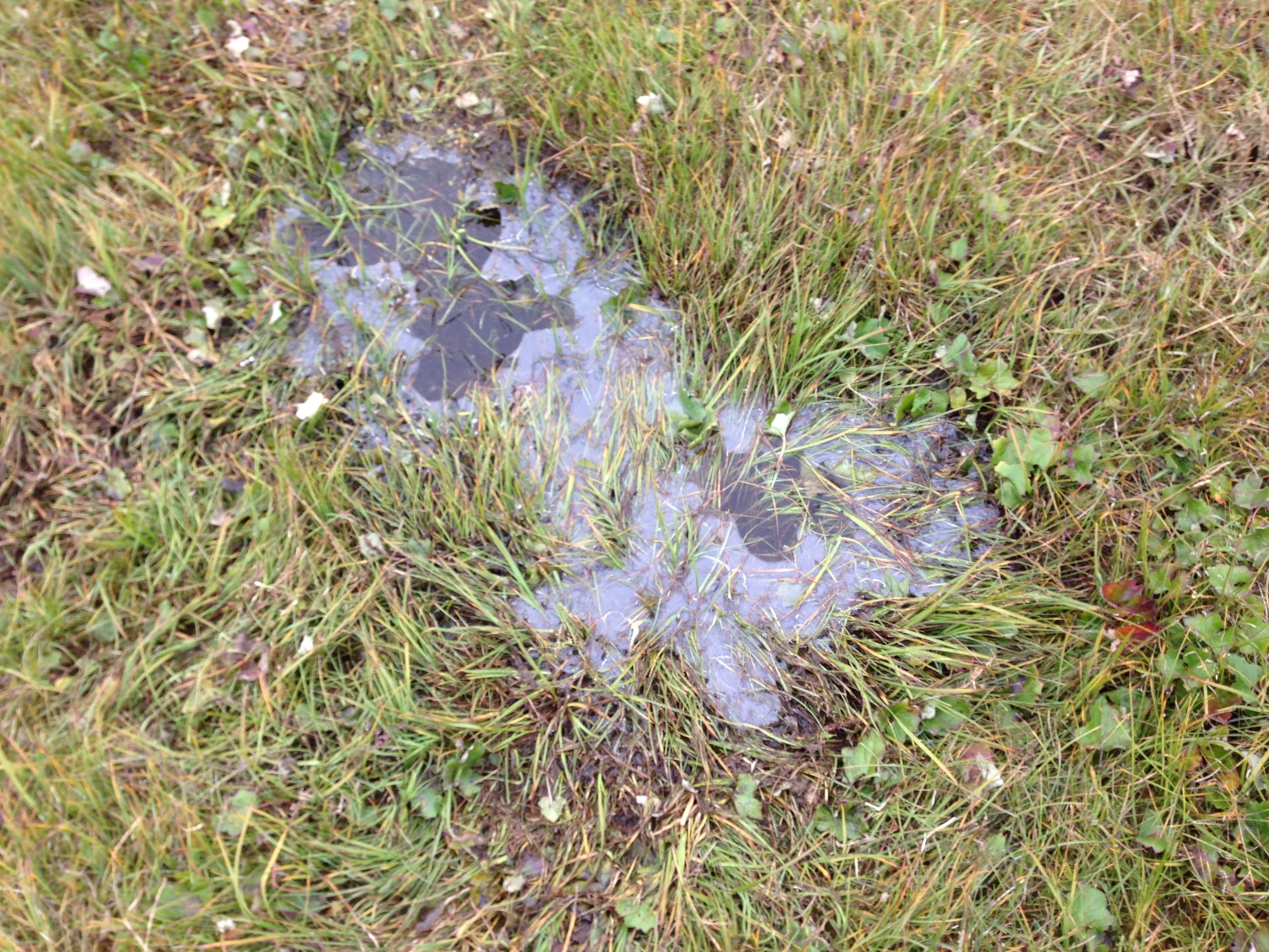
On Tuesday, we had a really small crew, due to a variety of circumstances. Only Trina, Mary Beth & I made it out. It was quite a cold day, with ice on the puddles when we got to Walakpa (or Monument).
Ice on a tundra pond.
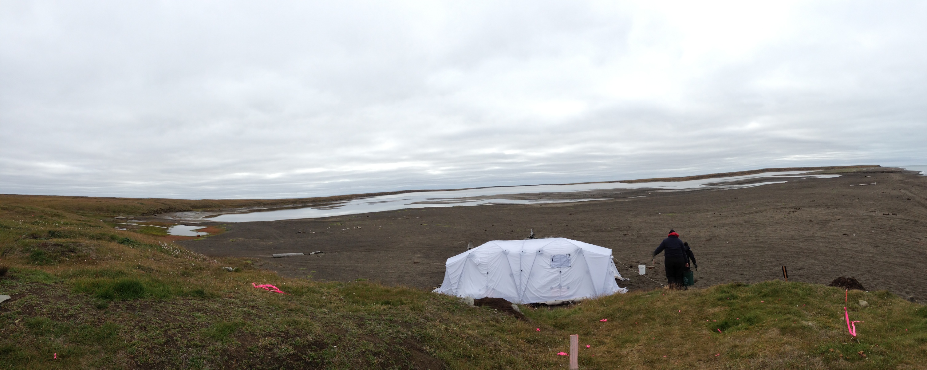
We decided to leave the screening for another day and just excavate. It was cold enough that we actually took advantage of the removable floor in the Arctic Oven tent on site and used the Coleman stove inside, but on the ground.
The Arctic Oven on a cold day
The next morning, we had a bigger crew, but there was snow on the ground when we set off.
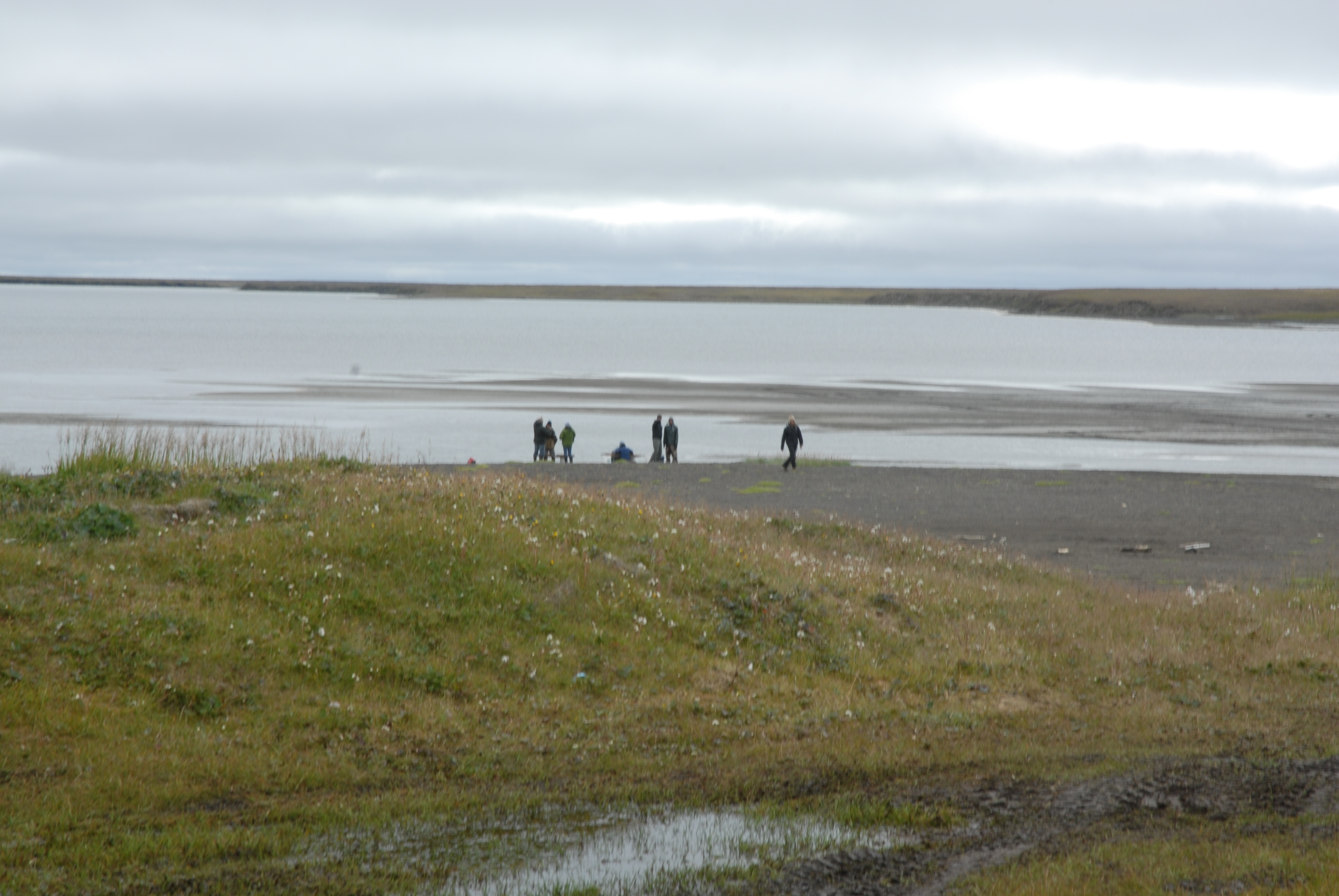
Snow on the tundra, seen across Middle Salt Lagoon.
We were not expecting to have a great day, but in fact it was warmer than the day before (no ice), and we started getting down to what seems to be structural wood from the house roof, so that was fairly satisfying. We got a lot of water screening done, as well. The beach had really stabilized, so we were able to go the whole way on hard sand, and even most of the lagoons had closed up, with sandbars across the entrances that we could just drive across. The commute to the site was much quicker.
Thursday did not go well. We headed out, only to find that for some reason, the waves were really coming up the beach and running into the lagoons, so that we were not able to get across the stream by the gravel pit. We went around and through the gravel pit, but then could not get across the stream by Nunavak. We did see a polar bear in the water near a dead walrus). I decided we should try to go around, since it was otherwise a nice day & I hated to lose it, but we didn’t have any extra gas along, and by the time we were half-way around, even cutting across country rather than following the shoreline, it was clear that some of the Polaris’s are sort of gas hogs. So back we went to the road, with only one minor mishap when the Tubby trailer bounced into a very wet low-centered polygon and dragged the ATV half-way in. I got my feet wet getting it unstuck, but we still went back down to the beach so that David Pettibone could get a picture of the bear, still in the water, from a safe distance.
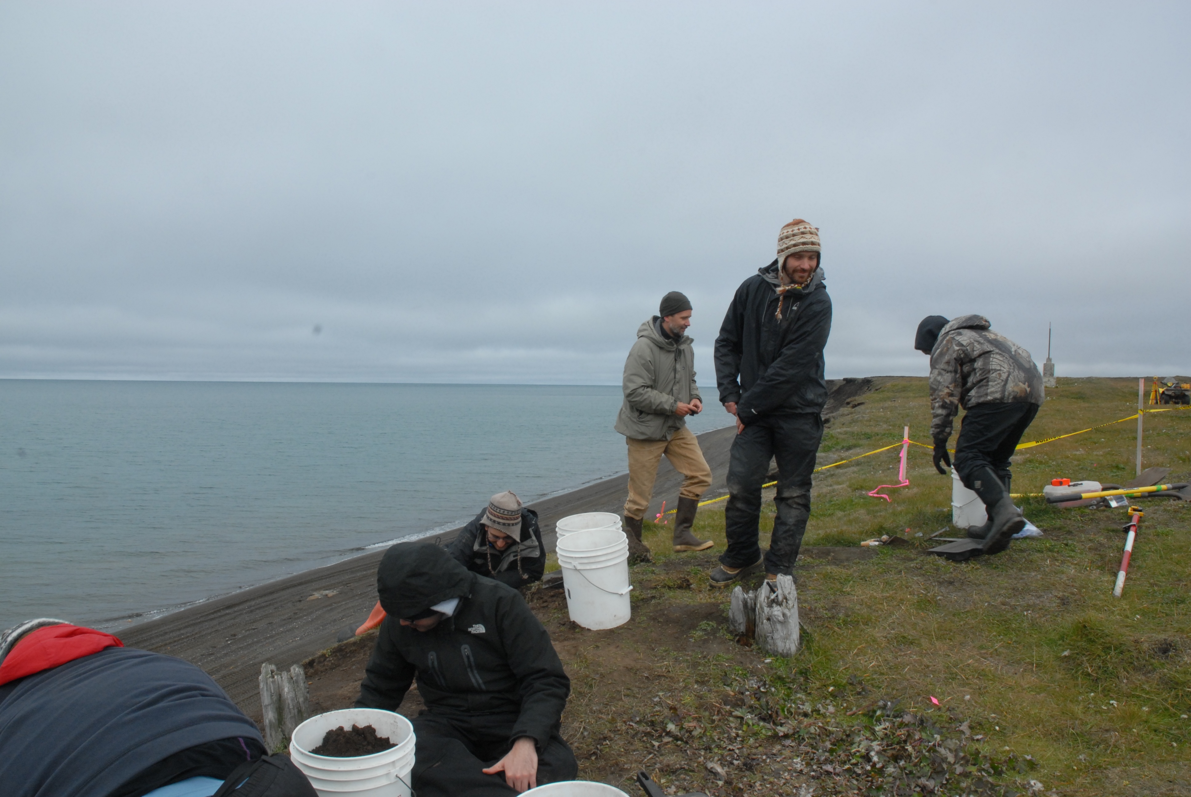
Today, despite no major change in wind strength or direction, was very different. The beach was back to Wednesday’s shape, and we got to the site easily. It was quite sunny in the morning, and we got right to work. We had six people, so we started with 4 excavating and 2 screening.
View from the south end of the trench, where I was digging. Pretty well maxed out. L to R: Mary Beth Timm, JoAnn Akootchook and Michael Berger.
I played around with my iPad mini for taking pictures to supplement field notes & drawings. I don’t draw all that well, and used to take Polaroids and draw on them, but that technology is gone and wasn’t that stable anyway. I’ve use a couple of programs to annotate lab photos, but this was the first time I tried it in the field. I used iAnnotate PDF, which lets you put sound files on the image, associated with notes or drawings. They open fine in Acrobat. This will be quite handy.
Seventy-eight years ago, it was a foggy day at Walakpa. The Okpeaha family was camping there. A floatplane descended out of the fog, and two men asked how to get to Barrow, since they had lost their bearings in the fog. Getting directions, the got back in the plane and took off. The engine failed, and the nose-heavy aircraft crashed into the lagoon and flipped. Unable to reach the plane to help the men, Clare Okpeaha ran all the way to Brower’s Trading Post in Barrow, over 12 miles of very rough going, to get help. When boats got back to Walakpa & they got to the plane, it became clear the men had been killed instantly. They were Will Rogers, a noted humorist and political commentator, who was traveling around Alaska to get stories for the newspapers, and Wiley Post, probably the most famous American aviator of the time after Charles Lindbergh.
The crash was national news at the time, and a few years later a monument was erected near the site, followed some time later by another one. These are the monuments that show up in some of the pictures of the site. For some reason, these are on the National Register of Historic Places, but the archaeological site isn’t.
The first monument , looking out over the lagoon where the crash occurred.
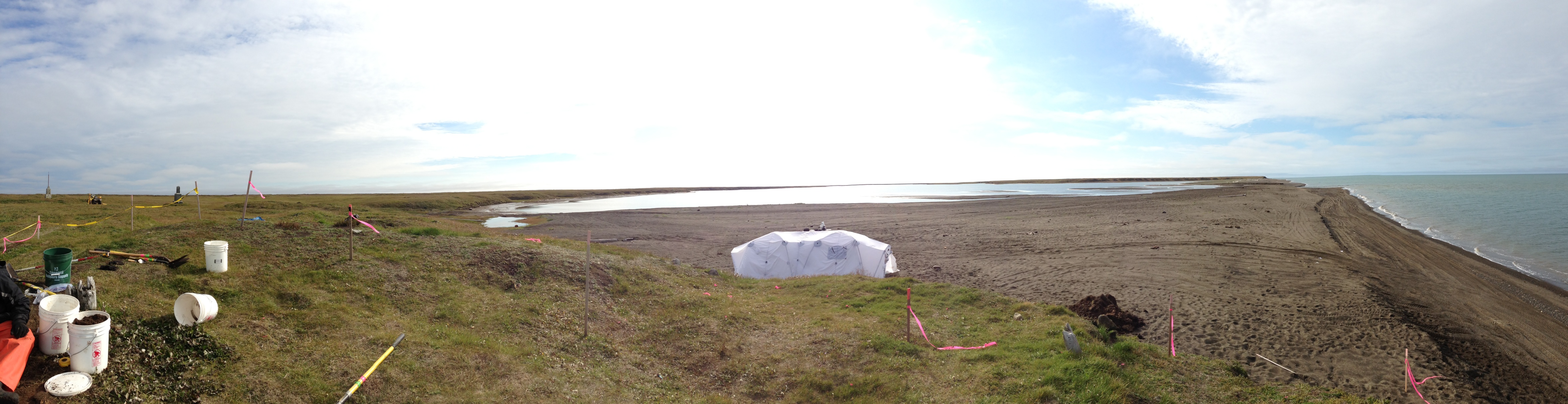
Today was a much better day at Walakpa. We headed down with 7 volunteers, including David Pettibone, Michael Berger, dental extern Temurkin Cucukov, and the entire Von Duyke family, plus Marybeth Timm from the Inupiat Heritage Center. The stream was running high and fast at Nunavak, but we got across, although not before I got my boot wet. With that many people, it seemed worth getting the water screening going, so we did, using a small pump to take water out of the lagoon. Alan & Scott Kerner happened by on an ATV ride and pitched in for a while as well.
Wet screeners in action by the lagoon.
The rest of us continued with taking down the rather disturbed level under the sod. It would be a lot easier if we could just shovel it out, but the bluff doesn’t seem that stable & we’re afraid we’ll knock the whole thing down if we shovel, especially since there are still a lot of roots holding things together at this level.
Excavating the disturbed layer. Note the Visqueen.
A while after we got there, a boat pulled in, and Jeff Rasic from the National Park Service (in town for a meeting at the Inupiat Heritage Center) Patuk Glenn (IHC) and Kunneak Nageak (IHLC) appeared. They got a good tour, and spent a bit of time wandering around. Jeff found a big sod with a lot of artifacts in it, including several very nice potsherds, one with residue, which we collected.
Excavation at Walakpa. L. to R. Marybeth Timm, Temerkin Cucukov, Michael Berger, Jeff Rasic, David Pettibone & Trina Brower.
Potsherds.
The ride home was even more exciting. Nunavak wasn’t too bad, but they were unloading a barge on the beach, so we took the old Nunavak “road” back to town. It has pretty much disappeared back into the tundra on the middle section the last few years, and it was a very muddy ride!
We went to Walakpa today. I’d heard that Nunavak might be running too hard to cross, so we were sort of preparing for having to ride around on the tundra, which would be time-consuming and bone-rattling. When we got there, we were able to find a couple of ways across, so no worries.
We made good progress on removing the sod & an underlying level of disturbed soil. Aside from the fact that it contains random fragments of bone, charcoal, rocks, lumps of clay, etc, the fact that it is on top of Visqueen in a lot of places is a strong hint.
Excavating at Walakpa.
The last bits of the overhang are gone. One fell, and the rest we cut off where it was cracking. It looks like the ground squirrels had a tunnel where the crack was, so there really wasn’t much holding it. Some of what came off looked like a sod wall, but it had part of a plastic eyeglasses frame in it, so it can’t be very old, or associated with the house. We are almost at the point where we should be able to excavate normally.
The erosion and slumping at Walakpa had left a large overhanging of sod, which was putting a lot of weight on the exposed house structure. The weight had already caused a crack in the sod on the surface up on the top of the site, and I was pretty worried that the whole thing could fall. We wanted to get that overhang cut back flush with the bluff. It was really hard to get to it, and we couldn’t just use shovels to cut the sod off, since there was nowhere to stand that didn’t risk knocking the whole thing down. It was more of an engineering problem than a regular excavation. We trimmed some of it off from below, standing on either side of the house, while others worked from on top.
Early stages of cutting back the overhang
The overhanging sod had seemed pretty thin, but it had apparently lost some soil off the bottom, since it proved to be over 30 cm (about 1 foot) thick when we cut into it. Getting all that heavy wet sod off reduced the weight on the structure
Overhang mostly removed
Once that was taken care of, we moved on to trying to strip the sod from the top of the house back about 1.5 meters (5 feet) from the bluff, so we can begin excavating the house. Trina Brower & I did surface topos of the north half of the mound with the total station, and then we started. We still couldn’t use a shovel along the edge, since the crack went too deep, so we started away from the bluff. We hadn’t gotten very far when some buried Visqueen showed up!
Initial sod cut, with VIsqueen showing at the south end.
Obviously, everything above the Visqueen is quite recent and can just be set aside for re-sodding the site. As far as I can tell from the profile, it is all a redeposited layer, maybe from Dennis Stanford‘s nearby excavations. Anne Garland is trying to excavate the Visqueen out, so we can at least get a surface that was exposed prior to the deposit of the plastic, and maybe figure out if this is an old test unit or something else. My husband Glenn has vague recollections of a group from the Utkiavik Project hiking to Walakpa and backfilling some disturbances they found, and using Visqueen in the process, so this may be from that.
On Friday, we had a cameraman from PBS along. PBS is in Barrow interviewing a number of scientists (and some other folks) for a program they are doing on sea ice retreat. That is part of the reason why sites are eroding so fast up here. They wanted to interview me about the Nuvuk Archaeological Project. They had already planned to go out to the point with another scientist, and since we aren’t digging there this summer (it was supposed to be all lab work), it didn’t seem to be that useful to go again. So we discussed going to Walakpa so they had something to film, and it was also a good example of the issues that arise from sea ice retreat. It was terribly buggy the last few days, which made for some unpleasant working conditions. It was quite difficult not to swat mosquitoes for the entire interview, but apparently I did OK. We had to shoot a bit more in the lab on Saturday, due to changing light in the field (and the fact the producer had caught a stomach bug on the way to Barrow and wasn’t able to leave her room, let alone go to Walakpa). I think I was able to make some points about how retreating sea ice increases coastal erosion and what we lose when that happens. We will see what if anything makes it through the editing.
Even if it was buggy, Walakpa was still pretty.
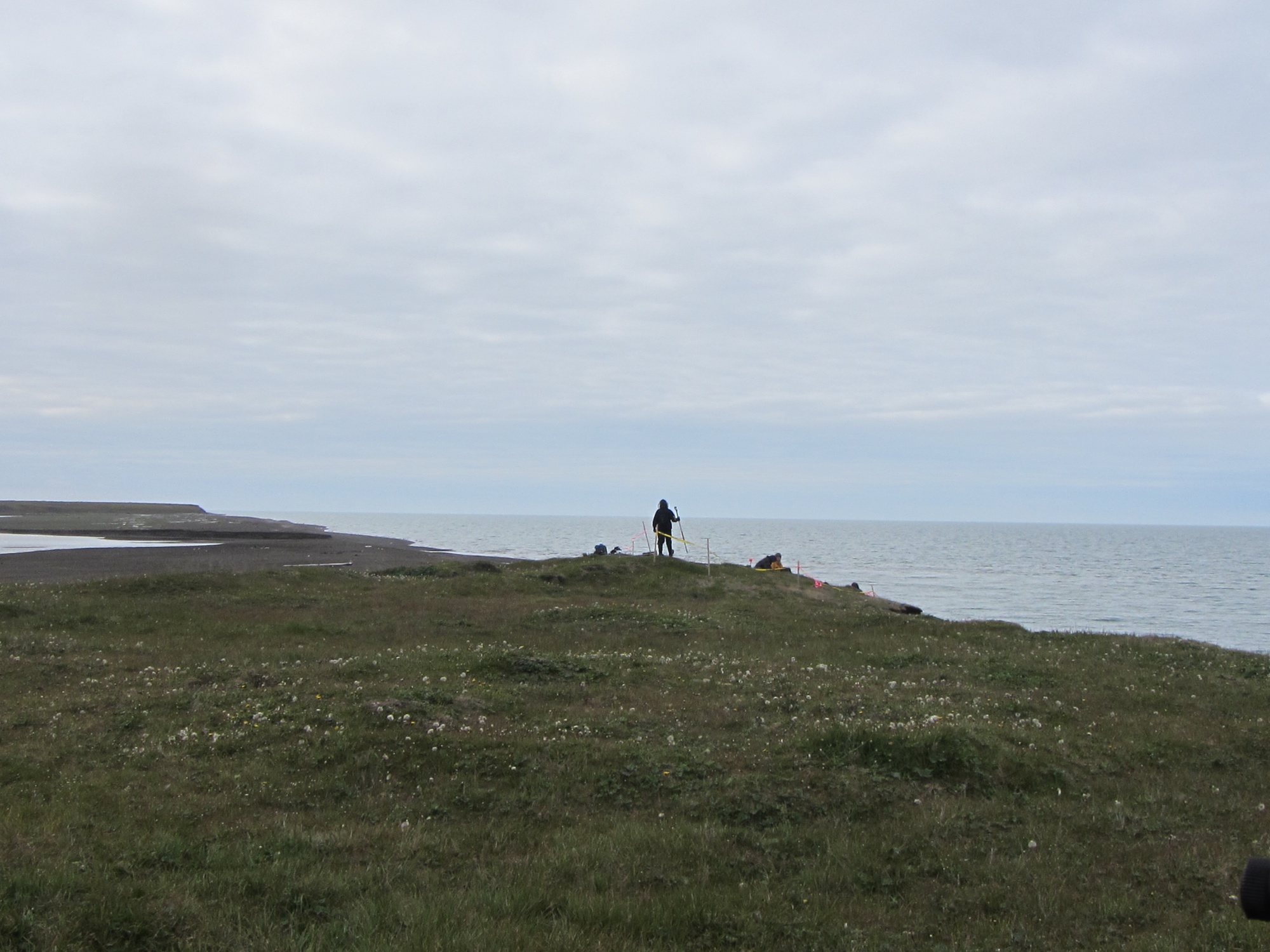
Walakpa Lagoon looking inland from the site.Looking west at the eroding house from the total station while doing surface topo. Anne Garland in yellow on the bluff edge, and Trina Brower with the stadia rod.