When I last posted I had just left for a trip to two conferences in Europe. Since then, I’ve been in 4 countries, given two papers (at EAA 2015 in Glasgow and CHAGS 11 in Vienna), submitted an organized SAA session for next spring, come home, gone to Fairbanks for shotgun qualification, come back home, had two of the WALRUS project participants up here to cut samples from the bones that the interns have been finding in the collections, written part of two reports, drafted two abstracts for a meeting in November, and started on a proposal for an edited volume dealing with climate change & archaeology. I haven’t managed to post at all.
Last week was a tough week for Barrow in many ways, with the deaths of several community members, including long-time mayor Nate Olemaun Jr.. On a brighter note, Barrow took three whales on Friday, and another three today.
I managed to get a couple of videos of the evaluation of things exposed by erosion at Ukkuqsi on Thursday uploaded to YouTube. You can see them here, and here.
Unfortunately, the erosion continued, and additional items were exposed after I left for a trip to two conferences in Europe, possibly including human remains (this is the site where the little frozen girl was found in 1994). The North Slope Borough is taking care of the situation at the moment.
Things have eroded out elsewhere in the Barrow area as well. At one point I was on the phone with someone from the North Slope Borough about one site, when someone else called about something found at another location entirely. And I now have a voicemail about yet another location!
There is a very large storm, with winds up to 50 mph and big waves from the west battering the Chukchi coastline from Barrow south. It has created a major storm surge, with big waves and coastal erosion. An emergency has been declared in Barrow due to flooding and road damage.
I flew back from Wainwright yesterday evening, and even through the storm was just building, the waves were already hitting Walakpa. I couldn’t get pictures but it did not look good.
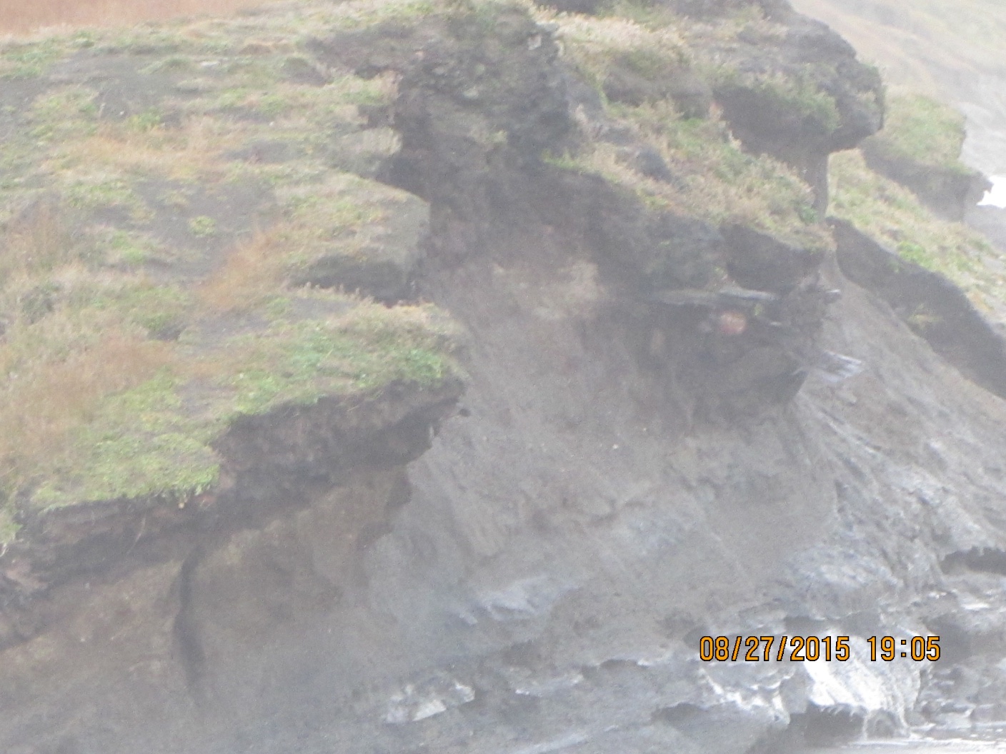
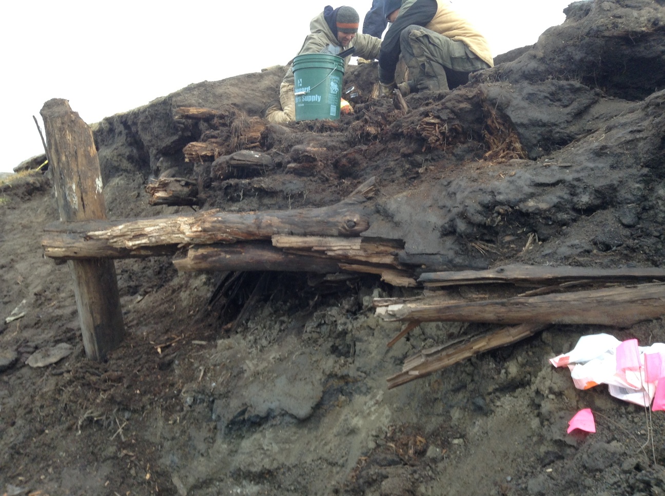
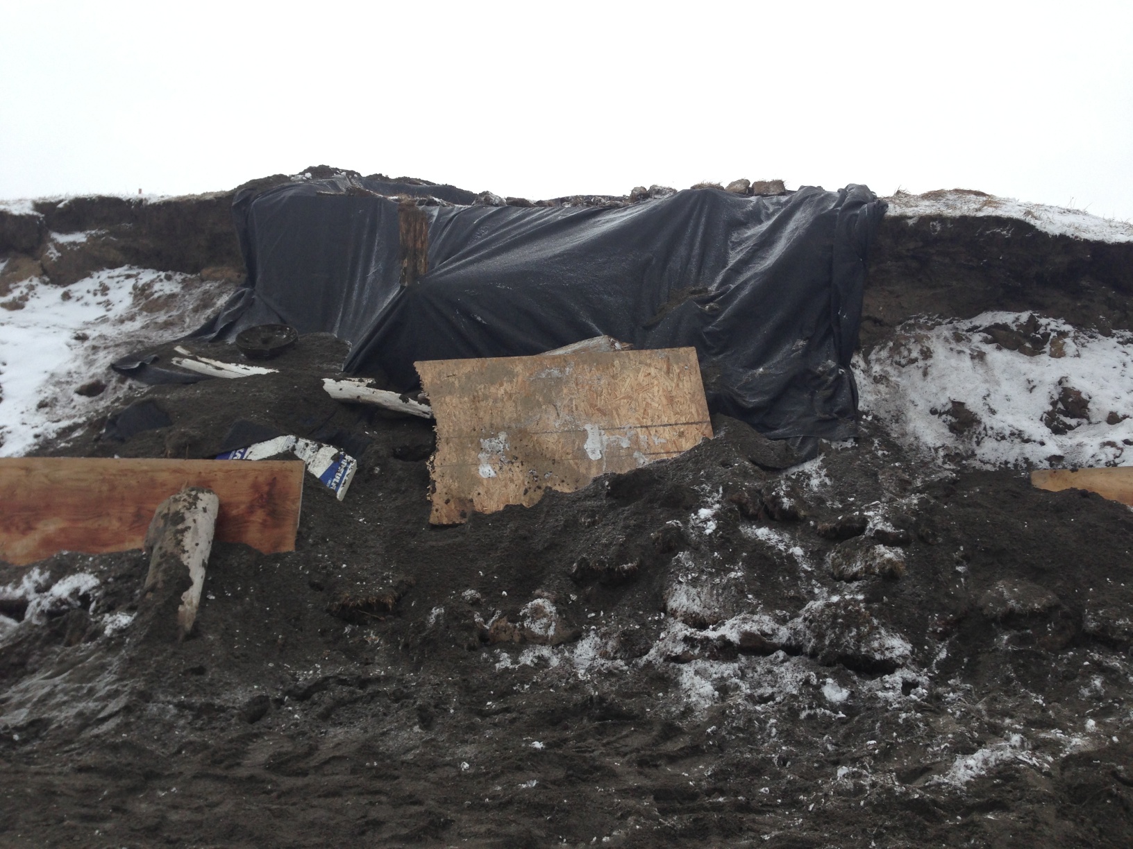
Today was much worse. Late this afternoon, I got a series of calls about something washing out at Ukkuqsi, where the little frozen girl Aġnaiyaaq was found. Aqamak Okpik from IHLC got things organized, with Morrie Lemen coming out to NARL in a bigger truck than mine to take me in to take a look. The North Slope Borough Fire Department came over, and two firefighters suited up and tied a rope onto me so I could go down and take a look.
View of Ukkuqsi from the north side.
The big concern was that a burial was eroding out, since there have been several in that area. In the end, it looked like part of a house (maybe two superimposed) with a whalebone and a baleen toboggan. We retrieved a few bones and a piece of structural wood that were going to fall in any minute, and hope to be able to get a radiocarbon date or two. I only got hit by one big wave.
Closeup of eroding structure from the beach.
Hope to get some video or at least frame grabs available soon.
Last night was not particularly restful. The collapse had complicated matters quite a bit. However, after breakfast, we went back to work.
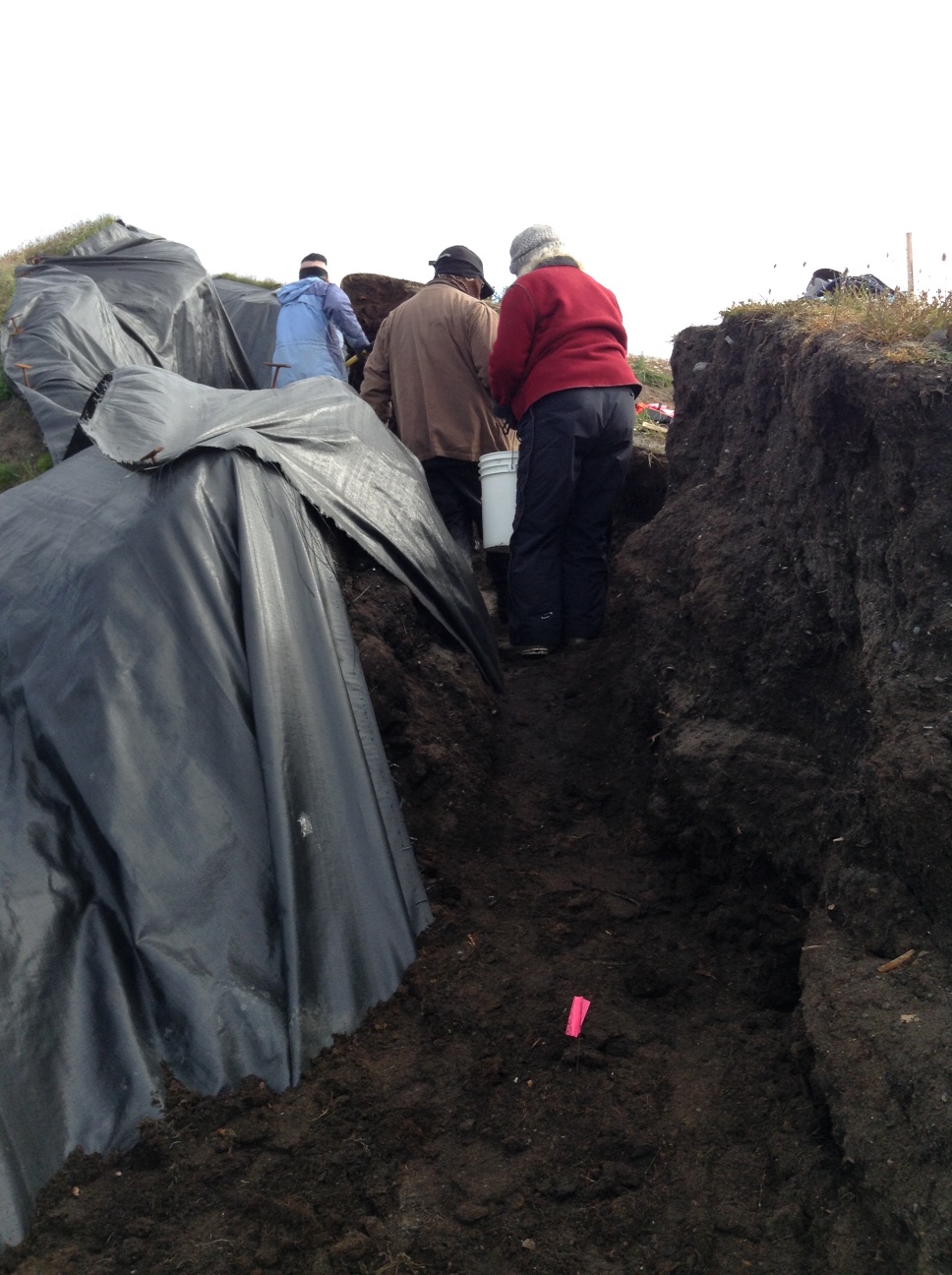
The old location was not viable, so I picked a new spot about a meter south, which became Column Sample 2 (CS 2). There was a bit of an overhang, and a very deep crack behind the bluff face. We needed to get all that material out of there. It took a bit of thought to figure out how to do it (not a usual archaeological operation, fortunately). Finally, we put a blue tarp down on the bottom of the main cleft so we could drag fill without anyone having to be under any overhangs or unstable areas, everybody got out of the way, and I cut the overhang back while standing as far back from it as possible. We then took the material out with a bucket brigade. Once that was done, I levered all the cracked material off, and we took it out the same way.
Bucket brigade in action.
Once that was done, I decided that we would excavate in levels labeled with letters, so we could proceed quickly, rather than wait for Owen to try to match levels in the detailed CS1 profile, which could have been a slow process. It seemed like the fairly warm, dry weather was letting the face dry out while detailed profiling was happening, and the longer it was exposed the more chance of another collapse. Owen would do another detailed profile after we got the column sample.
I also decided to make the sample a bit smaller in volume. CS 1 we had been trying for 75 cm x 75 cm (mostly because that size fit between some prior disturbances), but 50 cm x 50 cm seemed more manageable in the time we had left. One gallon from each sub level was retained as a bulk sample, and the remainder of sediment from the sub level was screened through 1/8″ and 1/4″ mesh.
We were just getting started when someone arrived to do a coastal DGPS survey that is part of the coastal mapping aspect of the Barrow Area Information Database project. He passed on a message that said my boss needed me to come back into town. (There is no effective connectivity at Walakpa, which is why this is being posted after the fact). I reviewed recording stratigraphy (or artifacts if any showed up) with Laura Crawford, made sure everyone knew how to use the InReach is needed, and headed back to Barrow by ATV around 1PM.
Something had come up with one of the compliance projects we are working on, and I needed to talk to people and draft some documents. I made it back to Walakpa around 10PM.
On the way, I met some folks out for an evening ride, and they stopped over to visit. One of them had spent a lot of time at Walakpa when she was younger, and had some great stories. I hope we can get them recorded for future generations.
The rest of the folks had managed to complete the column sample, so we talked about closing up shop tomorrow. We just need to finish screening, record the Test Units on the Pipe Monument midden, and backfill the TUs.
Things got rather busy around here, since I hadn’t actually been planning to be in the field, and had several other things going at work that required some time and attention. Combined with rather chilly weather and a commute that did my no-longer-fused spine no favors, I wound up putting sleep ahead of updating the blog. Now that the fieldwork is done & I’m getting everything else caught up, time for an update on what happened before the season ended.
We managed to get quite a bit accomplished before the weather stopped us. Fortunately, the entrances to the lagoons closed up, and we generally had less trouble getting to the site in September, thank goodness! In the end, we had just hit frozen ground at the back corner of the excavation when everything started freezing up. This is good, since that means everything behind/below that should still be in great shape if erosion doesn’t get to it before we can. We actually had some really lovely days. And enough wind so no bugs!
Lagoon and tent on a nice day, as seen from the excavation.
The floor that we had encountered in the south end of the trench cleaned up nicely. There had been a pot in the corner, but all that was left was a pile of smashed sherds. The digging of the pit that someone had put in above it had probably smashed what was left. Near where the arrow shafts were found was an area of floor so soaked with marine mammal oil that you could actually wipe it off of one patch of floor. It seems most likely that this was a tent floor, since there was no evidence of structure otherwise, and it was not far enough below the surface for a semi-subterranean house.
Probable tent floor after cleaning. Pot was located in the lower left corner, left of the stick. The oil patch surrounds the North arrow.
The house (at least I think it was a house) proved very complex. The small area we were able to open was not big enough to let me see what was going on well enough to be definite. However, there seem to have been several floors. We were not able to get down to them before freeze up, but we determined that there were several layers of midden (trash deposit) on them, so it would appear that the house must have been abandoned and reused, rather than just rebuilt.
View from the side showing several layers of floor logs above the sill logs & below the green bucket.
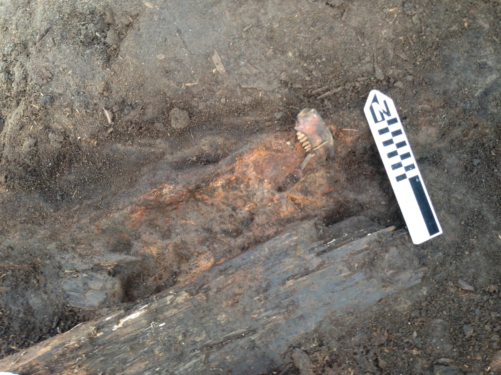
At some point in the sequence, it looks like the structure may have had a meat cache pit (sort of the forerunner of today’s ice cellars) in it. There was a distinct line of hardened red marine mammal oil
North edge of the meat pit. Caribou jaw lying along the sloping side just to the left of the North arrow. The red oil layer continued under the plank. The north logs were above the edge of the pit, but there was a layer of midden in between, so they were not associated.Another view of the red oil level underneath some logs (possibly 2 separate floors). Notice the seal scapula used as a chock under the plank on the right.Another view of the red oil layer showing it sloping up to the right. Note that the apparent sill logs for the main structure are below what is visible in the picture.
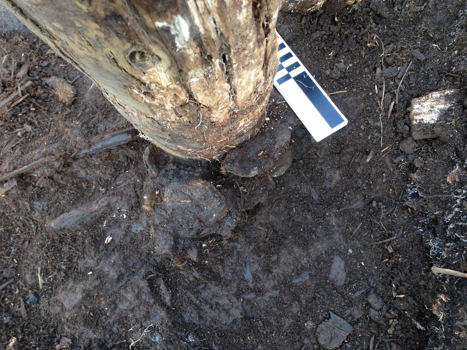
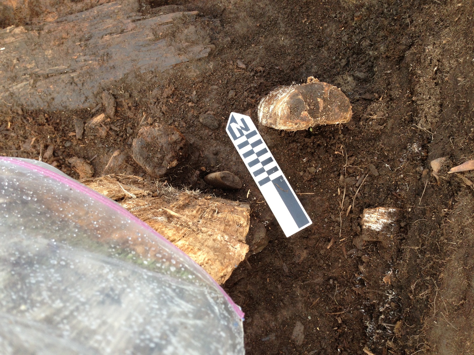
We got all the way to the bottom of the large post in the northern half of the trench. It turned out to be a later addition, dug into an existing midden, and chocked with a seal sacrum, a walrus vertebra and a broken pick head. There were two smaller (and apparently earlier) posts very close to it, one of which had a deposit of shell next to it. That will be interesting if we can ID any of them.
Post, showing sacrum and vertebra used as chocks.Post with pick used as chock at base to left of North arrow.A view of the excavation before the post and north logs came out. NO, the wall was not curved; this is a raw iPhone panorama shot, & that happens. Our walls are straighter than that!
We had been working as fast as we could on the structures at Walakpa. Given how far north we are, “Winter is coming!” pretty much applies as soon as it starts thawing in spring. We had a fair bit of windy weather, so it wasn’t pleasant working conditions, but the ambient temperature was generally above freezing, so the ground remained soft, and we were able to continue excavation.
The batteries on the transit were not happy, and we pretty much needed to have one charging at all times, or risk shut-down until we could charge a battery. The batteries are a bit old, and need to be re-celled or replaced, but since I hadn’t expected to be excavating this summer, that was scheduled to happen over the coming winter, which left us a bit handicapped.
But then, last Monday, there was a dusting of snow on the ground in the morning, and it didn’t melt. Further south in Alaska, snow on the tops of the mountains is often called “Termination Dust” since its appearance signals the beginning of the end of the summer season. And so it was here.
I had started accumulating materials to protect the site over the weekend. UIC Construction had some surplus damaged materials in their yard which would otherwise have just gone to the dump, and they were kind enough to donate them to the cause. Monday, we started hauling them down to Walakpa.
A dusting of snow on the site & the beach in the morningShards of ice from the tarp after the site was uncovered.
We kept digging, since the ground wasn’t frozen. The next morning, there was a lot more snow on the beach, and the ground was really stiff although we did manage to dig a bit more and screen all but two buckets.
We met a polar bear on the way down to the site. It was tired, resting on the beach, but was so wary that it got up and moved before we could detour around it so it could rest.
More snow on the beach. And a tired polar bear, who was none too happy when we showed up on ATVs.
We put particle board along the erosion face of the site, and gathered sods from the beach to stack up to hold them in place. We also used upright driftwood to help hold this in place. By the end of the day, I concluded that things were freezing to the point where only a pickax would move dirt, which would sort of defeat the purpose of archaeological excavation, so we started hauling gear back to town that night.
We allowed the site to freeze more the next day, and Thursday we went down to put the site to bed & take down the tent.
We put a layer of whiteboard insulation on the top and front of the site, and then covered it with geotextile fabric, fastened in place with spikes. Then we covered that with the original sods which had been saved.
Excavation surface covered by whiteboard.Protecting the site with particle board, geotextile, sod and driftwood.Sod back on the site.
Once we had that taken care of, the gear had to be packed up and the tent taken down. We spray painted the hubs of the Arctic Oven frame so the next folks who set it up will have an easier time of it than we did doing it without instructions.
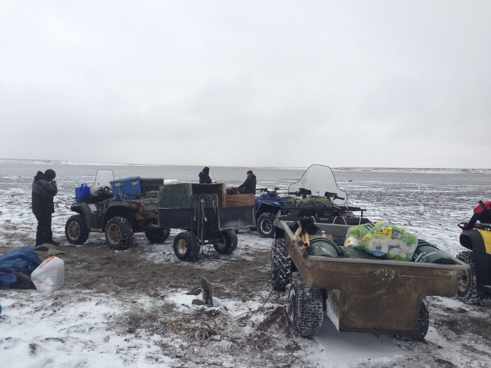
Tent & fly are packed and Jason Thomas is disassembling the frame.Packing the trailers. Riley Kalayauk brought his trailer down too, so we had 2.Happy hard-working crew ready to head home.
Now all we can do is hope and pray that there are no storms before the ocean freezes up that generate waves big enough to reach the site, and if there are, that they don’t last long enough to destroy the protection that we built. If we are fortunate, it will still be there next year, and we can learn more.
The water was a bit higher than yesterday on the way down, and we had to winch a couple of the 4-wheelers out of deeper mud, but we got to the site with not too much trouble. We put a stick in a the high water mark so we could see what the ocean was doing and went to work on the structure.
Yesterday, the strong winds made water screening where we have to do it a pretty sure ticket to hypothermia, so we tried just dry screening on the beach in the shelter of the bluffs, and it worked well.
Dry screening on the beach.
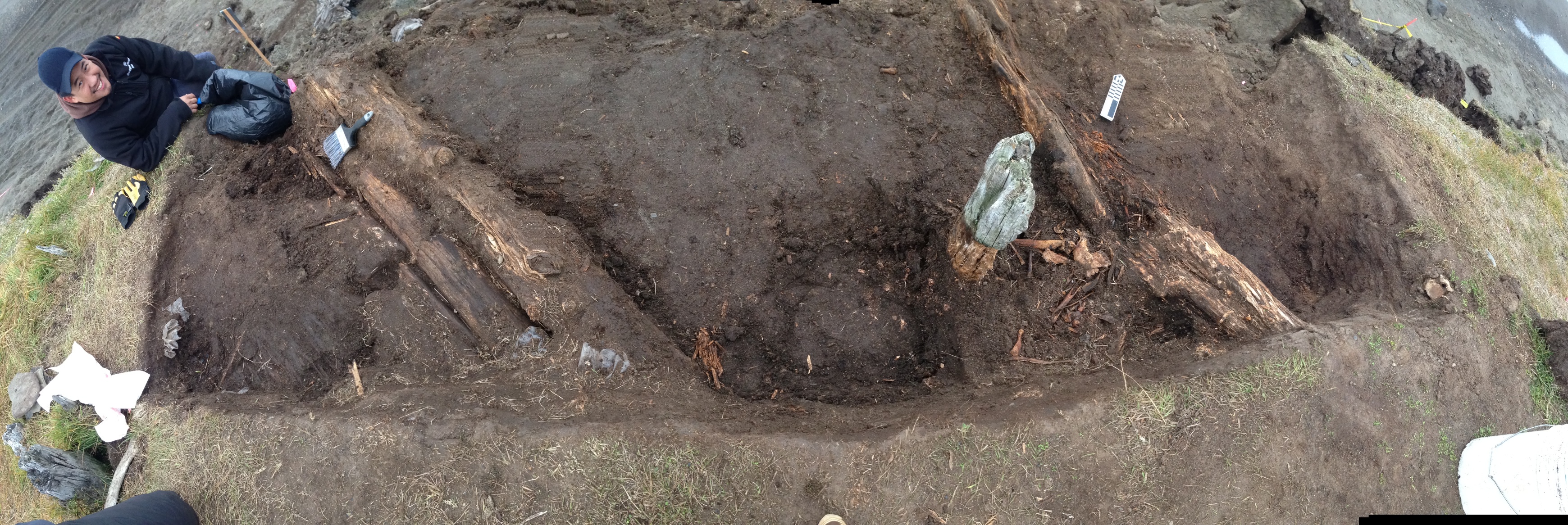
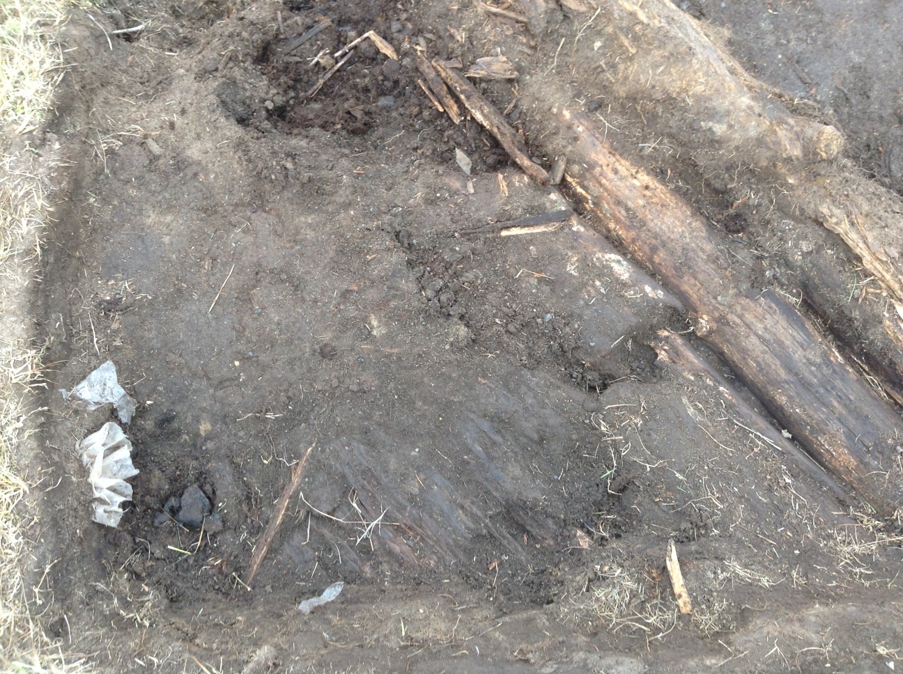
We made pretty good progress on the excavation. More logs were exposed in both of the parallel log features (fallen walls?). The area between the logs is getting soft, and seems to contain a lot of animal bones, many of which are lying in a way suggesting they were tossed into a depression. South of the southern logs, we uncovered what appears to be part of a plank floor, maybe for a tent, since it doesn’t seem deep enough for a house. Next to, but apparently not on it, there was a cluster of ceramic sherds, including a large rim sherd. This was right under an old looters pit, and their activity may have broken the pot.
Panorama of the excavation.Ceramic sherds at lower left (with Visqueen sticking out of the wall above them), plank floor in lower center, south logs at right, and arrow shafts at top center.
Beside the logs, but again not on the plank floor, we found two arrow shafts, apparently associated with a strip of baleen, and a fragment of bird hide. A couple of pieces of hide, one sewn, had been found just above this. This could be the remains of a quiver, or possibly a work bag, since there was a ground slate knife blade fragment and a worked piece of chert nearby. We’ll continue there tomorrow.
We didn’t stay out as long as we might have, since the waves seemed to be coming higher up the beach. It turned out to be a good thing. Going back to town was a bit of an adventure for us, although only one of us got stuck, but even more so for a man & his son we met on the way. They were trying to head out towing a trailer, and had gotten really stuck in a deep soft spot. It looked like they had been there a while trying to get out. We were able to get one of the 4-wheelers with a winch to where we could pull them out, and then waited until they got turned around and back on the town side.
I got back to Barrow to find snow on the ground. It hasn’t been that stormy here, but we had a coastal flood warning over the weekend, with part of the road to Nuvuk getting washed out, and waves getting over many of the berms. I am afraid that there may have been significant damage to the site beyond the 20 m we already lost in September. I would like to get out and take a look, maybe even shoot in the bluff, before I go to Valdez & Seattle, but that is not looking too likely.
Apparently, there is a likelihood of a storm surge from the Chukchi and flooding over the next few days, maybe until the 22nd or so. The North Slope Borough is quite worried, and sending out info on emergency kits & so forth. Not a great situation. The house I live in floated in the last really big storm surge event in 1963, and if it does it again, it could wind up in the NARL sewage lagoon. Yuck.
We’ll be prepared, but I don’t think it is that likely to get that bad. However, it most certainly is already damaging Nuvuk more. It has been blowing from the north and winds are picking up. It is a bit depressing given that erosion must nearly have reached the GPR returns that we think are Ipiutak features.
Not much to be done about it, so I just push on with writing proposals & papers. I’m going to a workshop on the Kurils & Aleutians, and am slightly belated working on the conference paper. Just as I got ready to really check out the other papers prior to doing the serious writing (the outline is done), it was discovered the website had lost the last 3 weeks of updates (explains where my stuff went–I thought they were just being slow getting it up), so I couldn’t get into it. I hope we don’t lose Internet later this week, and that I have decent connectivity in Valdez.
I got out to Nuvuk today for the first time today. The ARM project that we support want to put a flux tower at the Point to measure flux off the ocean during the open water season. The thing is that the ideal spot for the tower is on the ridge where the Nuvuk site is.
In the past, other folks wanted to put flux towers there, but there simply wasn’t room for a tower in an area where we had already tested and recovered all the burials, and we didn’t want to chance disturbance to a burial. Now we’ve gotten a good way ahead of the erosion, so it seemed that it might be possible. However, I didn’t want the tower to be on top of the possible Ipiutaq structures, just in case funding for their excavation is available. Since the tower installation involved moving a little gravel, it was important for me to be there just in case something showed up.
It took a while to get out there, since the ARM Kubota is on tracks and can only go about 15 miles an hour. We quickly got a spot picked for the tower. After that, I spent most of my time looking around for bears while the others started putting the tower together. I spotted 2, a mom and a cub, who were heading to the bone pile.
Polar bears heading for a meal.Assembling the base for the tower.Putting the tower together.Putting the instruments on the tower.
We decided to use sandbags for the guy-wires and then added some more on top the tracks on the base plate. To minimize disturbance to the site, we decided fill the “sand”bags with beach gravel, and bring them up with a four-wheeler.
“Sand”bags on the Honda.
After the tower was assembled and the instruments were on, the instruments needed to be wired up. That took a while, but I had to sick around since one of them needed to look down are gravel, so we needed to cover the plywood base plate, which meant more digging.
That gave me time to check out the area where we salvaged the Ipiutak structure last fall. Good thing we did that last fall, because that area is gone. There is a big notch in the bluff there, and that’s it. It would have been a pity to lose that, because we found some very interesting things in the field and in the lab.
Where the Ipiutak structure was…
While I was getting to play, the crew was working away in the lab. They have finished floating and sorting the materials from the fall salvage, and are moving on. Over the winter, we’ve had several sets of visitors on short notice, which required some materials to be cleaned off benches fairly quickly. As a result, there were a lot of miscellaneous boxes around the lab. The crew has reorganized several cabinets and gotten most of the boxes emptied. There is plenty of bench space, so we are moving on to cataloging and marking.
Part of the hard-working lab crew (l. to r. Victoria, Trina & Trace) working on faunal remains.